Property Record
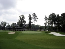
1108 Firethorne Club Dr, Waxhaw, NC 28173

NEARBY LISTINGS FOR SALE OR LEASE
-
-
View all Waxhaw listings for sale on LoopNet.com
Property Detail
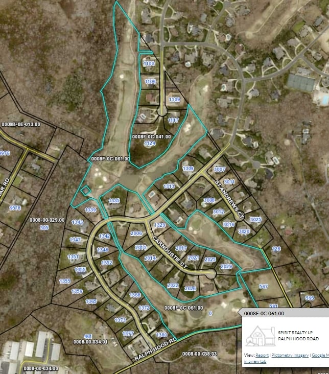
1108 Firethorne Club Dr
06-240-001-F
Firethorne Subdivision Of Golf Course
Clubslodgesprofessionalassociations
P/GOLF COURSE TRACT 5 8180-781
AE
Union
45057C0039E
North Carolina
2025
71.71 AC
2025
Union County
021007
Charlotte
10,783 SF
Charlotte-Concord-Gastonia, NC-SC
DEMOGRAPHICS near 1108 Firethorne Club Dr
1 Mile
3 Mile
5 Mile
2024 Total Population
3,169
57,260
137,341
2029 Population
3,440
63,427
151,745
Pop Growth 2024-2029
+ 8.55%
+ 10.77%
+ 10.49%
Average Age
37
38
39
2024 Total Households
922
19,891
49,852
HH Growth 2024-2029
+ 8.89%
+ 11.01%
+ 10.59%
Median Household Inc
$219,727
$136,506
$126,888
Avg Household Size
3.40
2.80
2.70
2024 Avg HH Vehicles
2.00
2.00
2.00
Median Home Value
$722,826
$466,626
$441,905
Median Year Built
2005
2005
2004
Nearby Places
Map Layers
Map Styles
 Street
 Aerial
- Restaurants
- Banks
- Shops
- Fitness
- Groceries
PUBLIC TRANSPORTATION
AIRPORT
Charlotte/Douglas International
DRIVE
WALK
Distance
Charlotte/Douglas International
36 min
18.8 mi
Concord-Padgett Regional
DRIVE
WALK
Distance
Concord-Padgett Regional
53 min
38.5 mi
Freight Ports
North Charleston Terminal
DRIVE
WALK
Distance
North Charleston Terminal
223 min
191.6 mi
Nearby Properties
Address
Land Use
TOTAL SIZE
Lot Size
Zoning
Address
Land Use
TOTAL SIZE
Lot Size
Zoning
294,279 SF
27.77 AC
R12MFCD
Address
Land Use
TOTAL SIZE
Lot Size
Zoning
215,600 SF
6.97 AC
R3
Address
Land Use
TOTAL SIZE
Lot Size
Zoning
324,188 SF
51.13 AC
Address
Land Use
TOTAL SIZE
Lot Size
Zoning
348,409 SF
26.08 AC
R17MFCD
Address
Land Use
TOTAL SIZE
Lot Size
Zoning
287,004 SF
14.52 AC
R3
Address
Land Use
TOTAL SIZE
Lot Size
Zoning
223,642 SF
76.75 AC
R-40 UNION
Address
Land Use
TOTAL SIZE
Lot Size
Zoning
353,996 SF
58.49 AC
R3
Address
Land Use
TOTAL SIZE
Lot Size
Zoning
195,262 SF
4.56 AC
Address
Land Use
TOTAL SIZE
Lot Size
Zoning
201,638 SF
7.44 AC
R-12PUD
Address
Land Use
TOTAL SIZE
Lot Size
Zoning
254,527 SF
9.34 AC
MX2
Address
Land Use
TOTAL SIZE
Lot Size
Zoning
117,672 SF
16.68 AC
CC
Address
Land Use
TOTAL SIZE
Lot Size
Zoning
211,609 SF
6.91 AC
UR2CD
Address
Land Use
TOTAL SIZE
Lot Size
Zoning
182,180 SF
7.31 AC
MX2
Address
Land Use
TOTAL SIZE
Lot Size
Zoning
160,395 SF
34.25 AC
R3
Address
Land Use
TOTAL SIZE
Lot Size
Zoning
84,475 SF
15.19 AC
CC
Address
Land Use
TOTAL SIZE
Lot Size
Zoning
121,812 SF
13.92 AC
CC
Address
Land Use
TOTAL SIZE
Lot Size
Zoning
137,210 SF
4.52 AC
Address
Land Use
TOTAL SIZE
Lot Size
Zoning
90,466 SF
105.72 AC
INST
Address
Land Use
TOTAL SIZE
Lot Size
Zoning
98,222 SF
2.84 AC
Address
Land Use
TOTAL SIZE
Lot Size
Zoning
120,698 SF
5.18 AC
Address
Land Use
TOTAL SIZE
Lot Size
Zoning
74,000 SF
20.51 AC
O-1(CD)
Address
Land Use
TOTAL SIZE
Lot Size
Zoning
121,180 SF
20.23 AC
INST
Address
Land Use
TOTAL SIZE
Lot Size
Zoning
86,368 SF
11.28 AC
NS
Address
Land Use
TOTAL SIZE
Lot Size
Zoning
133,155 SF
5.57 AC
I-1(CD)
Address
Land Use
TOTAL SIZE
Lot Size
Zoning
3,948 SF
14.70 AC
MUDD-O
Address
Land Use
TOTAL SIZE
Lot Size
Zoning
74,604 SF
2.26 AC
Address
Land Use
TOTAL SIZE
Lot Size
Zoning
77,646 SF
13.89 AC
Address
Land Use
TOTAL SIZE
Lot Size
Zoning
53,352 SF
17.65 AC
INST
Address
Land Use
TOTAL SIZE
Lot Size
Zoning
86,655 SF
17.61 AC
R-12PUD
Address
Land Use
TOTAL SIZE
Lot Size
Zoning
28,165 SF
76.76 AC
R-40 UNION
The World's #1 Commercial Real Estate Marketplace
Connect with us
© 2026 CoStar Group
The information above has been obtained from sources believed reliable. While we do not doubt its accuracy we have not verified it and make no guarantee, warranty or representation about it. It is your responsibility to independently confirm its accuracy and completeness. Any projections, opinions, assumptions, or estimates used are for example only and do not represent the current or future performance of the property. The value of this transaction to you depends on tax and other factors which should be evaluated by your tax, financial, and legal advisors. You and your advisors should conduct a careful, independent investigation of the property to determine to your satisfaction the suitability of the property for your needs.