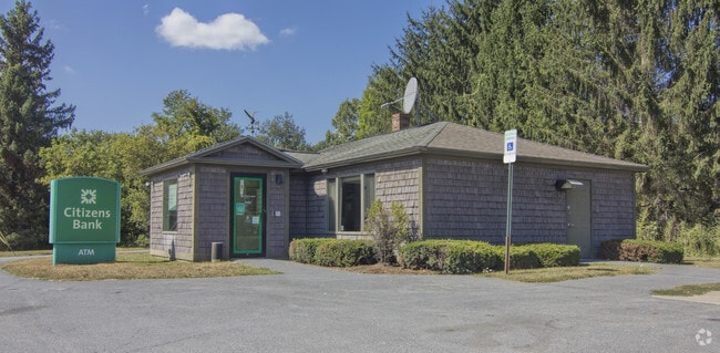
Property Record
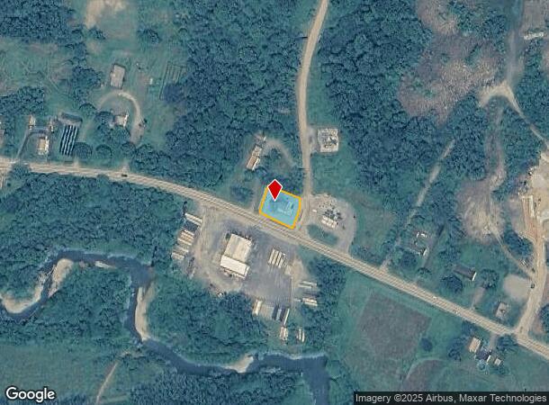
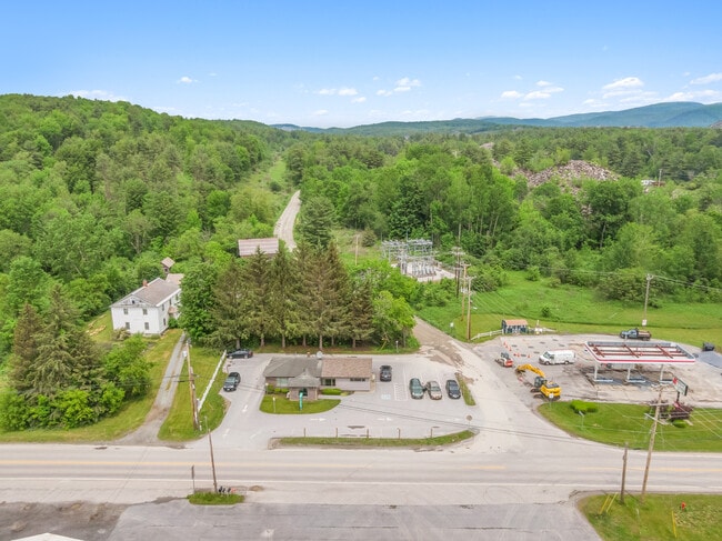
1108 Vt Route 149, West Pawlet, VT 05775

NEARBY LISTINGS FOR SALE OR LEASE
-
-
View all West Pawlet listings for sale on LoopNet.com
Property Detail
1108 Vt Route 149
465-147-10126
BANK BLD LOT
Commercialnec
Rutland
X
Vermont
50003C0050D
0.22 AC
2024
Vermont South Area
2024
Other Market Areas
964300
Rutland, VT
1,168 SF
DEMOGRAPHICS near 1108 Vt Route 149
1 Mile
3 Mile
5 Mile
2024 Total Population
1,551
4,171
6,799
2029 Population
1,539
4,150
6,782
Pop Growth 2024-2029
(0.77%)
(0.50%)
(0.25%)
Average Age
42
43
44
2024 Total Households
640
1,731
2,800
HH Growth 2024-2029
(0.63%)
(0.46%)
(0.21%)
Median Household Inc
$53,620
$55,000
$58,059
Avg Household Size
2.30
2.30
2.30
2024 Avg HH Vehicles
2.00
2.00
2.00
Median Home Value
$138,297
$148,144
$157,207
Median Year Built
1948
1960
1970
Nearby Places
- Restaurants
- Banks
- Shops
- Fitness
- Groceries
SALE & LEASE HISTORY
LISTING DATE
SALE/LEASE

Sep 23, 2021
For Sale
Jun 15, 2021
For Sale
Jan 03, 2023
For Sale
Apr 13, 2022
For Sale
Nearby Properties
Address
Land Use
TOTAL SIZE
Lot Size
Zoning
Address
Land Use
TOTAL SIZE
Lot Size
Zoning
Address
Land Use
TOTAL SIZE
Lot Size
Zoning
143,000 SF
32 AC
01 - NOT Z
Address
Land Use
TOTAL SIZE
Lot Size
Zoning
58,000 SF
18.80 AC
01 - NOT Z
Address
Land Use
TOTAL SIZE
Lot Size
Zoning
Address
Land Use
TOTAL SIZE
Lot Size
Zoning
62,880 SF
9.29 AC
01 - NOT Z
Address
Land Use
TOTAL SIZE
Lot Size
Zoning
50,080 SF
3 AC
01 - NOT Z
Address
Land Use
TOTAL SIZE
Lot Size
Zoning
133,395 SF
13.80 AC
01 - NOT Z
Address
Land Use
TOTAL SIZE
Lot Size
Zoning
Address
Land Use
TOTAL SIZE
Lot Size
Zoning
52,800 SF
22.96 AC
01 - NOT Z
Address
Land Use
TOTAL SIZE
Lot Size
Zoning
38,000 SF
19.80 AC
01 - NOT Z
Address
Land Use
TOTAL SIZE
Lot Size
Zoning
591,325 SF
28.20 AC
01 - NOT Z
Address
Land Use
TOTAL SIZE
Lot Size
Zoning
32,139 SF
2.07 AC
01 - NOT Z
Address
Land Use
TOTAL SIZE
Lot Size
Zoning
Address
Land Use
TOTAL SIZE
Lot Size
Zoning
45,964 SF
5.50 AC
01 - NOT Z
Address
Land Use
TOTAL SIZE
Lot Size
Zoning
Address
Land Use
TOTAL SIZE
Lot Size
Zoning
Address
Land Use
TOTAL SIZE
Lot Size
Zoning
57,594 SF
5.67 AC
01 - NOT Z
Address
Land Use
TOTAL SIZE
Lot Size
Zoning
175 AC
AGRICU
Address
Land Use
TOTAL SIZE
Lot Size
Zoning
43,200 SF
78.90 AC
AGRICU
Address
Land Use
TOTAL SIZE
Lot Size
Zoning
2,000 SF
0.50 AC
Address
Land Use
TOTAL SIZE
Lot Size
Zoning
Address
Land Use
TOTAL SIZE
Lot Size
Zoning
455.63 AC
AGRICU
Address
Land Use
TOTAL SIZE
Lot Size
Zoning
13,477 SF
7.15 AC
01 - NOT Z
Address
Land Use
TOTAL SIZE
Lot Size
Zoning
Address
Land Use
TOTAL SIZE
Lot Size
Zoning
0.74 AC
01 - NOT Z
Address
Land Use
TOTAL SIZE
Lot Size
Zoning
Address
Land Use
TOTAL SIZE
Lot Size
Zoning
14,494 SF
1.89 AC
01 - NOT Z
Address
Land Use
TOTAL SIZE
Lot Size
Zoning
3,641 SF
0.69 AC
01 - NOT Z
Address
Land Use
TOTAL SIZE
Lot Size
Zoning
6,601 SF
1.36 AC
01 - NOT Z
Address
Land Use
TOTAL SIZE
Lot Size
Zoning
The World's #1 Commercial Real Estate Marketplace
Connect with us
© 2025 CoStar Group
The information above has been obtained from sources believed reliable. While we do not doubt its accuracy we have not verified it and make no guarantee, warranty or representation about it. It is your responsibility to independently confirm its accuracy and completeness. Any projections, opinions, assumptions, or estimates used are for example only and do not represent the current or future performance of the property. The value of this transaction to you depends on tax and other factors which should be evaluated by your tax, financial, and legal advisors. You and your advisors should conduct a careful, independent investigation of the property to determine to your satisfaction the suitability of the property for your needs.