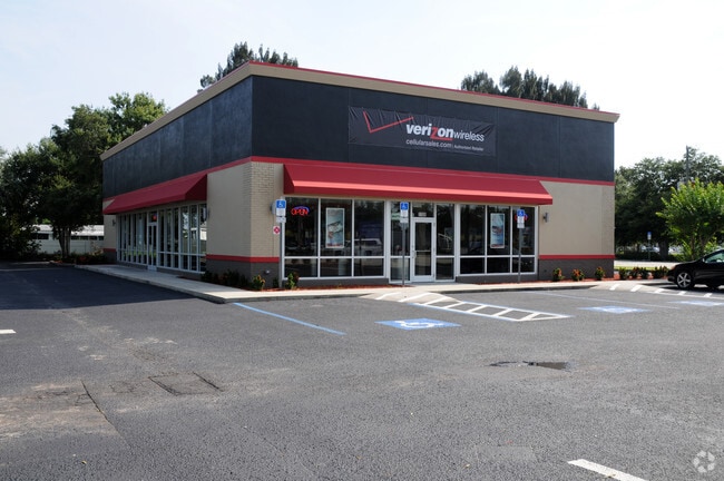
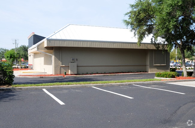
Property Record
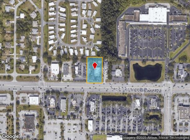
1109 Malabar Rd Ne, Palm Bay, FL 32907

NEARBY LISTINGS FOR SALE OR LEASE
Property Detail
1109 Malabar Rd Ne
Palm Bay-Melbourne-Titusville, FL
Florida Indian Riv Land Compan
28-37-33-00-00505.0-0000.00
S 1/4 OF LOT 8 EXC ST RD SUBD, ORB 3191 PG 2433, 3217 PG 4656, 3248 PG 3099, 3303 PG 2044
Storebuilding
Brevard
X
Florida
12009C0660G
8
2024
1.01 AC
2025
Brevard County
071351
Orlando
4,413 SF
DEMOGRAPHICS near 1109 Malabar Rd Ne
1 Mile
3 Mile
5 Mile
2024 Total Population
7,416
63,374
152,510
2029 Population
8,117
69,736
167,790
Pop Growth 2024-2029
+ 9.45%
+ 10.04%
+ 10.02%
Average Age
45
42
42
2024 Total Households
3,011
25,121
60,083
HH Growth 2024-2029
+ 9.30%
+ 9.88%
+ 9.81%
Median Household Inc
$43,174
$54,043
$56,639
Avg Household Size
2.40
2.40
2.40
2024 Avg HH Vehicles
2.00
2.00
2.00
Median Home Value
$176,662
$217,192
$224,477
Median Year Built
1987
1990
1991
Nearby Places
Map Layers
Map Styles
 Street
 Aerial
- Restaurants
- Banks
- Shops
- Fitness
- Groceries
PUBLIC TRANSPORTATION
AIRPORT
Melbourne Orlando International
DRIVE
WALK
Distance
Melbourne Orlando International
20 min
9.2 mi
Freight Ports
Port Canaveral
DRIVE
WALK
Distance
Port Canaveral
52 min
42.3 mi
Nearby Properties
Address
Land Use
TOTAL SIZE
Lot Size
Zoning
Address
Land Use
TOTAL SIZE
Lot Size
Zoning
458,852 SF
23.05 AC
GU
Address
Land Use
TOTAL SIZE
Lot Size
Zoning
292,165 SF
24.39 AC
RM15
Address
Land Use
TOTAL SIZE
Lot Size
Zoning
373,700 SF
12.96 AC
Address
Land Use
TOTAL SIZE
Lot Size
Zoning
282,680 SF
16 AC
IU
Address
Land Use
TOTAL SIZE
Lot Size
Zoning
349,772 SF
16.27 AC
R2
Address
Land Use
TOTAL SIZE
Lot Size
Zoning
294,170 SF
70.66 AC
IU
Address
Land Use
TOTAL SIZE
Lot Size
Zoning
307,849 SF
39.14 AC
IU
Address
Land Use
TOTAL SIZE
Lot Size
Zoning
257,044 SF
14.99 AC
Address
Land Use
TOTAL SIZE
Lot Size
Zoning
276,936 SF
18.44 AC
RM20
Address
Land Use
TOTAL SIZE
Lot Size
Zoning
260,331 SF
9.90 AC
RM10
Address
Land Use
TOTAL SIZE
Lot Size
Zoning
201,017 SF
13.77 AC
RM20
Address
Land Use
TOTAL SIZE
Lot Size
Zoning
270,428 SF
19.69 AC
R2
Address
Land Use
TOTAL SIZE
Lot Size
Zoning
219,628 SF
29.84 AC
R2(6)
Address
Land Use
TOTAL SIZE
Lot Size
Zoning
203,448 SF
10.36 AC
C2
Address
Land Use
TOTAL SIZE
Lot Size
Zoning
225,833 SF
14.45 AC
R2
Address
Land Use
TOTAL SIZE
Lot Size
Zoning
267,548 SF
23.10 AC
RM10
Address
Land Use
TOTAL SIZE
Lot Size
Zoning
97,093 SF
20.87 AC
Address
Land Use
TOTAL SIZE
Lot Size
Zoning
4,000 SF
12.20 AC
IU
Address
Land Use
TOTAL SIZE
Lot Size
Zoning
290,105 SF
30.94 AC
CC
Address
Land Use
TOTAL SIZE
Lot Size
Zoning
408,025 SF
24.10 AC
LI
Address
Land Use
TOTAL SIZE
Lot Size
Zoning
136,201 SF
11.93 AC
RM20
Address
Land Use
TOTAL SIZE
Lot Size
Zoning
143,529 SF
7.76 AC
RM20
Address
Land Use
TOTAL SIZE
Lot Size
Zoning
216,692 SF
28.97 AC
CC
Address
Land Use
TOTAL SIZE
Lot Size
Zoning
117,568 SF
28.97 AC
IU
Address
Land Use
TOTAL SIZE
Lot Size
Zoning
195,032 SF
13.26 AC
RM15
Address
Land Use
TOTAL SIZE
Lot Size
Zoning
118,747 SF
11.43 AC
RM10
Address
Land Use
TOTAL SIZE
Lot Size
Zoning
166,648 SF
13.01 AC
RM20
Address
Land Use
TOTAL SIZE
Lot Size
Zoning
104,620 SF
12.82 AC
IU
Address
Land Use
TOTAL SIZE
Lot Size
Zoning
106,915 SF
11.01 AC
IU
Address
Land Use
TOTAL SIZE
Lot Size
Zoning
200,850 SF
27.84 AC
CP
The World's #1 Commercial Real Estate Marketplace
Connect with us
© 2025 CoStar Group
The information above has been obtained from sources believed reliable. While we do not doubt its accuracy we have not verified it and make no guarantee, warranty or representation about it. It is your responsibility to independently confirm its accuracy and completeness. Any projections, opinions, assumptions, or estimates used are for example only and do not represent the current or future performance of the property. The value of this transaction to you depends on tax and other factors which should be evaluated by your tax, financial, and legal advisors. You and your advisors should conduct a careful, independent investigation of the property to determine to your satisfaction the suitability of the property for your needs.