Property Record
1109 Pittsburgh Ave, Wooster, OH 44691

NEARBY LISTINGS FOR SALE OR LEASE
Property Detail
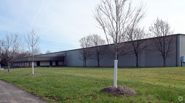
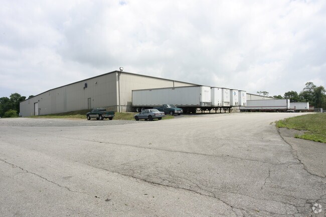
1109 Pittsburgh Ave
65-01564-000
13-15-01 NEPT NE 18.947A MP 28 CD 1854 A4664
Manufacturinglight
Wayne
AE
Ohio
39169C0216E
18.95 AC
2024
Ohio North Area
2024
Other Market Areas
000500
Wooster, OH
84,000 SF
DEMOGRAPHICS near 1109 Pittsburgh Ave
1 Mile
3 Mile
5 Mile
2024 Total Population
7,034
29,185
40,563
2029 Population
7,112
29,493
40,879
Pop Growth 2024-2029
+ 1.11%
+ 1.06%
+ 0.78%
Average Age
36
40
41
2024 Total Households
2,616
11,584
16,294
HH Growth 2024-2029
+ 1.19%
+ 1.03%
+ 0.70%
Median Household Inc
$39,843
$54,736
$56,646
Avg Household Size
2.20
2.20
2.20
2024 Avg HH Vehicles
1.00
2.00
2.00
Median Home Value
$95,068
$174,269
$183,654
Median Year Built
1952
1971
1975
Nearby Places
Map Layers
Map Styles
 Street
 Aerial
- Restaurants
- Banks
- Shops
- Fitness
- Groceries
PUBLIC TRANSPORTATION
AIRPORT
Akron-Canton Regional
DRIVE
WALK
Distance
Akron-Canton Regional
51 min
41.4 mi
Nearby Properties
Address
Land Use
TOTAL SIZE
Lot Size
Zoning
Address
Land Use
TOTAL SIZE
Lot Size
Zoning
537,309 SF
43.72 AC
CF
Address
Land Use
TOTAL SIZE
Lot Size
Zoning
70,726 SF
9 AC
CF
Address
Land Use
TOTAL SIZE
Lot Size
Zoning
2,268 SF
106.60 AC
CF
Address
Land Use
TOTAL SIZE
Lot Size
Zoning
81,133 SF
41.43 AC
CF
Address
Land Use
TOTAL SIZE
Lot Size
Zoning
51.79 AC
M2
Address
Land Use
TOTAL SIZE
Lot Size
Zoning
7.28 AC
CF
Address
Land Use
TOTAL SIZE
Lot Size
Zoning
227,500 SF
58.38 AC
Address
Land Use
TOTAL SIZE
Lot Size
Zoning
2,400 SF
99.04 AC
CF
Address
Land Use
TOTAL SIZE
Lot Size
Zoning
48,096 SF
1.67 AC
C4
Address
Land Use
TOTAL SIZE
Lot Size
Zoning
109.56 AC
M2
Address
Land Use
TOTAL SIZE
Lot Size
Zoning
50,110 SF
19.26 AC
CF
Address
Land Use
TOTAL SIZE
Lot Size
Zoning
25.14 AC
CF
Address
Land Use
TOTAL SIZE
Lot Size
Zoning
47,160 SF
3.22 AC
C4
Address
Land Use
TOTAL SIZE
Lot Size
Zoning
4,486 SF
5.57 AC
CF
Address
Land Use
TOTAL SIZE
Lot Size
Zoning
210,000 SF
20 AC
Address
Land Use
TOTAL SIZE
Lot Size
Zoning
2,536 SF
16.79 AC
R4
Address
Land Use
TOTAL SIZE
Lot Size
Zoning
85,910 SF
4.33 AC
Address
Land Use
TOTAL SIZE
Lot Size
Zoning
105,000 SF
25.29 AC
M2
Address
Land Use
TOTAL SIZE
Lot Size
Zoning
62,976 SF
10.46 AC
CF
Address
Land Use
TOTAL SIZE
Lot Size
Zoning
302,400 SF
24.51 AC
M2
Address
Land Use
TOTAL SIZE
Lot Size
Zoning
71,631 SF
17.88 AC
M1
Address
Land Use
TOTAL SIZE
Lot Size
Zoning
58,600 SF
6.30 AC
CF
Address
Land Use
TOTAL SIZE
Lot Size
Zoning
10.68 AC
M3
Address
Land Use
TOTAL SIZE
Lot Size
Zoning
71,511 SF
9.53 AC
CF
Address
Land Use
TOTAL SIZE
Lot Size
Zoning
3,846 SF
129.65 AC
CF
Address
Land Use
TOTAL SIZE
Lot Size
Zoning
102,500 SF
13.95 AC
M2
Address
Land Use
TOTAL SIZE
Lot Size
Zoning
6,631 SF
7.18 AC
R4
Address
Land Use
TOTAL SIZE
Lot Size
Zoning
89,980 SF
17.58 AC
M2
Address
Land Use
TOTAL SIZE
Lot Size
Zoning
61,107 SF
2.77 AC
C5
Address
Land Use
TOTAL SIZE
Lot Size
Zoning
25,920 SF
42 AC
CF
The World's #1 Commercial Real Estate Marketplace
Connect with us
© 2025 CoStar Group
The information above has been obtained from sources believed reliable. While we do not doubt its accuracy we have not verified it and make no guarantee, warranty or representation about it. It is your responsibility to independently confirm its accuracy and completeness. Any projections, opinions, assumptions, or estimates used are for example only and do not represent the current or future performance of the property. The value of this transaction to you depends on tax and other factors which should be evaluated by your tax, financial, and legal advisors. You and your advisors should conduct a careful, independent investigation of the property to determine to your satisfaction the suitability of the property for your needs.