Property Record
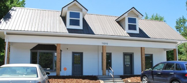
11090 Highway 25, Calera, AL 35040

NEARBY LISTINGS FOR SALE OR LEASE
-
-
View all Calera listings for lease on LoopNet.com
Property Detail
11090 Highway 25
Birmingham-Hoover, AL
Dunstans 6-8 27-30 45-48 110-119 126-129
28-5-21-1-003-013-000
SEC/TWNSHP/RAN 21 22S 02W NBRHD: 03 CALERA COMMERCIAL (DOWNTOWN) R-2
Storesoffices
Shelby
AE
Alabama
01021C0075E
2
2024
0.55 AC
2024
I-65 Corr/S Shelby County
030504
Birmingham
5,000 SF
DEMOGRAPHICS near 11090 Highway 25
1 Mile
3 Mile
5 Mile
2024 Total Population
2,199
10,341
22,460
2029 Population
2,403
11,368
24,498
Pop Growth 2024-2029
+ 9.28%
+ 9.93%
+ 9.07%
Average Age
36
36
37
2024 Total Households
831
3,755
8,373
HH Growth 2024-2029
+ 9.27%
+ 10.07%
+ 9.21%
Median Household Inc
$51,634
$66,382
$69,885
Avg Household Size
2.60
2.70
2.60
2024 Avg HH Vehicles
2.00
2.00
2.00
Median Home Value
$164,634
$187,697
$190,758
Median Year Built
1999
2003
2003
Nearby Places
Map Layers
Map Styles
 Street
 Aerial
- Restaurants
- Banks
- Shops
- Fitness
- Groceries
PUBLIC TRANSPORTATION
AIRPORT
Birmingham-Shuttlesworth International
DRIVE
WALK
Distance
Birmingham-Shuttlesworth International
47 min
37.9 mi
SALE & LEASE HISTORY
LISTING DATE
SALE/LEASE

Sep 24, 2016
For Sale
Aug 01, 2019
For Lease
Nearby Properties
Address
Land Use
TOTAL SIZE
Lot Size
Zoning
Address
Land Use
TOTAL SIZE
Lot Size
Zoning
205,546 SF
14.10 AC
Address
Land Use
TOTAL SIZE
Lot Size
Zoning
1,880 SF
7.80 AC
Address
Land Use
TOTAL SIZE
Lot Size
Zoning
85,144 SF
2.94 AC
Address
Land Use
TOTAL SIZE
Lot Size
Zoning
104,643 SF
5.39 AC
Address
Land Use
TOTAL SIZE
Lot Size
Zoning
8,328 SF
6.89 AC
Address
Land Use
TOTAL SIZE
Lot Size
Zoning
73,825 SF
15 AC
Address
Land Use
TOTAL SIZE
Lot Size
Zoning
33,440 SF
5.08 AC
Address
Land Use
TOTAL SIZE
Lot Size
Zoning
38,429 SF
4.28 AC
Address
Land Use
TOTAL SIZE
Lot Size
Zoning
38,816 SF
33.96 AC
Address
Land Use
TOTAL SIZE
Lot Size
Zoning
40,295 SF
0.56 AC
Address
Land Use
TOTAL SIZE
Lot Size
Zoning
36,430 SF
4.10 AC
Address
Land Use
TOTAL SIZE
Lot Size
Zoning
Address
Land Use
TOTAL SIZE
Lot Size
Zoning
2,400 SF
13 AC
Address
Land Use
TOTAL SIZE
Lot Size
Zoning
66,260 SF
3.84 AC
Address
Land Use
TOTAL SIZE
Lot Size
Zoning
14,700 SF
12 AC
Address
Land Use
TOTAL SIZE
Lot Size
Zoning
8,120 SF
24 AC
Address
Land Use
TOTAL SIZE
Lot Size
Zoning
17,950 SF
8.89 AC
Address
Land Use
TOTAL SIZE
Lot Size
Zoning
47,480 SF
19.86 AC
Address
Land Use
TOTAL SIZE
Lot Size
Zoning
10,268 SF
5 AC
Address
Land Use
TOTAL SIZE
Lot Size
Zoning
14,300 SF
5.15 AC
Address
Land Use
TOTAL SIZE
Lot Size
Zoning
9,945 SF
2.27 AC
Address
Land Use
TOTAL SIZE
Lot Size
Zoning
25,980 SF
2.43 AC
Address
Land Use
TOTAL SIZE
Lot Size
Zoning
14,058 SF
21 AC
Address
Land Use
TOTAL SIZE
Lot Size
Zoning
13,304 SF
1.41 AC
Address
Land Use
TOTAL SIZE
Lot Size
Zoning
21,286 SF
1.40 AC
Address
Land Use
TOTAL SIZE
Lot Size
Zoning
13,355 SF
29.90 AC
Address
Land Use
TOTAL SIZE
Lot Size
Zoning
1,399 SF
11.58 AC
Address
Land Use
TOTAL SIZE
Lot Size
Zoning
10,345 SF
1.13 AC
Address
Land Use
TOTAL SIZE
Lot Size
Zoning
9,829 SF
2.75 AC
The World's #1 Commercial Real Estate Marketplace
Connect with us
© 2026 CoStar Group
The information above has been obtained from sources believed reliable. While we do not doubt its accuracy we have not verified it and make no guarantee, warranty or representation about it. It is your responsibility to independently confirm its accuracy and completeness. Any projections, opinions, assumptions, or estimates used are for example only and do not represent the current or future performance of the property. The value of this transaction to you depends on tax and other factors which should be evaluated by your tax, financial, and legal advisors. You and your advisors should conduct a careful, independent investigation of the property to determine to your satisfaction the suitability of the property for your needs.