Property Record
11095 Amigo St, Henderson, NV 89052


Property Detail
11095 Amigo St
Las Vegas-Henderson-North Las Vegas, NV
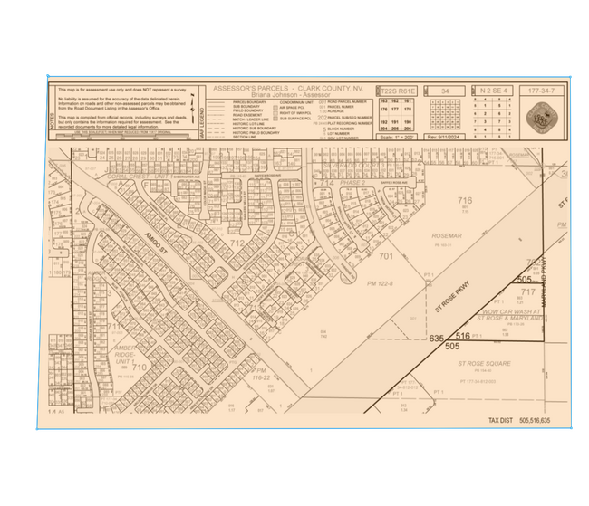
PARCEL MAP FILE 116 PAGE 22 LOT 1
177-34-701-031
CLARK
Vacantlandnec
Nevada
C2
1
B and X Area of moderate flood hazard, usually the area between the limits of the 100-year and 500-year floods.
1.07 AC
2026
Southeast Las Vegas
2026
Las Vegas
002851
NEARBY LISTINGS FOR SALE OR LEASE
DEMOGRAPHICS near 11095 Amigo St
1 mile
3 mile
5 mile
2025 Total Population
19,031
138,681
294,749
2030 Population
20,227
146,479
312,069
Pop Growth 2025-2030
+ 6.28%
+ 5.62%
+ 5.88%
Average Age
38
41
43
2025 Total Households
6,949
54,679
116,972
HH Growth 2025-2030
+ 6.42%
+ 5.62%
+ 5.80%
Median Household Inc
$83,110
$90,097
$96,557
Avg Household Size
2.70
2.50
2.50
2025 Avg HH Vehicles
2.00
2.00
2.00
Median Home Value
$490,110
$498,190
$528,546
Median Year Built
2006
2003
2002
Nearby Places
Map Layers
Map Styles
 Street
 Aerial
Layers
 Traffic
 Biking
Places
Listings with unknown addresses are not visible on the map
- Restaurants
- Banks
- Shops
- Fitness
- Groceries
PUBLIC TRANSPORTATION
AIRPORT
Harry Reid International
Drive
Walk
Distance
Harry Reid International
15 min
9.9 mi
Boulder City Municipal
Drive
Walk
Distance
Boulder City Municipal
31 min
21.8 mi
Freight Ports
Port of Long Beach
Drive
Walk
Distance
Port of Long Beach
302 min
271.5 mi
SALE & LEASE HISTORY
LISTING DATE
SALE/LEASE

Apr 24, 2024
For Lease
Nearby Properties
Address
Land Use
TOTAL SIZE
Lot Size
Zoning
Address
Land Use
TOTAL SIZE
Lot Size
Zoning
2,340,130 SF
56.10 AC
H1
Address
Land Use
TOTAL SIZE
Lot Size
Zoning
756,333 SF
72.72 AC
Address
Land Use
TOTAL SIZE
Lot Size
Zoning
9,314 SF
23.10 AC
PS
Address
Land Use
TOTAL SIZE
Lot Size
Zoning
14,422 SF
30.79 AC
Address
Land Use
TOTAL SIZE
Lot Size
Zoning
882 SF
39.43 AC
Address
Land Use
TOTAL SIZE
Lot Size
Zoning
197,134 SF
24.59 AC
Address
Land Use
TOTAL SIZE
Lot Size
Zoning
614,616 SF
55.59 AC
Address
Land Use
TOTAL SIZE
Lot Size
Zoning
1,365 SF
22.68 AC
Address
Land Use
TOTAL SIZE
Lot Size
Zoning
5,227 SF
16.79 AC
Address
Land Use
TOTAL SIZE
Lot Size
Zoning
5,271 SF
22.88 AC
Address
Land Use
TOTAL SIZE
Lot Size
Zoning
1,010,035 SF
57.02 AC
IP
Address
Land Use
TOTAL SIZE
Lot Size
Zoning
5,975 SF
18.81 AC
Address
Land Use
TOTAL SIZE
Lot Size
Zoning
10,572 SF
11.84 AC
Address
Land Use
TOTAL SIZE
Lot Size
Zoning
614,520 SF
28.81 AC
Address
Land Use
TOTAL SIZE
Lot Size
Zoning
7,370 SF
18.03 AC
Address
Land Use
TOTAL SIZE
Lot Size
Zoning
362,584 SF
31.86 AC
Address
Land Use
TOTAL SIZE
Lot Size
Zoning
3,528 SF
18.15 AC
RH36
Address
Land Use
TOTAL SIZE
Lot Size
Zoning
4,924 SF
16.14 AC
C:R-3
Address
Land Use
TOTAL SIZE
Lot Size
Zoning
6,043 SF
15.86 AC
Address
Land Use
TOTAL SIZE
Lot Size
Zoning
4,312 SF
19.42 AC
C:R-4
Address
Land Use
TOTAL SIZE
Lot Size
Zoning
117.50 AC
Address
Land Use
TOTAL SIZE
Lot Size
Zoning
36.85 AC
PS
Address
Land Use
TOTAL SIZE
Lot Size
Zoning
Address
Land Use
TOTAL SIZE
Lot Size
Zoning
438,778 SF
19.30 AC
C:R-4
Address
Land Use
TOTAL SIZE
Lot Size
Zoning
3,990 SF
24.88 AC
RM16
Address
Land Use
TOTAL SIZE
Lot Size
Zoning
Address
Land Use
TOTAL SIZE
Lot Size
Zoning
4,405 SF
19.79 AC
Address
Land Use
TOTAL SIZE
Lot Size
Zoning
18.08 AC
RE
The World's #1 Commercial Real Estate Marketplace
Connect with us
© 2026 CoStar Group
The information above has been obtained from sources believed reliable. While we do not doubt its accuracy we have not verified it and make no guarantee, warranty or representation about it. It is your responsibility to independently confirm its accuracy and completeness. Any projections, opinions, assumptions, or estimates used are for example only and do not represent the current or future performance of the property. The value of this transaction to you depends on tax and other factors which should be evaluated by your tax, financial, and legal advisors. You and your advisors should conduct a careful, independent investigation of the property to determine to your satisfaction the suitability of the property for your needs.