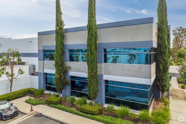
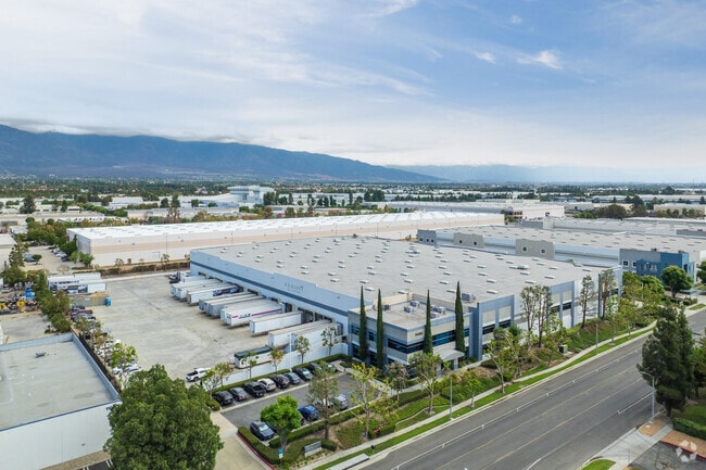
Property Record
11096 Jersey Blvd, Rancho Cucamonga, CA 91730

NEARBY LISTINGS FOR SALE OR LEASE
Property Detail
11096 Jersey Blvd
0209-145-08
THAT PTN E 2783.57 FT S 1/2 SEC 12 TP 1S R 7W LYING NLY OF N LI S 1026.04 FT SD S 1/2 AND LYING SLY OF SLY LI A T AND S F RR R/W EASEMENT AS DESC IN DEED RECORDED MARCH 20 1970 IN BK 7409 PG 723 OFFICIAL RECORDS EX THAT PTN LYING ELY OF THE FOLL DESC
Lightindustrial
San Bernardino
X
California
06071C8630J
5.63 AC
2024
Airport Area
2025
Inland Empire (California)
002112
Riverside-San Bernardino-Ontario, CA
127,559 SF
DEMOGRAPHICS near 11096 Jersey Blvd
1 Mile
3 Mile
5 Mile
2024 Total Population
4,389
119,431
276,300
2029 Population
4,547
121,368
280,483
Pop Growth 2024-2029
+ 3.60%
+ 1.62%
+ 1.51%
Average Age
35
37
38
2024 Total Households
1,887
41,186
87,972
HH Growth 2024-2029
+ 4.08%
+ 1.70%
+ 1.58%
Median Household Inc
$78,571
$91,568
$93,217
Avg Household Size
2.30
2.80
3.00
2024 Avg HH Vehicles
2.00
2.00
2.00
Median Home Value
$480,768
$586,566
$608,965
Median Year Built
2003
1988
1985
Nearby Places
Map Layers
Map Styles
 Street
 Aerial
- Restaurants
- Banks
- Shops
- Fitness
- Groceries
PUBLIC TRANSPORTATION
COMMUTER RAIL
Rancho Cucamonga (San Bernardino Line - Southern California Regional Rail Authority (Metrolink))
DRIVE
WALK
Distance
Rancho Cucamonga (San Bernardino Line - Southern California Regional Rail Authority (Metrolink))
3 min
1.0 mi
East Ontario (Riverside Line - Southern California Regional Rail Authority (Metrolink))
DRIVE
WALK
Distance
East Ontario (Riverside Line - Southern California Regional Rail Authority (Metrolink))
10 min
4.9 mi
AIRPORT
Ontario International
DRIVE
WALK
Distance
Ontario International
10 min
4.8 mi
John Wayne/Orange County
DRIVE
WALK
Distance
John Wayne/Orange County
56 min
44.6 mi
Nearby Properties
Address
Land Use
TOTAL SIZE
Lot Size
Zoning
Address
Land Use
TOTAL SIZE
Lot Size
Zoning
1,459,702 SF
96.41 AC
Address
Land Use
TOTAL SIZE
Lot Size
Zoning
1,422,524 SF
44.96 AC
Address
Land Use
TOTAL SIZE
Lot Size
Zoning
707,551 SF
20.36 AC
Address
Land Use
TOTAL SIZE
Lot Size
Zoning
502,314 SF
40.06 AC
Address
Land Use
TOTAL SIZE
Lot Size
Zoning
752,497 SF
24.89 AC
Address
Land Use
TOTAL SIZE
Lot Size
Zoning
1,385,866 SF
69.84 AC
Address
Land Use
TOTAL SIZE
Lot Size
Zoning
275,783 SF
11.82 AC
Address
Land Use
TOTAL SIZE
Lot Size
Zoning
261,114 SF
11.23 AC
Address
Land Use
TOTAL SIZE
Lot Size
Zoning
293,860 SF
16.10 AC
Address
Land Use
TOTAL SIZE
Lot Size
Zoning
34.80 AC
Address
Land Use
TOTAL SIZE
Lot Size
Zoning
145,111 SF
48.01 AC
Address
Land Use
TOTAL SIZE
Lot Size
Zoning
249,658 SF
20.03 AC
Address
Land Use
TOTAL SIZE
Lot Size
Zoning
545,161 SF
11.10 AC
Address
Land Use
TOTAL SIZE
Lot Size
Zoning
500,403 SF
24.69 AC
Address
Land Use
TOTAL SIZE
Lot Size
Zoning
453,960 SF
18.54 AC
Address
Land Use
TOTAL SIZE
Lot Size
Zoning
591,495 SF
18.29 AC
Address
Land Use
TOTAL SIZE
Lot Size
Zoning
104,537 SF
30.72 AC
Address
Land Use
TOTAL SIZE
Lot Size
Zoning
1,052,840 SF
41.85 AC
Address
Land Use
TOTAL SIZE
Lot Size
Zoning
611,573 SF
26.64 AC
Address
Land Use
TOTAL SIZE
Lot Size
Zoning
87,909 SF
30.12 AC
Address
Land Use
TOTAL SIZE
Lot Size
Zoning
286,732 SF
9.58 AC
Address
Land Use
TOTAL SIZE
Lot Size
Zoning
261,357 SF
10.03 AC
Address
Land Use
TOTAL SIZE
Lot Size
Zoning
314,580 SF
24 AC
Address
Land Use
TOTAL SIZE
Lot Size
Zoning
440,209 SF
10.34 AC
Address
Land Use
TOTAL SIZE
Lot Size
Zoning
830,300 SF
39.99 AC
Address
Land Use
TOTAL SIZE
Lot Size
Zoning
190,724 SF
10.69 AC
Address
Land Use
TOTAL SIZE
Lot Size
Zoning
849,900 SF
39.25 AC
KCSP
Address
Land Use
TOTAL SIZE
Lot Size
Zoning
387,965 SF
10.92 AC
Address
Land Use
TOTAL SIZE
Lot Size
Zoning
1,034,356 SF
47.48 AC
Address
Land Use
TOTAL SIZE
Lot Size
Zoning
278,453 SF
4.73 AC
The World's #1 Commercial Real Estate Marketplace
Connect with us
© 2025 CoStar Group
The information above has been obtained from sources believed reliable. While we do not doubt its accuracy we have not verified it and make no guarantee, warranty or representation about it. It is your responsibility to independently confirm its accuracy and completeness. Any projections, opinions, assumptions, or estimates used are for example only and do not represent the current or future performance of the property. The value of this transaction to you depends on tax and other factors which should be evaluated by your tax, financial, and legal advisors. You and your advisors should conduct a careful, independent investigation of the property to determine to your satisfaction the suitability of the property for your needs.