Property Record
111 9Th Ave, Eau Claire, WI 54703


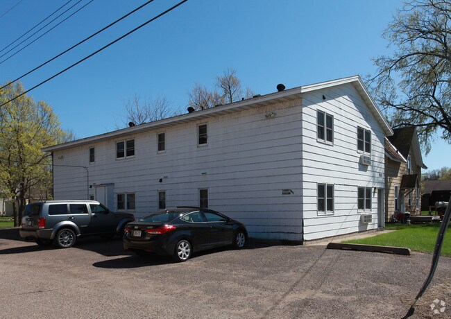
Property Detail
111 9Th Ave
07-0334-A
THE N 63 FT OF LOTS 15-16-17 BLK 50 ADIN RANDALLS 2ND ADD
Apartment
EAU CLAIRE
RM
Wisconsin
B and X Area of moderate flood hazard, usually the area between the limits of the 100-year and 500-year floods.
15-17
2025
0.14 AC
2025
Downtown Eau Claire
001200
Other Market Areas
3,120 SF
Eau Claire, WI
NEARBY LISTINGS FOR SALE OR LEASE
DEMOGRAPHICS near 111 9Th Ave
1 mile
3 mile
5 mile
2025 Total Population
8,362
53,567
87,748
2030 Population
8,525
54,859
90,217
Pop Growth 2025-2030
+ 1.95%
+ 2.41%
+ 2.81%
Average Age
30
37
38
2025 Total Households
3,338
22,023
36,341
HH Growth 2025-2030
+ 2.25%
+ 2.59%
+ 2.96%
Median Household Inc
$39,547
$65,576
$72,258
Avg Household Size
2.10
2.20
2.20
2025 Avg HH Vehicles
2.00
2.00
2.00
Median Home Value
$218,377
$247,215
$256,364
Median Year Built
1968
1971
1978
Nearby Places
Map Layers
Map Styles
 Street
 Aerial
Layers
 Traffic
 Biking
Places
Listings with unknown addresses are not visible on the map
- Restaurants
- Banks
- Shops
- Fitness
- Groceries
Nearby Properties
Address
Land Use
TOTAL SIZE
Lot Size
Zoning
Address
Land Use
TOTAL SIZE
Lot Size
Zoning
203,723 SF
Address
Land Use
TOTAL SIZE
Lot Size
Zoning
97,194 SF
7.39 AC
C3H
Address
Land Use
TOTAL SIZE
Lot Size
Zoning
361,759 SF
8.46 AC
Address
Land Use
TOTAL SIZE
Lot Size
Zoning
206,042 SF
5.59 AC
Address
Land Use
TOTAL SIZE
Lot Size
Zoning
0.78 AC
Address
Land Use
TOTAL SIZE
Lot Size
Zoning
Address
Land Use
TOTAL SIZE
Lot Size
Zoning
21.83 AC
I1
Address
Land Use
TOTAL SIZE
Lot Size
Zoning
1.36 AC
CBD
Address
Land Use
TOTAL SIZE
Lot Size
Zoning
114,683 SF
5.47 AC
C3H
Address
Land Use
TOTAL SIZE
Lot Size
Zoning
94,173 SF
9.36 AC
C3
Address
Land Use
TOTAL SIZE
Lot Size
Zoning
81,260 SF
2.32 AC
R4
Address
Land Use
TOTAL SIZE
Lot Size
Zoning
199,534 SF
7.23 AC
Address
Land Use
TOTAL SIZE
Lot Size
Zoning
1.05 AC
P
Address
Land Use
TOTAL SIZE
Lot Size
Zoning
105,434 SF
1.55 AC
CBD
Address
Land Use
TOTAL SIZE
Lot Size
Zoning
65,378 SF
1.83 AC
Address
Land Use
TOTAL SIZE
Lot Size
Zoning
114,100 SF
2.64 AC
Address
Land Use
TOTAL SIZE
Lot Size
Zoning
68,024 SF
0.80 AC
CBD
Address
Land Use
TOTAL SIZE
Lot Size
Zoning
169,740 SF
19.59 AC
C3P
Address
Land Use
TOTAL SIZE
Lot Size
Zoning
4.35 AC
Address
Land Use
TOTAL SIZE
Lot Size
Zoning
Address
Land Use
TOTAL SIZE
Lot Size
Zoning
Address
Land Use
TOTAL SIZE
Lot Size
Zoning
88,350 SF
0.40 AC
Address
Land Use
TOTAL SIZE
Lot Size
Zoning
85,790 SF
5.68 AC
C3
Address
Land Use
TOTAL SIZE
Lot Size
Zoning
21,786 SF
4.14 AC
Address
Land Use
TOTAL SIZE
Lot Size
Zoning
66,497 SF
0.81 AC
CBDP
Address
Land Use
TOTAL SIZE
Lot Size
Zoning
7,084 SF
26.73 AC
I2P
Address
Land Use
TOTAL SIZE
Lot Size
Zoning
92,339 SF
9.93 AC
C3
Address
Land Use
TOTAL SIZE
Lot Size
Zoning
38,808 SF
11.65 AC
I1P
Address
Land Use
TOTAL SIZE
Lot Size
Zoning
103,890 SF
6.30 AC
R4P
Address
Land Use
TOTAL SIZE
Lot Size
Zoning
10.68 AC
I1P
The World's #1 Commercial Real Estate Marketplace
Connect with us
© 2026 CoStar Group
The information above has been obtained from sources believed reliable. While we do not doubt its accuracy we have not verified it and make no guarantee, warranty or representation about it. It is your responsibility to independently confirm its accuracy and completeness. Any projections, opinions, assumptions, or estimates used are for example only and do not represent the current or future performance of the property. The value of this transaction to you depends on tax and other factors which should be evaluated by your tax, financial, and legal advisors. You and your advisors should conduct a careful, independent investigation of the property to determine to your satisfaction the suitability of the property for your needs.