Property Record
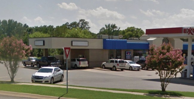
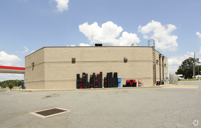
111 Bill Foster Memorial Hwy, Cabot, AR 72023

NEARBY LISTINGS FOR SALE OR LEASE
Property Detail
111 Bill Foster Memorial Hwy
722-54001-000
Russell Coml Addn
Carwash
Lonoke
X
Arkansas
05085C0084F
1
2023
1.19 AC
2025
Lonoke County
020206
Little Rock/N Little Rock
5,054 SF
Little Rock-North Little Rock-Conway, AR
DEMOGRAPHICS near 111 Bill Foster Memorial Hwy
1 Mile
3 Mile
5 Mile
2024 Total Population
3,835
21,422
37,063
2029 Population
3,917
22,161
38,285
Pop Growth 2024-2029
+ 2.14%
+ 3.45%
+ 3.30%
Average Age
38
38
39
2024 Total Households
1,436
8,086
13,960
HH Growth 2024-2029
+ 1.95%
+ 3.38%
+ 3.25%
Median Household Inc
$58,425
$60,275
$67,159
Avg Household Size
2.60
2.60
2.60
2024 Avg HH Vehicles
2.00
2.00
2.00
Median Home Value
$185,586
$170,434
$174,093
Median Year Built
2001
1997
1997
Nearby Places
Map Layers
Map Styles
 Street
 Aerial
- Restaurants
- Banks
- Shops
- Fitness
- Groceries
PUBLIC TRANSPORTATION
AIRPORT
Bill and Hillary Clinton Ntl/Adams Field
DRIVE
WALK
Distance
Bill and Hillary Clinton Ntl/Adams Field
32 min
25.6 mi
Freight Ports
Port of Shreveport
DRIVE
WALK
Distance
Port of Shreveport
278 min
256.6 mi
SALE & LEASE HISTORY
LISTING DATE
SALE/LEASE

Oct 18, 2017
For Lease
Nearby Properties
Address
Land Use
TOTAL SIZE
Lot Size
Zoning
Address
Land Use
TOTAL SIZE
Lot Size
Zoning
44,884 SF
9.65 AC
Address
Land Use
TOTAL SIZE
Lot Size
Zoning
143,892 SF
8.65 AC
Address
Land Use
TOTAL SIZE
Lot Size
Zoning
23,603 SF
0.70 AC
Address
Land Use
TOTAL SIZE
Lot Size
Zoning
141,490 SF
9.97 AC
Address
Land Use
TOTAL SIZE
Lot Size
Zoning
184,011 SF
15 AC
Address
Land Use
TOTAL SIZE
Lot Size
Zoning
13,302 SF
0.71 AC
Address
Land Use
TOTAL SIZE
Lot Size
Zoning
50,550 SF
8.98 AC
Address
Land Use
TOTAL SIZE
Lot Size
Zoning
139,126 SF
10 AC
Address
Land Use
TOTAL SIZE
Lot Size
Zoning
51,992 SF
2.82 AC
Address
Land Use
TOTAL SIZE
Lot Size
Zoning
42,336 SF
6.80 AC
Address
Land Use
TOTAL SIZE
Lot Size
Zoning
45,172 SF
4.35 AC
Address
Land Use
TOTAL SIZE
Lot Size
Zoning
67,672 SF
5.23 AC
Address
Land Use
TOTAL SIZE
Lot Size
Zoning
10,408 SF
6.25 AC
Address
Land Use
TOTAL SIZE
Lot Size
Zoning
91,224 SF
8.39 AC
Address
Land Use
TOTAL SIZE
Lot Size
Zoning
32,438 SF
7.40 AC
Address
Land Use
TOTAL SIZE
Lot Size
Zoning
15,600 SF
3 AC
Address
Land Use
TOTAL SIZE
Lot Size
Zoning
9,750 SF
1.62 AC
Address
Land Use
TOTAL SIZE
Lot Size
Zoning
11,683 SF
0.58 AC
Address
Land Use
TOTAL SIZE
Lot Size
Zoning
8,450 SF
0.62 AC
Address
Land Use
TOTAL SIZE
Lot Size
Zoning
19,967 SF
2.06 AC
Address
Land Use
TOTAL SIZE
Lot Size
Zoning
31,919 SF
4.15 AC
Address
Land Use
TOTAL SIZE
Lot Size
Zoning
46,936 SF
7.70 AC
Address
Land Use
TOTAL SIZE
Lot Size
Zoning
41,952 SF
1.50 AC
Address
Land Use
TOTAL SIZE
Lot Size
Zoning
7,288 SF
3.13 AC
Address
Land Use
TOTAL SIZE
Lot Size
Zoning
21,000 SF
2.21 AC
Address
Land Use
TOTAL SIZE
Lot Size
Zoning
23,874 SF
3.01 AC
Address
Land Use
TOTAL SIZE
Lot Size
Zoning
17,416 SF
2.23 AC
Address
Land Use
TOTAL SIZE
Lot Size
Zoning
151,754 SF
10 AC
Address
Land Use
TOTAL SIZE
Lot Size
Zoning
32,697 SF
3 AC
Address
Land Use
TOTAL SIZE
Lot Size
Zoning
32,080 SF
14.22 AC
The World's #1 Commercial Real Estate Marketplace
Connect with us
© 2026 CoStar Group
The information above has been obtained from sources believed reliable. While we do not doubt its accuracy we have not verified it and make no guarantee, warranty or representation about it. It is your responsibility to independently confirm its accuracy and completeness. Any projections, opinions, assumptions, or estimates used are for example only and do not represent the current or future performance of the property. The value of this transaction to you depends on tax and other factors which should be evaluated by your tax, financial, and legal advisors. You and your advisors should conduct a careful, independent investigation of the property to determine to your satisfaction the suitability of the property for your needs.