Property Record
111 E Main St, Flushing, MI 48433

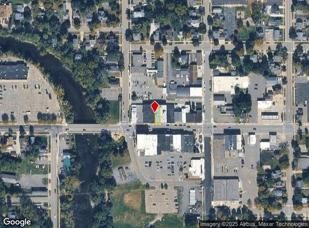


Property Detail
111 E Main St
Flint, MI
The Enlarged Plat
55-27-580-012
S 100 FT OF E 5 FT OF LOT 8 BLK 1 & S 100 FT OF W 21 FT OF LOT 9 BLK 1 THE ENLARGED PLAT OF FLUSHING (78)
Commercialnec
Genesee
X
Michigan
26049C0153D
8-9
2024
0.06 AC
2025
Flint
010603
Detroit
5,188 SF
NEARBY LISTINGS FOR SALE OR LEASE
-
-
View all Flushing listings for sale on LoopNet.com
DEMOGRAPHICS near 111 E Main St
1 mile
3 mile
5 mile
2024 Total Population
5,098
16,718
32,702
2029 Population
4,912
16,132
31,713
Pop Growth 2024-2029
(3.65%)
(3.51%)
(3.02%)
Average Age
42
43
43
2024 Total Households
2,185
6,761
13,123
HH Growth 2024-2029
(3.66%)
(3.56%)
(3.08%)
Median Household Inc
$69,415
$73,314
$67,655
Avg Household Size
2.30
2.40
2.40
2024 Avg HH Vehicles
2.00
2.00
2.00
Median Home Value
$166,508
$184,129
$182,268
Median Year Built
1969
1971
1973
Nearby Places
Map Layers
Map Styles
 Street
 Aerial
Transit
 Traffic
 Biking
Places
Listings with unknown addresses are not visible on the map
- Restaurants
- Banks
- Shops
- Fitness
- Groceries
PUBLIC TRANSPORTATION
AIRPORT
Bishop International
Drive
Walk
Distance
Bishop International
30 min
13.1 mi
MBS International
Drive
Walk
Distance
MBS International
69 min
43.6 mi
Nearby Properties
Address
Land Use
TOTAL SIZE
Lot Size
Zoning
Address
Land Use
TOTAL SIZE
Lot Size
Zoning
106,551 SF
11.44 AC
R3-B (HDR)
Address
Land Use
TOTAL SIZE
Lot Size
Zoning
72,367 SF
10.60 AC
R3-B (HDR)
Address
Land Use
TOTAL SIZE
Lot Size
Zoning
67,266 SF
8.11 AC
CBD CENTL
Address
Land Use
TOTAL SIZE
Lot Size
Zoning
133,008 SF
7.46 AC
RES R-3 A
Address
Land Use
TOTAL SIZE
Lot Size
Zoning
62,121 SF
6.23 AC
B-2 CC GEN
Address
Land Use
TOTAL SIZE
Lot Size
Zoning
3.32 AC
Address
Land Use
TOTAL SIZE
Lot Size
Zoning
21,763 SF
4.36 AC
B-2 CC GEN
Address
Land Use
TOTAL SIZE
Lot Size
Zoning
31,008 SF
6.14 AC
R3-B (HDR)
Address
Land Use
TOTAL SIZE
Lot Size
Zoning
2.74 AC
Address
Land Use
TOTAL SIZE
Lot Size
Zoning
12,500 SF
6.84 AC
Address
Land Use
TOTAL SIZE
Lot Size
Zoning
34,708 SF
5.05 AC
B-2 CC GEN
Address
Land Use
TOTAL SIZE
Lot Size
Zoning
1,440 SF
104 AC
RES R-1 (L
Address
Land Use
TOTAL SIZE
Lot Size
Zoning
11,078 SF
2.24 AC
RSA
Address
Land Use
TOTAL SIZE
Lot Size
Zoning
3.24 AC
Address
Land Use
TOTAL SIZE
Lot Size
Zoning
18.06 AC
Address
Land Use
TOTAL SIZE
Lot Size
Zoning
2.40 AC
Address
Land Use
TOTAL SIZE
Lot Size
Zoning
1.26 AC
Address
Land Use
TOTAL SIZE
Lot Size
Zoning
3,951 SF
2.04 AC
RSA
Address
Land Use
TOTAL SIZE
Lot Size
Zoning
7,668 SF
2.58 AC
RSA
Address
Land Use
TOTAL SIZE
Lot Size
Zoning
15,160 SF
1.49 AC
B-2 CC GEN
Address
Land Use
TOTAL SIZE
Lot Size
Zoning
3,824 SF
45.85 AC
RSF,SUB
Address
Land Use
TOTAL SIZE
Lot Size
Zoning
1.28 AC
Address
Land Use
TOTAL SIZE
Lot Size
Zoning
6,786 SF
10.17 AC
FS,SING
Address
Land Use
TOTAL SIZE
Lot Size
Zoning
5.03 AC
Address
Land Use
TOTAL SIZE
Lot Size
Zoning
1.62 AC
Address
Land Use
TOTAL SIZE
Lot Size
Zoning
3.93 AC
Address
Land Use
TOTAL SIZE
Lot Size
Zoning
5,542 SF
1.63 AC
RSA
Address
Land Use
TOTAL SIZE
Lot Size
Zoning
4,078 SF
5 AC
RSA
Address
Land Use
TOTAL SIZE
Lot Size
Zoning
1.61 AC
Address
Land Use
TOTAL SIZE
Lot Size
Zoning
5,432 SF
10.10 AC
FS,SING
The World's #1 Commercial Real Estate Marketplace
Connect with us
© 2026 CoStar Group
The information above has been obtained from sources believed reliable. While we do not doubt its accuracy we have not verified it and make no guarantee, warranty or representation about it. It is your responsibility to independently confirm its accuracy and completeness. Any projections, opinions, assumptions, or estimates used are for example only and do not represent the current or future performance of the property. The value of this transaction to you depends on tax and other factors which should be evaluated by your tax, financial, and legal advisors. You and your advisors should conduct a careful, independent investigation of the property to determine to your satisfaction the suitability of the property for your needs.