Property Record
111 Kane St, Baltimore, MD 21224


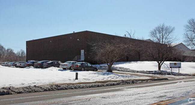
Property Detail
111 Kane St
6345D-004
3.3595 ACRES
Lightindustrial
Baltimore City
I-1
Maryland
B and X Area of moderate flood hazard, usually the area between the limits of the 100-year and 500-year floods.
4
2023
3.35 AC
2025
Baltimore SE
260501
Baltimore
56,442 SF
Baltimore-Columbia-Towson, MD
NEARBY LISTINGS FOR SALE OR LEASE
DEMOGRAPHICS near 111 Kane St
1 mile
3 mile
5 mile
2025 Total Population
11,136
152,938
389,054
2030 Population
10,892
150,949
385,350
Pop Growth 2025-2030
(2.19%)
(1.30%)
(0.95%)
Average Age
38
38
39
2025 Total Households
3,931
60,637
165,380
HH Growth 2025-2030
(2.29%)
(1.43%)
(1.05%)
Median Household Inc
$63,430
$64,720
$67,128
Avg Household Size
2.70
2.40
2.30
2025 Avg HH Vehicles
2.00
1.00
1.00
Median Home Value
$189,077
$228,389
$249,128
Median Year Built
1952
1950
1951
Nearby Places
Map Layers
Map Styles
 Street
 Aerial
Transit
 Traffic
 Biking
Places
Listings with unknown addresses are not visible on the map
- Restaurants
- Banks
- Shops
- Fitness
- Groceries
PUBLIC TRANSPORTATION
COMMUTER RAIL
Penn Station (PENN - WASHINGTON - Maryland Area Regional Commuter Trains (The MARC), Penn Line - Maryland Area Regional Commuter Trains (The MARC), Penn Station & Camden Yards - Maryland Area Regional Commuter Trains (The MARC))
Drive
Walk
Distance
Penn Station (PENN - WASHINGTON - Maryland Area Regional Commuter Trains (The MARC), Penn Line - Maryland Area Regional Commuter Trains (The MARC), Penn Station & Camden Yards - Maryland Area Regional Commuter Trains (The MARC))
15 min
5.9 mi
Camden Station Marc (CAMDEN - WASHINGTON - Maryland Transit Administration)
Drive
Walk
Distance
Camden Station Marc (CAMDEN - WASHINGTON - Maryland Transit Administration)
15 min
7.9 mi
AIRPORT
Baltimore/Washington International Thurgood Marshall
Drive
Walk
Distance
Baltimore/Washington International Thurgood Marshall
26 min
15.5 mi
Freight Ports
Port of Baltimore
Drive
Walk
Distance
Port of Baltimore
12 min
6.0 mi
Nearby Properties
Address
Land Use
TOTAL SIZE
Lot Size
Zoning
Address
Land Use
TOTAL SIZE
Lot Size
Zoning
608,666 SF
8.42 AC
H
Address
Land Use
TOTAL SIZE
Lot Size
Zoning
268,543 SF
84.93 AC
H
Address
Land Use
TOTAL SIZE
Lot Size
Zoning
1,015,550 SF
64.95 AC
I-2
Address
Land Use
TOTAL SIZE
Lot Size
Zoning
831,350 SF
5.56 AC
C-2
Address
Land Use
TOTAL SIZE
Lot Size
Zoning
598,638 SF
3.75 AC
C-2
Address
Land Use
TOTAL SIZE
Lot Size
Zoning
728,691 SF
3.95 AC
C-2
Address
Land Use
TOTAL SIZE
Lot Size
Zoning
534,109 SF
5.57 AC
R-8
Address
Land Use
TOTAL SIZE
Lot Size
Zoning
417,571 SF
4.20 AC
C-2*
Address
Land Use
TOTAL SIZE
Lot Size
Zoning
475,525 SF
4.22 AC
C-3
Address
Land Use
TOTAL SIZE
Lot Size
Zoning
347,000 SF
42.73 AC
DR
Address
Land Use
TOTAL SIZE
Lot Size
Zoning
522,274 SF
1.23 AC
C-3
Address
Land Use
TOTAL SIZE
Lot Size
Zoning
619,700 SF
34.98 AC
I-2
Address
Land Use
TOTAL SIZE
Lot Size
Zoning
278,006 SF
49.85 AC
DR
Address
Land Use
TOTAL SIZE
Lot Size
Zoning
210,873 SF
12.28 AC
C-3
Address
Land Use
TOTAL SIZE
Lot Size
Zoning
413,345 SF
46.90 AC
I-2
Address
Land Use
TOTAL SIZE
Lot Size
Zoning
49,950 SF
28.31 AC
I-2
Address
Land Use
TOTAL SIZE
Lot Size
Zoning
621,041 SF
32.69 AC
MH-IM
Address
Land Use
TOTAL SIZE
Lot Size
Zoning
249,000 SF
1.40 AC
R-8
Address
Land Use
TOTAL SIZE
Lot Size
Zoning
126,507 SF
1.05 AC
H
Address
Land Use
TOTAL SIZE
Lot Size
Zoning
135,548 SF
13 AC
DR5.5
Address
Land Use
TOTAL SIZE
Lot Size
Zoning
382,743 SF
3.47 AC
C-2*
Address
Land Use
TOTAL SIZE
Lot Size
Zoning
111.89 AC
OS
Address
Land Use
TOTAL SIZE
Lot Size
Zoning
227,772 SF
19.14 AC
2-1
Address
Land Use
TOTAL SIZE
Lot Size
Zoning
279,062 SF
13.40 AC
I-2
Address
Land Use
TOTAL SIZE
Lot Size
Zoning
132,038 SF
5.38 AC
OIC
Address
Land Use
TOTAL SIZE
Lot Size
Zoning
346,408 SF
18.50 AC
I-2
Address
Land Use
TOTAL SIZE
Lot Size
Zoning
139.18 AC
MI
Address
Land Use
TOTAL SIZE
Lot Size
Zoning
97,784 SF
1.35 AC
DR10.
Address
Land Use
TOTAL SIZE
Lot Size
Zoning
342,500 SF
52.40 AC
I-2
Address
Land Use
TOTAL SIZE
Lot Size
Zoning
666,800 SF
17.50 AC
OIC
The World's #1 Commercial Real Estate Marketplace
Connect with us
© 2026 CoStar Group
The information above has been obtained from sources believed reliable. While we do not doubt its accuracy we have not verified it and make no guarantee, warranty or representation about it. It is your responsibility to independently confirm its accuracy and completeness. Any projections, opinions, assumptions, or estimates used are for example only and do not represent the current or future performance of the property. The value of this transaction to you depends on tax and other factors which should be evaluated by your tax, financial, and legal advisors. You and your advisors should conduct a careful, independent investigation of the property to determine to your satisfaction the suitability of the property for your needs.