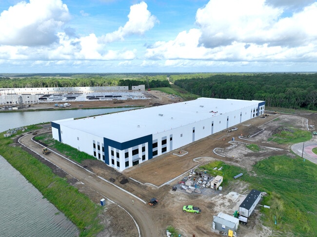
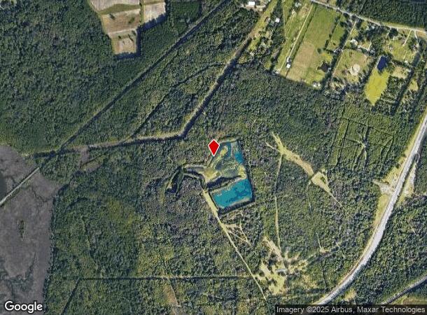
Property Record
100 Feldspar Dr, Savannah, GA 31405
Current Lease Availabilities
NEARBY LISTINGS FOR SALE OR LEASE
Property Detail
100 Feldspar Dr
Savannah, GA
TRACT 3 ROCKINGHAM FARMS, 7TH GM D, SAVANNAH
2094301004
Chatham
Vacantlandnec
Georgia
0
103.46 AC
2025
Outlying Chatham County
010502
Savannah
DEMOGRAPHICS near 100 Feldspar Dr
1 Mile
3 Mile
5 Mile
2024 Total Population
196
23,057
109,463
2029 Population
215
25,511
120,362
Pop Growth 2024-2029
+ 9.69%
+ 10.64%
+ 9.96%
Average Age
44
38
39
2024 Total Households
88
9,357
43,982
HH Growth 2024-2029
+ 10.23%
+ 11.05%
+ 10.30%
Median Household Inc
$67,500
$56,798
$63,066
Avg Household Size
2.20
2.30
2.30
2024 Avg HH Vehicles
2.00
2.00
2.00
Median Home Value
$248,333
$256,112
$274,319
Median Year Built
1975
1995
1985
Nearby Places
Map Layers
Map Styles
 Street
 Aerial
- Restaurants
- Banks
- Shops
- Fitness
- Groceries
PUBLIC TRANSPORTATION
COMMUTER RAIL
Savannah (Palmetto - Amtrak, Silver Meteor - Amtrak, Silver Star - Amtrak)
DRIVE
WALK
Distance
Savannah (Palmetto - Amtrak, Silver Meteor - Amtrak, Silver Star - Amtrak)
14 min
6.4 mi
AIRPORT
Savannah/Hilton Head International
DRIVE
WALK
Distance
Savannah/Hilton Head International
23 min
11.1 mi
Freight Ports
Georgia Ports - Savannah
DRIVE
WALK
Distance
Georgia Ports - Savannah
19 min
10.3 mi
Nearby Properties
Address
Land Use
TOTAL SIZE
Lot Size
Zoning
Address
Land Use
TOTAL SIZE
Lot Size
Zoning
99.50 AC
M
Address
Land Use
TOTAL SIZE
Lot Size
Zoning
70.49 AC
M
Address
Land Use
TOTAL SIZE
Lot Size
Zoning
0.12 AC
R6
Address
Land Use
TOTAL SIZE
Lot Size
Zoning
942,210 SF
50.60 AC
Address
Land Use
TOTAL SIZE
Lot Size
Zoning
34,224 SF
20 AC
C-1
Address
Land Use
TOTAL SIZE
Lot Size
Zoning
21,316 SF
26.07 AC
PUDM18
Address
Land Use
TOTAL SIZE
Lot Size
Zoning
32,190 SF
22.11 AC
PUDBR
Address
Land Use
TOTAL SIZE
Lot Size
Zoning
12,560 SF
14.82 AC
PUD
Address
Land Use
TOTAL SIZE
Lot Size
Zoning
29,304 SF
27.20 AC
R3
Address
Land Use
TOTAL SIZE
Lot Size
Zoning
21.13 AC
PUDC
Address
Land Use
TOTAL SIZE
Lot Size
Zoning
413,230 SF
39.64 AC
M-CO
Address
Land Use
TOTAL SIZE
Lot Size
Zoning
355,570 SF
25.41 AC
PIL
Address
Land Use
TOTAL SIZE
Lot Size
Zoning
12,560 SF
22.94 AC
PUD
Address
Land Use
TOTAL SIZE
Lot Size
Zoning
31,710 SF
15.91 AC
PUDBR
Address
Land Use
TOTAL SIZE
Lot Size
Zoning
3,848 SF
9.14 AC
PBG
Address
Land Use
TOTAL SIZE
Lot Size
Zoning
16,138 SF
18.33 AC
PUDC
Address
Land Use
TOTAL SIZE
Lot Size
Zoning
10,200 SF
12.79 AC
RM25
Address
Land Use
TOTAL SIZE
Lot Size
Zoning
73,992 SF
11.89 AC
PUDBR
Address
Land Use
TOTAL SIZE
Lot Size
Zoning
97,200 SF
30.77 AC
PUDBR
Address
Land Use
TOTAL SIZE
Lot Size
Zoning
28.95 AC
M
Address
Land Use
TOTAL SIZE
Lot Size
Zoning
71,502 SF
10.60 AC
PUDIS
Address
Land Use
TOTAL SIZE
Lot Size
Zoning
124,110 SF
17.38 AC
PUDB
Address
Land Use
TOTAL SIZE
Lot Size
Zoning
30,964 SF
23.02 AC
PUDBR
Address
Land Use
TOTAL SIZE
Lot Size
Zoning
11,784 SF
9.79 AC
PUDC
Address
Land Use
TOTAL SIZE
Lot Size
Zoning
142,560 SF
6.67 AC
PUDCC
Address
Land Use
TOTAL SIZE
Lot Size
Zoning
35,732 SF
6.11 AC
PUDBR
Address
Land Use
TOTAL SIZE
Lot Size
Zoning
8,052 SF
6.94 AC
PUDM
Address
Land Use
TOTAL SIZE
Lot Size
Zoning
22,600 SF
7.45 AC
BN
Address
Land Use
TOTAL SIZE
Lot Size
Zoning
8,672 SF
6.06 AC
PR4
Address
Land Use
TOTAL SIZE
Lot Size
Zoning
35,304 SF
6.40 AC
PUDC
The World's #1 Commercial Real Estate Marketplace
Connect with us
© 2026 CoStar Group
The information above has been obtained from sources believed reliable. While we do not doubt its accuracy we have not verified it and make no guarantee, warranty or representation about it. It is your responsibility to independently confirm its accuracy and completeness. Any projections, opinions, assumptions, or estimates used are for example only and do not represent the current or future performance of the property. The value of this transaction to you depends on tax and other factors which should be evaluated by your tax, financial, and legal advisors. You and your advisors should conduct a careful, independent investigation of the property to determine to your satisfaction the suitability of the property for your needs.