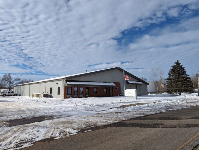
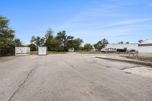
Property Record
111 Mccollum, Galesburg, MI 49053

NEARBY LISTINGS FOR SALE OR LEASE
-
-
View all Galesburg listings for lease on LoopNet.com
Property Detail
111 Mccollum
Kalamazoo-Portage, MI
Assrs Of City Of Galesburg
08-18-376-026
ASSESSORS PLAT OF CITY OF GALESBURG BEG IN E LI LOT 291 150 FT N OF NE COR LOT 290 TH N ON E LI 165 FT TH W 400 FT TH S 165FT
Commercialnec
Kalamazoo
X
Michigan
26077C0216E
290-291
2025
1.51 AC
2025
NE Kalamazoo County
006701
West Michigan
19,000 SF
DEMOGRAPHICS near 111 Mccollum
1 Mile
3 Mile
5 Mile
2024 Total Population
2,155
6,134
12,753
2029 Population
2,139
6,103
12,693
Pop Growth 2024-2029
(0.74%)
(0.51%)
(0.47%)
Average Age
38
40
41
2024 Total Households
829
2,374
5,014
HH Growth 2024-2029
(0.72%)
(0.51%)
(0.50%)
Median Household Inc
$45,532
$67,681
$72,012
Avg Household Size
2.60
2.60
2.50
2024 Avg HH Vehicles
2.00
2.00
2.00
Median Home Value
$168,506
$211,482
$219,040
Median Year Built
1970
1974
1974
Nearby Places
Map Layers
Map Styles
 Street
 Aerial
- Restaurants
- Banks
- Shops
- Fitness
- Groceries
PUBLIC TRANSPORTATION
COMMUTER RAIL
DRIVE
WALK
Distance
17 min
9.7 mi
AIRPORT
Kalamazoo/Battle Creek International
DRIVE
WALK
Distance
Kalamazoo/Battle Creek International
21 min
11.4 mi
SALE & LEASE HISTORY
LISTING DATE
SALE/LEASE

Feb 21, 2025
For Lease
Feb 05, 2024
For Sale
Nearby Properties
Address
Land Use
TOTAL SIZE
Lot Size
Zoning
Address
Land Use
TOTAL SIZE
Lot Size
Zoning
1,348,074 SF
136.92 AC
R-IP
Address
Land Use
TOTAL SIZE
Lot Size
Zoning
68,520 SF
28.94 AC
LM
Address
Land Use
TOTAL SIZE
Lot Size
Zoning
254,848 SF
106.40 AC
I-1
Address
Land Use
TOTAL SIZE
Lot Size
Zoning
268,277 SF
92.43 AC
M
Address
Land Use
TOTAL SIZE
Lot Size
Zoning
102,937 SF
N/A
Address
Land Use
TOTAL SIZE
Lot Size
Zoning
73,710 SF
10.18 AC
LM
Address
Land Use
TOTAL SIZE
Lot Size
Zoning
52,009 SF
20 AC
LM
Address
Land Use
TOTAL SIZE
Lot Size
Zoning
2,814 SF
46.48 AC
R6
Address
Land Use
TOTAL SIZE
Lot Size
Zoning
130,000 SF
9.27 AC
LM
Address
Land Use
TOTAL SIZE
Lot Size
Zoning
33,300 SF
6.47 AC
B-3
Address
Land Use
TOTAL SIZE
Lot Size
Zoning
41,310 SF
1.81 AC
LM
Address
Land Use
TOTAL SIZE
Lot Size
Zoning
73,710 SF
LM
Address
Land Use
TOTAL SIZE
Lot Size
Zoning
27,556 SF
5 AC
R2
Address
Land Use
TOTAL SIZE
Lot Size
Zoning
Address
Land Use
TOTAL SIZE
Lot Size
Zoning
46,880 SF
19.50 AC
LM
Address
Land Use
TOTAL SIZE
Lot Size
Zoning
36,191 SF
4.47 AC
LM
Address
Land Use
TOTAL SIZE
Lot Size
Zoning
21,600 SF
5.46 AC
LM
Address
Land Use
TOTAL SIZE
Lot Size
Zoning
7,653 SF
2.71 AC
B-3
Address
Land Use
TOTAL SIZE
Lot Size
Zoning
24,053 SF
N/A
Address
Land Use
TOTAL SIZE
Lot Size
Zoning
69,250 SF
5.62 AC
LM
Address
Land Use
TOTAL SIZE
Lot Size
Zoning
16,580 SF
3.45 AC
RM
Address
Land Use
TOTAL SIZE
Lot Size
Zoning
1,906 SF
77.61 AC
AG-2
Address
Land Use
TOTAL SIZE
Lot Size
Zoning
30,000 SF
N/A
Address
Land Use
TOTAL SIZE
Lot Size
Zoning
89,840 SF
4.97 AC
I2
Address
Land Use
TOTAL SIZE
Lot Size
Zoning
16,884 SF
5 AC
LM
Address
Land Use
TOTAL SIZE
Lot Size
Zoning
55,086 SF
4.56 AC
I2
Address
Land Use
TOTAL SIZE
Lot Size
Zoning
199.85 AC
AG-2
Address
Land Use
TOTAL SIZE
Lot Size
Zoning
13,164 SF
2.10 AC
R4
Address
Land Use
TOTAL SIZE
Lot Size
Zoning
18,263 SF
0.49 AC
C2
Address
Land Use
TOTAL SIZE
Lot Size
Zoning
14,100 SF
3.27 AC
CRO
The World's #1 Commercial Real Estate Marketplace
Connect with us
© 2026 CoStar Group
The information above has been obtained from sources believed reliable. While we do not doubt its accuracy we have not verified it and make no guarantee, warranty or representation about it. It is your responsibility to independently confirm its accuracy and completeness. Any projections, opinions, assumptions, or estimates used are for example only and do not represent the current or future performance of the property. The value of this transaction to you depends on tax and other factors which should be evaluated by your tax, financial, and legal advisors. You and your advisors should conduct a careful, independent investigation of the property to determine to your satisfaction the suitability of the property for your needs.