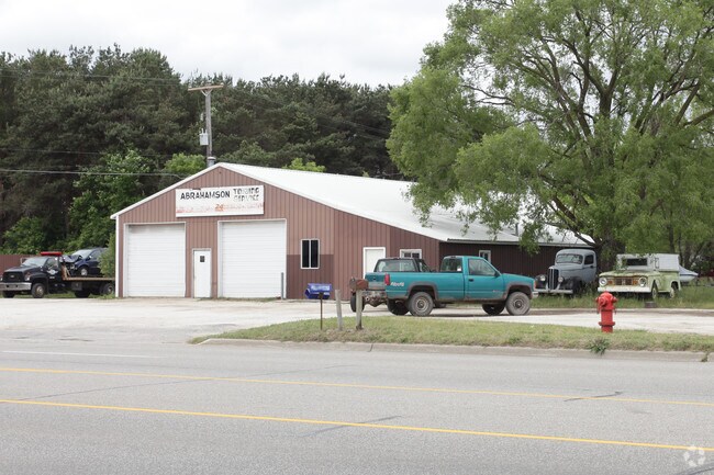
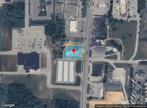
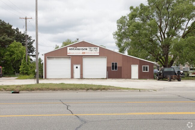
Property Record
111 S Pere Marquette Hwy, Ludington, MI 49431
NEARBY LISTINGS FOR SALE OR LEASE
Property Detail
111 S Pere Marquette Hwy
010-013-300-011-10
SEC 13 T18N R18W COMMENCING AT THE NORTHWEST CORNER OF THE EAST 1/2 OF THE WEST 1/2 OF THE SOUTHWEST 1/4 OF SECTION 13. TOWN
Commercialnec
Mason
X
Michigan
26105C0235D
0.77 AC
2024
Michigan Northwest Area
2025
Other Market Areas
950500
Ludington, MI
6,444 SF
DEMOGRAPHICS near 111 S Pere Marquette Hwy
1 Mile
3 Mile
5 Mile
2024 Total Population
1,429
11,368
14,873
2029 Population
1,412
11,548
15,146
Pop Growth 2024-2029
(1.19%)
+ 1.58%
+ 1.84%
Average Age
45
45
45
2024 Total Households
631
5,072
6,551
HH Growth 2024-2029
(1.27%)
+ 1.50%
+ 1.79%
Median Household Inc
$39,258
$55,486
$57,083
Avg Household Size
2.10
2.10
2.20
2024 Avg HH Vehicles
1.00
2.00
2.00
Median Home Value
$142,413
$190,871
$194,295
Median Year Built
1973
1970
1974
Nearby Places
Map Layers
Map Styles
 Street
 Aerial
- Restaurants
- Banks
- Shops
- Fitness
- Groceries
Nearby Properties
Address
Land Use
TOTAL SIZE
Lot Size
Zoning
Address
Land Use
TOTAL SIZE
Lot Size
Zoning
360,065 SF
65 AC
Address
Land Use
TOTAL SIZE
Lot Size
Zoning
272,984 SF
24.92 AC
Address
Land Use
TOTAL SIZE
Lot Size
Zoning
75,925 SF
6.90 AC
Address
Land Use
TOTAL SIZE
Lot Size
Zoning
197,531 SF
26.61 AC
Address
Land Use
TOTAL SIZE
Lot Size
Zoning
59,349 SF
4.58 AC
Address
Land Use
TOTAL SIZE
Lot Size
Zoning
7,338 SF
9.85 AC
Address
Land Use
TOTAL SIZE
Lot Size
Zoning
9.85 AC
Address
Land Use
TOTAL SIZE
Lot Size
Zoning
23,980 SF
2 AC
Address
Land Use
TOTAL SIZE
Lot Size
Zoning
45,000 SF
28 AC
Address
Land Use
TOTAL SIZE
Lot Size
Zoning
80,700 SF
Address
Land Use
TOTAL SIZE
Lot Size
Zoning
51,876 SF
7.79 AC
Address
Land Use
TOTAL SIZE
Lot Size
Zoning
27.84 AC
Address
Land Use
TOTAL SIZE
Lot Size
Zoning
6,858 SF
Address
Land Use
TOTAL SIZE
Lot Size
Zoning
134,563 SF
15.91 AC
Address
Land Use
TOTAL SIZE
Lot Size
Zoning
54,208 SF
17 AC
Address
Land Use
TOTAL SIZE
Lot Size
Zoning
150,943 SF
9.47 AC
Address
Land Use
TOTAL SIZE
Lot Size
Zoning
25,144 SF
0.03 AC
Address
Land Use
TOTAL SIZE
Lot Size
Zoning
116,000 SF
17.12 AC
Address
Land Use
TOTAL SIZE
Lot Size
Zoning
50,696 SF
9.67 AC
Address
Land Use
TOTAL SIZE
Lot Size
Zoning
69,922 SF
19.52 AC
Address
Land Use
TOTAL SIZE
Lot Size
Zoning
29,337 SF
2.63 AC
Address
Land Use
TOTAL SIZE
Lot Size
Zoning
67,942 SF
9.47 AC
Address
Land Use
TOTAL SIZE
Lot Size
Zoning
49,823 SF
1.90 AC
Address
Land Use
TOTAL SIZE
Lot Size
Zoning
35,930 SF
6.75 AC
Address
Land Use
TOTAL SIZE
Lot Size
Zoning
110,000 SF
28.18 AC
Address
Land Use
TOTAL SIZE
Lot Size
Zoning
110,000 SF
Address
Land Use
TOTAL SIZE
Lot Size
Zoning
37,140 SF
3.86 AC
Address
Land Use
TOTAL SIZE
Lot Size
Zoning
8,979 SF
0.23 AC
Address
Land Use
TOTAL SIZE
Lot Size
Zoning
41,248 SF
3.86 AC
Address
Land Use
TOTAL SIZE
Lot Size
Zoning
211,573 SF
6.46 AC
The World's #1 Commercial Real Estate Marketplace
Connect with us
© 2025 CoStar Group
The information above has been obtained from sources believed reliable. While we do not doubt its accuracy we have not verified it and make no guarantee, warranty or representation about it. It is your responsibility to independently confirm its accuracy and completeness. Any projections, opinions, assumptions, or estimates used are for example only and do not represent the current or future performance of the property. The value of this transaction to you depends on tax and other factors which should be evaluated by your tax, financial, and legal advisors. You and your advisors should conduct a careful, independent investigation of the property to determine to your satisfaction the suitability of the property for your needs.