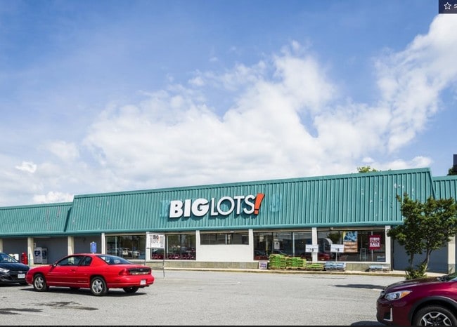
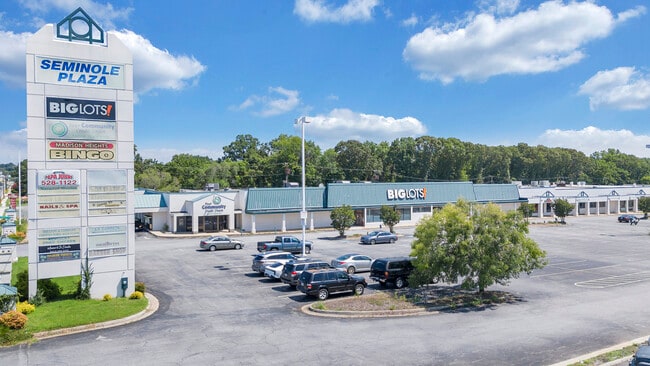
Property Record
109 Seminole Plz, Madison Heights, VA 24572
NEARBY LISTINGS FOR SALE OR LEASE
Property Detail
109 Seminole Plz
156-A-6
SEMINOLE SHOPPING CENTER PT OF TRACT A PLAT K-233 156 A 6
Storebuilding
Amherst
X
Virginia
51011C0075D
16.33 AC
2024
Lynchburg
2025
Other Market Areas
010504
Lynchburg, VA
60,545 SF
DEMOGRAPHICS near 109 Seminole Plz
1 Mile
3 Mile
5 Mile
2024 Total Population
2,333
20,202
51,406
2029 Population
2,378
20,562
51,902
Pop Growth 2024-2029
+ 1.93%
+ 1.78%
+ 0.96%
Average Age
41
40
38
2024 Total Households
1,036
8,822
20,760
HH Growth 2024-2029
+ 1.93%
+ 1.82%
+ 1.04%
Median Household Inc
$41,944
$46,192
$48,714
Avg Household Size
2.30
2.20
2.20
2024 Avg HH Vehicles
2.00
2.00
2.00
Median Home Value
$155,280
$148,208
$154,440
Median Year Built
1968
1960
1960
Nearby Places
Map Layers
Map Styles
 Street
 Aerial
- Restaurants
- Banks
- Shops
- Fitness
- Groceries
PUBLIC TRANSPORTATION
COMMUTER RAIL
Lynchburg (Crescent - Amtrak, Northeast Regional - Amtrak)
DRIVE
WALK
Distance
Lynchburg (Crescent - Amtrak, Northeast Regional - Amtrak)
7 min
4.5 mi
AIRPORT
Lynchburg Regional/Preston Glenn Field
DRIVE
WALK
Distance
Lynchburg Regional/Preston Glenn Field
19 min
11.8 mi
Freight Ports
Virginia Port Authority - Richmond
DRIVE
WALK
Distance
Virginia Port Authority - Richmond
152 min
112.6 mi
SALE & LEASE HISTORY
LISTING DATE
SALE/LEASE

Sep 24, 2016
For Sale
May 22, 2019
For Sale
Jan 11, 2018
For Lease
Jan 05, 2017
For Lease
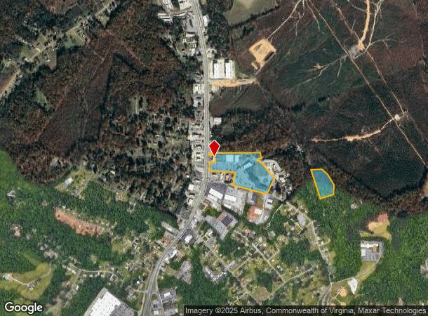
Nearby Properties
Address
Land Use
TOTAL SIZE
Lot Size
Zoning
Address
Land Use
TOTAL SIZE
Lot Size
Zoning
626,329 SF
50.88 AC
2521
Address
Land Use
TOTAL SIZE
Lot Size
Zoning
186,536 SF
21.45 AC
P1
Address
Land Use
TOTAL SIZE
Lot Size
Zoning
183,584 SF
2 AC
R4
Address
Land Use
TOTAL SIZE
Lot Size
Zoning
118,789 SF
1.90 AC
2501
Address
Land Use
TOTAL SIZE
Lot Size
Zoning
114,738 SF
0.51 AC
B4
Address
Land Use
TOTAL SIZE
Lot Size
Zoning
46,689 SF
1.74 AC
B6
Address
Land Use
TOTAL SIZE
Lot Size
Zoning
21,542 SF
41.78 AC
R2
Address
Land Use
TOTAL SIZE
Lot Size
Zoning
80,165 SF
1.26 AC
090125
Address
Land Use
TOTAL SIZE
Lot Size
Zoning
66,832 SF
48.77 AC
B2
Address
Land Use
TOTAL SIZE
Lot Size
Zoning
342,948 SF
1.94 AC
B4
Address
Land Use
TOTAL SIZE
Lot Size
Zoning
152,112 SF
4.74 AC
R3
Address
Land Use
TOTAL SIZE
Lot Size
Zoning
57,270 SF
1.56 AC
B6
Address
Land Use
TOTAL SIZE
Lot Size
Zoning
88,473 SF
0.97 AC
B4
Address
Land Use
TOTAL SIZE
Lot Size
Zoning
134,387 SF
12.17 AC
B2
Address
Land Use
TOTAL SIZE
Lot Size
Zoning
9.79 AC
B2
Address
Land Use
TOTAL SIZE
Lot Size
Zoning
61,415 SF
24.11 AC
P1
Address
Land Use
TOTAL SIZE
Lot Size
Zoning
154,922 SF
16.89 AC
B2
Address
Land Use
TOTAL SIZE
Lot Size
Zoning
45,837 SF
0.90 AC
B4
Address
Land Use
TOTAL SIZE
Lot Size
Zoning
67,310 SF
1.44 AC
B6
Address
Land Use
TOTAL SIZE
Lot Size
Zoning
156,177 SF
1.75 AC
B4
Address
Land Use
TOTAL SIZE
Lot Size
Zoning
57,120 SF
0.46 AC
B6
Address
Land Use
TOTAL SIZE
Lot Size
Zoning
259,925 SF
0.54 AC
B4
Address
Land Use
TOTAL SIZE
Lot Size
Zoning
128,488 SF
15.60 AC
B2
Address
Land Use
TOTAL SIZE
Lot Size
Zoning
107,695 SF
1.47 AC
B6
Address
Land Use
TOTAL SIZE
Lot Size
Zoning
31,734 SF
0.23 AC
B6
Address
Land Use
TOTAL SIZE
Lot Size
Zoning
104,012 SF
1.03 AC
B6
Address
Land Use
TOTAL SIZE
Lot Size
Zoning
6,900 SF
0.13 AC
B4
Address
Land Use
TOTAL SIZE
Lot Size
Zoning
65,688 SF
0.31 AC
B6
The World's #1 Commercial Real Estate Marketplace
Connect with us
© 2026 CoStar Group
The information above has been obtained from sources believed reliable. While we do not doubt its accuracy we have not verified it and make no guarantee, warranty or representation about it. It is your responsibility to independently confirm its accuracy and completeness. Any projections, opinions, assumptions, or estimates used are for example only and do not represent the current or future performance of the property. The value of this transaction to you depends on tax and other factors which should be evaluated by your tax, financial, and legal advisors. You and your advisors should conduct a careful, independent investigation of the property to determine to your satisfaction the suitability of the property for your needs.