Property Record
111 W Ruby St, Tavares, FL 32778
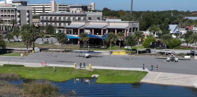


Property Detail
111 W Ruby St
29-19-26-0500-002-00A00
TAVARES GOVT SURVEY LOTS A B C D E F G BLK 2 *UNRECORDED PLAT SEE DEED FOR FULL PROPERTY DESCRIPTION ORB 6130 PG 2262
Restaurantbuilding
LAKE
PD
Florida
B and X Area of moderate flood hazard, usually the area between the limits of the 100-year and 500-year floods.
a
2024
0.96 AC
2026
Lake County
030803
Orlando
6,470 SF
Orlando-Kissimmee-Sanford, FL
NEARBY LISTINGS FOR SALE OR LEASE
DEMOGRAPHICS near 111 W Ruby St
1 mile
3 mile
5 mile
2025 Total Population
5,624
31,336
67,121
2030 Population
6,454
35,937
76,571
Pop Growth 2025-2030
+ 14.76%
+ 14.68%
+ 14.08%
Average Age
46
46
46
2025 Total Households
2,462
13,838
29,169
HH Growth 2025-2030
+ 15.64%
+ 14.93%
+ 14.27%
Median Household Inc
$47,247
$49,395
$59,842
Avg Household Size
2.00
2.20
2.20
2025 Avg HH Vehicles
1.00
1.00
2.00
Median Home Value
$192,499
$242,090
$255,323
Median Year Built
1982
1990
1987
Nearby Places
Map Layers
Map Styles
 Street
 Aerial
Layers
 Traffic
 Biking
Places
Listings with unknown addresses are not visible on the map
- Restaurants
- Banks
- Shops
- Fitness
- Groceries
PUBLIC TRANSPORTATION
AIRPORT
Orlando Sanford International
Drive
Walk
Distance
Orlando Sanford International
59 min
37.9 mi
SALE & LEASE HISTORY
LISTING DATE
SALE/LEASE

Apr 29, 2026
For Sale
Nearby Properties
Address
Land Use
TOTAL SIZE
Lot Size
Zoning
Address
Land Use
TOTAL SIZE
Lot Size
Zoning
730,215 SF
151.42 AC
PD
Address
Land Use
TOTAL SIZE
Lot Size
Zoning
15,600 SF
9.32 AC
PFD
Address
Land Use
TOTAL SIZE
Lot Size
Zoning
278,266 SF
23.85 AC
PD
Address
Land Use
TOTAL SIZE
Lot Size
Zoning
226,508 SF
19.15 AC
Address
Land Use
TOTAL SIZE
Lot Size
Zoning
481,096 SF
2.17 AC
PFD
Address
Land Use
TOTAL SIZE
Lot Size
Zoning
158,442 SF
17.50 AC
MCI
Address
Land Use
TOTAL SIZE
Lot Size
Zoning
121,005 SF
6.56 AC
Address
Land Use
TOTAL SIZE
Lot Size
Zoning
85,539 SF
9.39 AC
Address
Land Use
TOTAL SIZE
Lot Size
Zoning
138,613 SF
24.59 AC
PFD
Address
Land Use
TOTAL SIZE
Lot Size
Zoning
97,053 SF
1.50 AC
PFD
Address
Land Use
TOTAL SIZE
Lot Size
Zoning
45,732 SF
5.68 AC
PD
Address
Land Use
TOTAL SIZE
Lot Size
Zoning
145,614 SF
11.27 AC
PD
Address
Land Use
TOTAL SIZE
Lot Size
Zoning
135,298 SF
9.22 AC
SR
Address
Land Use
TOTAL SIZE
Lot Size
Zoning
29,066 SF
0.76 AC
Address
Land Use
TOTAL SIZE
Lot Size
Zoning
149,998 SF
8.73 AC
I
Address
Land Use
TOTAL SIZE
Lot Size
Zoning
36,261 SF
6.27 AC
PD
Address
Land Use
TOTAL SIZE
Lot Size
Zoning
2,000 SF
3.04 AC
PFD
Address
Land Use
TOTAL SIZE
Lot Size
Zoning
45,310 SF
2.93 AC
PFD
Address
Land Use
TOTAL SIZE
Lot Size
Zoning
Address
Land Use
TOTAL SIZE
Lot Size
Zoning
146,690 SF
15.19 AC
RMF2
Address
Land Use
TOTAL SIZE
Lot Size
Zoning
106,175 SF
8.10 AC
UR
Address
Land Use
TOTAL SIZE
Lot Size
Zoning
54,035 SF
1.65 AC
PD
Address
Land Use
TOTAL SIZE
Lot Size
Zoning
87,462 SF
4.94 AC
RMF3
Address
Land Use
TOTAL SIZE
Lot Size
Zoning
121,815 SF
33.48 AC
PD
Address
Land Use
TOTAL SIZE
Lot Size
Zoning
2,000 SF
19.74 AC
PFD
Address
Land Use
TOTAL SIZE
Lot Size
Zoning
2,000 SF
2.14 AC
PFD
Address
Land Use
TOTAL SIZE
Lot Size
Zoning
63,600 SF
1.24 AC
PD
Address
Land Use
TOTAL SIZE
Lot Size
Zoning
100,117 SF
7.45 AC
GC
Address
Land Use
TOTAL SIZE
Lot Size
Zoning
116,261 SF
5.66 AC
Address
Land Use
TOTAL SIZE
Lot Size
Zoning
40,776 SF
2.28 AC
C1
The World's #1 Commercial Real Estate Marketplace
Connect with us
© 2026 CoStar Group
The information above has been obtained from sources believed reliable. While we do not doubt its accuracy we have not verified it and make no guarantee, warranty or representation about it. It is your responsibility to independently confirm its accuracy and completeness. Any projections, opinions, assumptions, or estimates used are for example only and do not represent the current or future performance of the property. The value of this transaction to you depends on tax and other factors which should be evaluated by your tax, financial, and legal advisors. You and your advisors should conduct a careful, independent investigation of the property to determine to your satisfaction the suitability of the property for your needs.