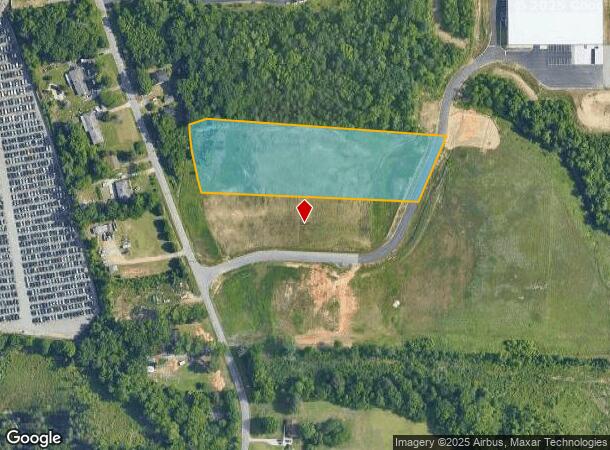
Property Record
111 Ward Rd, Greensboro, NC 27405

NEARBY LISTINGS FOR SALE OR LEASE
Property Detail
111 Ward Rd
Greensboro-High Point, NC
Wendover Industrial Center
0082832
WENDOVER INDUSTRIAL CENTER, SHEETS 1 & 2 LO:1
Vacantlandnec
Guilford
X
North Carolina
3710788500J
1
2024
3.86 AC
2025
NE Guilford County
012803
Greensboro/Winston-Salem
45,019 SF
DEMOGRAPHICS near 111 Ward Rd
1 Mile
3 Mile
5 Mile
2024 Total Population
3,329
41,923
119,132
2029 Population
3,329
42,166
119,614
Pop Growth 2024-2029
0.00%
+ 0.58%
+ 0.40%
Average Age
35
36
36
2024 Total Households
1,196
15,191
44,155
HH Growth 2024-2029
(0.08%)
+ 0.74%
+ 0.54%
Median Household Inc
$37,500
$38,514
$44,125
Avg Household Size
2.70
2.50
2.30
2024 Avg HH Vehicles
2.00
2.00
2.00
Median Home Value
$124,827
$121,716
$158,334
Median Year Built
1972
1976
1976
Nearby Places
Map Layers
Map Styles
 Street
 Aerial
- Restaurants
- Banks
- Shops
- Fitness
- Groceries
PUBLIC TRANSPORTATION
COMMUTER RAIL
Greensboro Station (Piedmont - North Carolina by Train (NC Train))
DRIVE
WALK
Distance
Greensboro Station (Piedmont - North Carolina by Train (NC Train))
9 min
5.1 mi
AIRPORT
Piedmont Triad International
DRIVE
WALK
Distance
Piedmont Triad International
28 min
16.0 mi
Freight Ports
Virginia Port Authority - Richmond
DRIVE
WALK
Distance
Virginia Port Authority - Richmond
225 min
195.1 mi
SALE & LEASE HISTORY
LISTING DATE
SALE/LEASE

Sep 24, 2016
For Sale
Nearby Properties
Address
Land Use
TOTAL SIZE
Lot Size
Zoning
Address
Land Use
TOTAL SIZE
Lot Size
Zoning
905,672 SF
28.64 AC
PI
Address
Land Use
TOTAL SIZE
Lot Size
Zoning
1,546,815 SF
93.94 AC
CU-LI
Address
Land Use
TOTAL SIZE
Lot Size
Zoning
313,033 SF
71.38 AC
O
Address
Land Use
TOTAL SIZE
Lot Size
Zoning
364,783 SF
30.12 AC
RM-18
Address
Land Use
TOTAL SIZE
Lot Size
Zoning
418,596 SF
23.53 AC
LI
Address
Land Use
TOTAL SIZE
Lot Size
Zoning
224,444 SF
80.09 AC
PI
Address
Land Use
TOTAL SIZE
Lot Size
Zoning
275,282 SF
43.43 AC
PI
Address
Land Use
TOTAL SIZE
Lot Size
Zoning
505,615 SF
39.50 AC
LI
Address
Land Use
TOTAL SIZE
Lot Size
Zoning
661,843 SF
46.38 AC
PI
Address
Land Use
TOTAL SIZE
Lot Size
Zoning
267,277 SF
12.97 AC
PI
Address
Land Use
TOTAL SIZE
Lot Size
Zoning
310,758 SF
63.58 AC
PI
Address
Land Use
TOTAL SIZE
Lot Size
Zoning
344,972 SF
65.45 AC
LI
Address
Land Use
TOTAL SIZE
Lot Size
Zoning
293,760 SF
21.94 AC
LI
Address
Land Use
TOTAL SIZE
Lot Size
Zoning
363,920 SF
34.27 AC
LI
Address
Land Use
TOTAL SIZE
Lot Size
Zoning
112,050 SF
9.24 AC
LI
Address
Land Use
TOTAL SIZE
Lot Size
Zoning
419,126 SF
33.68 AC
LI
Address
Land Use
TOTAL SIZE
Lot Size
Zoning
82,450 SF
117.82 AC
R-5
Address
Land Use
TOTAL SIZE
Lot Size
Zoning
240,170 SF
14.01 AC
LI
Address
Land Use
TOTAL SIZE
Lot Size
Zoning
301,592 SF
19.38 AC
LI
Address
Land Use
TOTAL SIZE
Lot Size
Zoning
270,848 SF
18.28 AC
RM-18
Address
Land Use
TOTAL SIZE
Lot Size
Zoning
238,315 SF
19.63 AC
RM-12
Address
Land Use
TOTAL SIZE
Lot Size
Zoning
214,583 SF
20.64 AC
C-H
Address
Land Use
TOTAL SIZE
Lot Size
Zoning
163,506 SF
25.89 AC
RM-12
Address
Land Use
TOTAL SIZE
Lot Size
Zoning
141,210 SF
4.42 AC
PUD
Address
Land Use
TOTAL SIZE
Lot Size
Zoning
109,948 SF
392.35 AC
HI
Address
Land Use
TOTAL SIZE
Lot Size
Zoning
141,729 SF
8.68 AC
O
Address
Land Use
TOTAL SIZE
Lot Size
Zoning
128,500 SF
14.15 AC
LI
Address
Land Use
TOTAL SIZE
Lot Size
Zoning
1,097,293 SF
73.53 AC
HI
Address
Land Use
TOTAL SIZE
Lot Size
Zoning
204,260 SF
11.83 AC
RM-18
Address
Land Use
TOTAL SIZE
Lot Size
Zoning
152,857 SF
11.58 AC
RM-18
The World's #1 Commercial Real Estate Marketplace
Connect with us
© 2026 CoStar Group
The information above has been obtained from sources believed reliable. While we do not doubt its accuracy we have not verified it and make no guarantee, warranty or representation about it. It is your responsibility to independently confirm its accuracy and completeness. Any projections, opinions, assumptions, or estimates used are for example only and do not represent the current or future performance of the property. The value of this transaction to you depends on tax and other factors which should be evaluated by your tax, financial, and legal advisors. You and your advisors should conduct a careful, independent investigation of the property to determine to your satisfaction the suitability of the property for your needs.