Property Record
111 Williams Ave, San Francisco, CA 94124


Property Detail
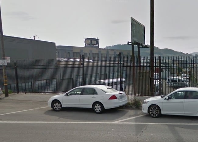
111 Williams Ave
San Francisco-San Mateo-Redwood City, CA
San Francisco
5415-004
California
Vacantlandnec
4
M1
0.10 AC
2024
Bayview/Hunters Point
2025
San Francisco
023300
NEARBY LISTINGS FOR SALE OR LEASE
DEMOGRAPHICS near 111 Williams Ave
1 mile
3 mile
5 mile
2025 Total Population
45,165
262,109
720,222
2030 Population
44,746
263,704
727,805
Pop Growth 2025-2030
(0.93%)
+ 0.61%
+ 1.05%
Average Age
42
42
43
2025 Total Households
12,883
93,418
295,750
HH Growth 2025-2030
(1.08%)
+ 0.84%
+ 1.24%
Median Household Inc
$90,706
$135,563
$124,081
Avg Household Size
3.10
2.60
2.30
2025 Avg HH Vehicles
2.00
1.00
1.00
Median Home Value
$1,027,786
$1,088,478
$1,084,331
Median Year Built
1958
1950
1952
Nearby Places
Map Layers
Map Styles
 Street
 Aerial
Layers
 Traffic
 Biking
Places
Listings with unknown addresses are not visible on the map
- Restaurants
- Banks
- Shops
- Fitness
- Groceries
PUBLIC TRANSPORTATION
TRANSIT/SUBWAY
Williams Station Outbound (T Third Street - San Francisco Municipal Railway (MUNI Metro))
Drive
Walk
Distance
Williams Station Outbound (T Third Street - San Francisco Municipal Railway (MUNI Metro))
0 min
3 min
0.2 mi
Revere Ave & 3Rd St (T Third Street - San Francisco Municipal Railway (MUNI Metro), THIRD - San Francisco Municipal Railway (MUNI Metro))
Drive
Walk
Distance
Revere Ave & 3Rd St (T Third Street - San Francisco Municipal Railway (MUNI Metro), THIRD - San Francisco Municipal Railway (MUNI Metro))
1 min
7 min
0.4 mi
Carroll Station (T Third Street - San Francisco Municipal Railway (MUNI Metro), THIRD - San Francisco Municipal Railway (MUNI Metro))
Drive
Walk
Distance
Carroll Station (T Third Street - San Francisco Municipal Railway (MUNI Metro), THIRD - San Francisco Municipal Railway (MUNI Metro))
1 min
7 min
0.4 mi
Third Street/Oakdale/Palou (THIRD - San Francisco Municipal Transportation Agency)
Drive
Walk
Distance
Third Street/Oakdale/Palou (THIRD - San Francisco Municipal Transportation Agency)
2 min
10 min
0.5 mi
Gilman/Paul Station Inbound (T Third Street - San Francisco Municipal Railway (MUNI Metro))
Drive
Walk
Distance
Gilman/Paul Station Inbound (T Third Street - San Francisco Municipal Railway (MUNI Metro))
2 min
11 min
0.6 mi
COMMUTER RAIL
Bayshore Caltrain Station Southbound (Local Weekday - Caltrain (Caltrain), Local Weekend - Caltrain (Caltrain))
Drive
Walk
Distance
Bayshore Caltrain Station Southbound (Local Weekday - Caltrain (Caltrain), Local Weekend - Caltrain (Caltrain))
5 min
1.9 mi
San Francisco Caltrain Station Southbound (Express - Caltrain (Caltrain), Limited - Caltrain (Caltrain), Local Weekday - Caltrain (Caltrain), Local Weekend - Caltrain (Caltrain))
Drive
Walk
Distance
San Francisco Caltrain Station Southbound (Express - Caltrain (Caltrain), Limited - Caltrain (Caltrain), Local Weekday - Caltrain (Caltrain), Local Weekend - Caltrain (Caltrain))
9 min
4.7 mi
AIRPORT
San Francisco International
Drive
Walk
Distance
San Francisco International
16 min
9.7 mi
Metro Oakland International
Drive
Walk
Distance
Metro Oakland International
35 min
23.1 mi
Freight Ports
Port of San Francisco
Drive
Walk
Distance
Port of San Francisco
12 min
6.0 mi
SALE & LEASE HISTORY
LISTING DATE
SALE/LEASE

May 09, 2017
For Lease
Jan 03, 2020
For Lease
Nearby Properties
Address
Land Use
TOTAL SIZE
Lot Size
Zoning
Address
Land Use
TOTAL SIZE
Lot Size
Zoning
750,370 SF
3.25 AC
MBR3
Address
Land Use
TOTAL SIZE
Lot Size
Zoning
248,303 SF
4.35 AC
Address
Land Use
TOTAL SIZE
Lot Size
Zoning
717,234 SF
3.47 AC
UMU
Address
Land Use
TOTAL SIZE
Lot Size
Zoning
10.92 AC
Address
Land Use
TOTAL SIZE
Lot Size
Zoning
2.74 AC
Address
Land Use
TOTAL SIZE
Lot Size
Zoning
314,826 SF
1.85 AC
MB-RA
Address
Land Use
TOTAL SIZE
Lot Size
Zoning
10.92 AC
Address
Land Use
TOTAL SIZE
Lot Size
Zoning
241,659 SF
3.76 AC
Address
Land Use
TOTAL SIZE
Lot Size
Zoning
230,853 SF
3.76 AC
Address
Land Use
TOTAL SIZE
Lot Size
Zoning
302,084 SF
0.88 AC
MBO
Address
Land Use
TOTAL SIZE
Lot Size
Zoning
222,000 SF
1 AC
MB-RA
Address
Land Use
TOTAL SIZE
Lot Size
Zoning
10.92 AC
Address
Land Use
TOTAL SIZE
Lot Size
Zoning
250,884 SF
1.66 AC
MB-RA
Address
Land Use
TOTAL SIZE
Lot Size
Zoning
248,974 SF
0.88 AC
MBO
Address
Land Use
TOTAL SIZE
Lot Size
Zoning
2.22 AC
M1
Address
Land Use
TOTAL SIZE
Lot Size
Zoning
333,244 SF
2.67 AC
UMU
Address
Land Use
TOTAL SIZE
Lot Size
Zoning
347,857 SF
2.76 AC
Address
Land Use
TOTAL SIZE
Lot Size
Zoning
346,710 SF
7.45 AC
RH2
Address
Land Use
TOTAL SIZE
Lot Size
Zoning
167,053 SF
0.99 AC
MB-RA
Address
Land Use
TOTAL SIZE
Lot Size
Zoning
3.49 AC
Address
Land Use
TOTAL SIZE
Lot Size
Zoning
100,732 SF
4.55 AC
M2
Address
Land Use
TOTAL SIZE
Lot Size
Zoning
210,036 SF
23.85 AC
UMU
Address
Land Use
TOTAL SIZE
Lot Size
Zoning
243,176 SF
1.48 AC
UMU
Address
Land Use
TOTAL SIZE
Lot Size
Zoning
164,464 SF
1.05 AC
MB-RA
Address
Land Use
TOTAL SIZE
Lot Size
Zoning
319,279 SF
1.85 AC
MB-RA
Address
Land Use
TOTAL SIZE
Lot Size
Zoning
231,687 SF
8.64 AC
Address
Land Use
TOTAL SIZE
Lot Size
Zoning
149,402 SF
3.47 AC
M2
Address
Land Use
TOTAL SIZE
Lot Size
Zoning
54,000 SF
1.67 AC
PDR2
Address
Land Use
TOTAL SIZE
Lot Size
Zoning
296,800 SF
1.84 AC
MB-RA
Address
Land Use
TOTAL SIZE
Lot Size
Zoning
225,851 SF
1.19 AC
NCT1
The World's #1 Commercial Real Estate Marketplace
Connect with us
© 2026 CoStar Group
The information above has been obtained from sources believed reliable. While we do not doubt its accuracy we have not verified it and make no guarantee, warranty or representation about it. It is your responsibility to independently confirm its accuracy and completeness. Any projections, opinions, assumptions, or estimates used are for example only and do not represent the current or future performance of the property. The value of this transaction to you depends on tax and other factors which should be evaluated by your tax, financial, and legal advisors. You and your advisors should conduct a careful, independent investigation of the property to determine to your satisfaction the suitability of the property for your needs.