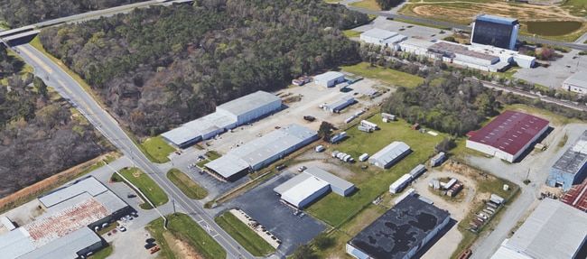
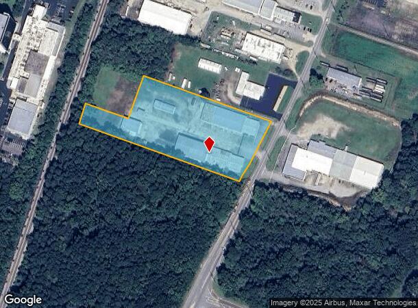
Property Record
1100 Atlantic Ave, Rocky Mount, NC 27801
NEARBY LISTINGS FOR SALE OR LEASE
Property Detail
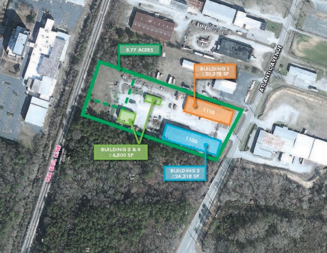
1100 Atlantic Ave
3850-97-4156-00
Israel Battle Division
Industrialgeneral
1100-1110 ATLANTIC AVE BATTLE LD
AE
Edgecombe
3720385000K
North Carolina
2024
4.77 AC
2025
Rocky Mount/Wilson
020600
Other Market Areas
10,983 SF
Rocky Mount, NC
DEMOGRAPHICS near 1100 Atlantic Ave
1 Mile
3 Mile
5 Mile
2024 Total Population
2,336
33,782
55,148
2029 Population
2,405
34,541
56,382
Pop Growth 2024-2029
+ 2.95%
+ 2.25%
+ 2.24%
Average Age
40
40
41
2024 Total Households
1,082
14,476
23,552
HH Growth 2024-2029
+ 3.14%
+ 2.36%
+ 2.28%
Median Household Inc
$33,524
$40,580
$45,673
Avg Household Size
2.10
2.20
2.30
2024 Avg HH Vehicles
2.00
2.00
2.00
Median Home Value
$68,884
$103,595
$130,096
Median Year Built
1963
1974
1978
Nearby Places
Map Layers
Map Styles
 Street
 Aerial
- Restaurants
- Banks
- Shops
- Fitness
- Groceries
PUBLIC TRANSPORTATION
COMMUTER RAIL
DRIVE
WALK
Distance
5 min
2.2 mi
AIRPORT
Pitt-Greenville
DRIVE
WALK
Distance
Pitt-Greenville
51 min
41.6 mi
SALE & LEASE HISTORY
LISTING DATE
SALE/LEASE

May 23, 2022
For Lease
Nearby Properties
Address
Land Use
TOTAL SIZE
Lot Size
Zoning
Address
Land Use
TOTAL SIZE
Lot Size
Zoning
7,020 SF
33.70 AC
R6
Address
Land Use
TOTAL SIZE
Lot Size
Zoning
2,500 SF
14.61 AC
R6
Address
Land Use
TOTAL SIZE
Lot Size
Zoning
129,595 SF
11.35 AC
B2CU
Address
Land Use
TOTAL SIZE
Lot Size
Zoning
104,995 SF
16.01 AC
Address
Land Use
TOTAL SIZE
Lot Size
Zoning
10,632 SF
16.61 AC
R6
Address
Land Use
TOTAL SIZE
Lot Size
Zoning
78,052 SF
122.10 AC
I2
Address
Land Use
TOTAL SIZE
Lot Size
Zoning
27,990 SF
5.75 AC
R10
Address
Land Use
TOTAL SIZE
Lot Size
Zoning
165,000 SF
4.66 AC
Address
Land Use
TOTAL SIZE
Lot Size
Zoning
6,976 SF
15.97 AC
R6
Address
Land Use
TOTAL SIZE
Lot Size
Zoning
8,216 SF
4.21 AC
B4
Address
Land Use
TOTAL SIZE
Lot Size
Zoning
65,826 SF
16.77 AC
Address
Land Use
TOTAL SIZE
Lot Size
Zoning
204,903 SF
23.07 AC
Address
Land Use
TOTAL SIZE
Lot Size
Zoning
8,822 SF
9.70 AC
R6
Address
Land Use
TOTAL SIZE
Lot Size
Zoning
32,051 SF
18.50 AC
R6
Address
Land Use
TOTAL SIZE
Lot Size
Zoning
8,020 SF
13.81 AC
R6
Address
Land Use
TOTAL SIZE
Lot Size
Zoning
51,543 SF
9.61 AC
I
Address
Land Use
TOTAL SIZE
Lot Size
Zoning
47,968 SF
4.68 AC
I
Address
Land Use
TOTAL SIZE
Lot Size
Zoning
118,800 SF
5.51 AC
I
Address
Land Use
TOTAL SIZE
Lot Size
Zoning
13,075 SF
14.90 AC
Address
Land Use
TOTAL SIZE
Lot Size
Zoning
7,952 SF
8.59 AC
R6
Address
Land Use
TOTAL SIZE
Lot Size
Zoning
135,400 SF
21.45 AC
B2
Address
Land Use
TOTAL SIZE
Lot Size
Zoning
129,264 SF
31.28 AC
B3
Address
Land Use
TOTAL SIZE
Lot Size
Zoning
42,449 SF
2.49 AC
I2
Address
Land Use
TOTAL SIZE
Lot Size
Zoning
61,850 SF
10 AC
I2
Address
Land Use
TOTAL SIZE
Lot Size
Zoning
253,009 SF
52.80 AC
B3
Address
Land Use
TOTAL SIZE
Lot Size
Zoning
79,481 SF
14.25 AC
R6
Address
Land Use
TOTAL SIZE
Lot Size
Zoning
30,481 SF
4.14 AC
Address
Land Use
TOTAL SIZE
Lot Size
Zoning
3,360 SF
6.27 AC
R10
Address
Land Use
TOTAL SIZE
Lot Size
Zoning
70,557 SF
27.65 AC
I
Address
Land Use
TOTAL SIZE
Lot Size
Zoning
2,888 SF
3.35 AC
The World's #1 Commercial Real Estate Marketplace
Connect with us
© 2025 CoStar Group
The information above has been obtained from sources believed reliable. While we do not doubt its accuracy we have not verified it and make no guarantee, warranty or representation about it. It is your responsibility to independently confirm its accuracy and completeness. Any projections, opinions, assumptions, or estimates used are for example only and do not represent the current or future performance of the property. The value of this transaction to you depends on tax and other factors which should be evaluated by your tax, financial, and legal advisors. You and your advisors should conduct a careful, independent investigation of the property to determine to your satisfaction the suitability of the property for your needs.