Property Record
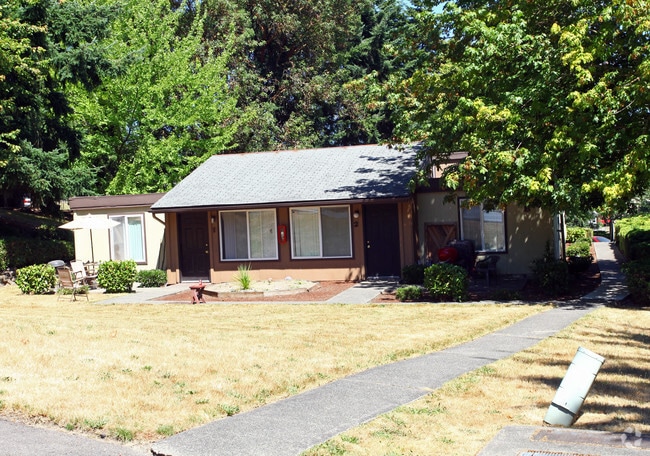
1110 Callahan Dr, Bremerton, WA 98310


NEARBY LISTINGS FOR SALE OR LEASE
Property Detail
1110 Callahan Dr
Bremerton-Silverdale, WA
Amended Plat Of The Fourth Add. To Sheri
3968-002-007-00-03
LOT 7, BLOCK 2, AMENDED PLAT OF FOURTH ADDITION TO SHERIDAN PARK, ACCORDING TO THE PLAT RECORDED IN VOLUME 9 OF PLATS, PAGES 1 TO 3, INCLUSIVE, RECORDS OF KITSAP COUNTY, WASHINGTON; BEING A RE-RECORDING OF VOLUME 8 OF PLATS, PAGES 58 TO 60, INCLUSIVE
Multifamilydwelling
Kitsap
X
Washington
53035C0380F
7
2025
6.68 AC
2026
Sheridan Park
080300
Bremerton/Silverdale
58,376 SF
DEMOGRAPHICS near 1110 Callahan Dr
1 Mile
3 Mile
5 Mile
2024 Total Population
12,739
60,682
125,285
2029 Population
12,931
61,288
126,772
Pop Growth 2024-2029
+ 1.51%
+ 1.00%
+ 1.19%
Average Age
41
39
40
2024 Total Households
5,506
23,234
47,991
HH Growth 2024-2029
+ 1.54%
+ 1.20%
+ 1.30%
Median Household Inc
$59,124
$66,525
$74,280
Avg Household Size
2.20
2.30
2.40
2024 Avg HH Vehicles
2.00
2.00
2.00
Median Home Value
$410,939
$389,493
$411,207
Median Year Built
1967
1971
1978
Nearby Places
Map Layers
Map Styles
 Street
 Aerial
- Restaurants
- Banks
- Shops
- Fitness
- Groceries
PUBLIC TRANSPORTATION
AIRPORT
Seattle Paine Field International
DRIVE
WALK
Distance
Seattle Paine Field International
90 min
41.9 mi
Freight Ports
Port of Seattle
DRIVE
WALK
Distance
Port of Seattle
91 min
66.9 mi
Nearby Properties
Address
Land Use
TOTAL SIZE
Lot Size
Zoning
Address
Land Use
TOTAL SIZE
Lot Size
Zoning
0.13 AC
UH
Address
Land Use
TOTAL SIZE
Lot Size
Zoning
134,724 SF
6.85 AC
GC
Address
Land Use
TOTAL SIZE
Lot Size
Zoning
151,599 SF
5.44 AC
R-40
Address
Land Use
TOTAL SIZE
Lot Size
Zoning
2,672 SF
0.13 AC
UHUL
Address
Land Use
TOTAL SIZE
Lot Size
Zoning
214,450 SF
21.68 AC
R-40
Address
Land Use
TOTAL SIZE
Lot Size
Zoning
192,475 SF
16.26 AC
C
Address
Land Use
TOTAL SIZE
Lot Size
Zoning
1,716 SF
3.70 AC
UH
Address
Land Use
TOTAL SIZE
Lot Size
Zoning
Address
Land Use
TOTAL SIZE
Lot Size
Zoning
80,228 SF
7.03 AC
GC
Address
Land Use
TOTAL SIZE
Lot Size
Zoning
1,344 SF
5.47 AC
R-40
Address
Land Use
TOTAL SIZE
Lot Size
Zoning
79,615 SF
1.25 AC
DSAP
Address
Land Use
TOTAL SIZE
Lot Size
Zoning
75,390 SF
4.46 AC
R-18
Address
Land Use
TOTAL SIZE
Lot Size
Zoning
122,799 SF
4.48 AC
R-40
Address
Land Use
TOTAL SIZE
Lot Size
Zoning
63,213 SF
4.15 AC
R-10
Address
Land Use
TOTAL SIZE
Lot Size
Zoning
150,790 SF
26.33 AC
C
Address
Land Use
TOTAL SIZE
Lot Size
Zoning
64,584 SF
4.92 AC
R-40
Address
Land Use
TOTAL SIZE
Lot Size
Zoning
68,079 SF
2.16 AC
BVSAP
Address
Land Use
TOTAL SIZE
Lot Size
Zoning
60,518 SF
2.62 AC
R-18
Address
Land Use
TOTAL SIZE
Lot Size
Zoning
55,412 SF
1.74 AC
R-18
Address
Land Use
TOTAL SIZE
Lot Size
Zoning
57,900 SF
3.90 AC
UH
Address
Land Use
TOTAL SIZE
Lot Size
Zoning
10.38 AC
Address
Land Use
TOTAL SIZE
Lot Size
Zoning
135,160 SF
1.14 AC
C
Address
Land Use
TOTAL SIZE
Lot Size
Zoning
84,193 SF
5.57 AC
DCC
Address
Land Use
TOTAL SIZE
Lot Size
Zoning
47,584 SF
3.76 AC
R-40
Address
Land Use
TOTAL SIZE
Lot Size
Zoning
126,276 SF
13.41 AC
UH
Address
Land Use
TOTAL SIZE
Lot Size
Zoning
75,225 SF
3.30 AC
R-10
Address
Land Use
TOTAL SIZE
Lot Size
Zoning
44,220 SF
2.86 AC
R-40
Address
Land Use
TOTAL SIZE
Lot Size
Zoning
60,977 SF
0.47 AC
DSAP
Address
Land Use
TOTAL SIZE
Lot Size
Zoning
24,930 SF
0.33 AC
DSAP
The World's #1 Commercial Real Estate Marketplace
Connect with us
© 2025 CoStar Group
The information above has been obtained from sources believed reliable. While we do not doubt its accuracy we have not verified it and make no guarantee, warranty or representation about it. It is your responsibility to independently confirm its accuracy and completeness. Any projections, opinions, assumptions, or estimates used are for example only and do not represent the current or future performance of the property. The value of this transaction to you depends on tax and other factors which should be evaluated by your tax, financial, and legal advisors. You and your advisors should conduct a careful, independent investigation of the property to determine to your satisfaction the suitability of the property for your needs.