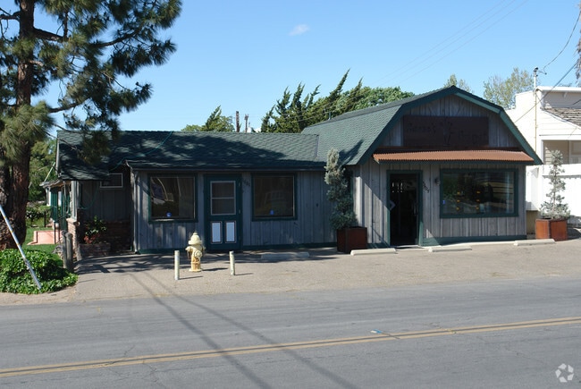
Property Record
1110 Faraday St, Santa Ynez, CA 93460


NEARBY LISTINGS FOR SALE OR LEASE
Property Detail
1110 Faraday St
Santa Maria-Santa Barbara, CA
Town Santa Ynez
143-182-001
LOT 10 BLK 8
Storebuilding
Santa Barbara
X
California
06083C1077G
10
2024
0.22 AC
2025
Central SB County
001908
Santa Barbara/Sta Maria/Goleta
DEMOGRAPHICS near 1110 Faraday St
1 mile
3 mile
5 mile
2024 Total Population
2,167
6,109
13,257
2029 Population
2,067
5,838
12,763
Pop Growth 2024-2029
(4.61%)
(4.44%)
(3.73%)
Average Age
45
46
46
2024 Total Households
813
2,348
5,155
HH Growth 2024-2029
(4.67%)
(4.60%)
(3.90%)
Median Household Inc
$115,217
$121,928
$117,790
Avg Household Size
2.60
2.50
2.40
2024 Avg HH Vehicles
3.00
3.00
2.00
Median Home Value
$877,906
$1,029,937
$1,013,106
Median Year Built
1978
1976
1979
Nearby Places
Map Layers
Map Styles
 Street
 Aerial
Transit
 Traffic
 Biking
Places
Listings with unknown addresses are not visible on the map
- Restaurants
- Banks
- Shops
- Fitness
- Groceries
PUBLIC TRANSPORTATION
AIRPORT
Santa Barbara Municipal
Drive
Walk
Distance
Santa Barbara Municipal
46 min
31.5 mi
Freight Ports
The Port of Hueneme
Drive
Walk
Distance
The Port of Hueneme
94 min
69.8 mi
SALE & LEASE HISTORY
LISTING DATE
SALE/LEASE

Sep 23, 2016
For Sale
Nearby Properties
Address
Land Use
TOTAL SIZE
Lot Size
Zoning
Address
Land Use
TOTAL SIZE
Lot Size
Zoning
5.10 AC
Address
Land Use
TOTAL SIZE
Lot Size
Zoning
14,794 SF
34.82 AC
AGII40
Address
Land Use
TOTAL SIZE
Lot Size
Zoning
10,924 SF
18.80 AC
AGI20
Address
Land Use
TOTAL SIZE
Lot Size
Zoning
18.16 AC
AGI40
Address
Land Use
TOTAL SIZE
Lot Size
Zoning
5,405 SF
56.01 AC
AGI20
Address
Land Use
TOTAL SIZE
Lot Size
Zoning
4.35 AC
C2
Address
Land Use
TOTAL SIZE
Lot Size
Zoning
8,775 SF
71.38 AC
AGII100
Address
Land Use
TOTAL SIZE
Lot Size
Zoning
6,332 SF
24.44 AC
AGI20
Address
Land Use
TOTAL SIZE
Lot Size
Zoning
4,912 SF
65.81 AC
AGI40
Address
Land Use
TOTAL SIZE
Lot Size
Zoning
52 AC
AGII40
Address
Land Use
TOTAL SIZE
Lot Size
Zoning
3.08 AC
Address
Land Use
TOTAL SIZE
Lot Size
Zoning
6,663 SF
28.54 AC
AGI20
Address
Land Use
TOTAL SIZE
Lot Size
Zoning
4,874 SF
29.34 AC
AGI20
Address
Land Use
TOTAL SIZE
Lot Size
Zoning
5,454 SF
110.42 AC
AGII100
Address
Land Use
TOTAL SIZE
Lot Size
Zoning
8,469 SF
103.41 AC
AGII100
Address
Land Use
TOTAL SIZE
Lot Size
Zoning
5,284 SF
13.40 AC
AGI10
Address
Land Use
TOTAL SIZE
Lot Size
Zoning
7,499 SF
36.64 AC
100AG
Address
Land Use
TOTAL SIZE
Lot Size
Zoning
8,960 SF
14.10 AC
AGI20
Address
Land Use
TOTAL SIZE
Lot Size
Zoning
6,470 SF
25.85 AC
AGI10
Address
Land Use
TOTAL SIZE
Lot Size
Zoning
7,437 SF
39.88 AC
AGI20
Address
Land Use
TOTAL SIZE
Lot Size
Zoning
5,348 SF
26.48 AC
AGI20
Address
Land Use
TOTAL SIZE
Lot Size
Zoning
15.19 AC
AGI10
Address
Land Use
TOTAL SIZE
Lot Size
Zoning
37.06 AC
AGI40
Address
Land Use
TOTAL SIZE
Lot Size
Zoning
4,149 SF
19.52 AC
AGI20
Address
Land Use
TOTAL SIZE
Lot Size
Zoning
413.83 AC
AGII100
Address
Land Use
TOTAL SIZE
Lot Size
Zoning
4,528 SF
9.77 AC
AGI20
Address
Land Use
TOTAL SIZE
Lot Size
Zoning
5,093 SF
40 AC
AGII40
Address
Land Use
TOTAL SIZE
Lot Size
Zoning
6,615 SF
49.67 AC
AGII100
The World's #1 Commercial Real Estate Marketplace
Connect with us
© 2026 CoStar Group
The information above has been obtained from sources believed reliable. While we do not doubt its accuracy we have not verified it and make no guarantee, warranty or representation about it. It is your responsibility to independently confirm its accuracy and completeness. Any projections, opinions, assumptions, or estimates used are for example only and do not represent the current or future performance of the property. The value of this transaction to you depends on tax and other factors which should be evaluated by your tax, financial, and legal advisors. You and your advisors should conduct a careful, independent investigation of the property to determine to your satisfaction the suitability of the property for your needs.