Property Record
1110 Interstate 45 S, Conroe, TX 77301
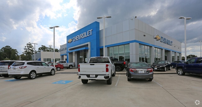

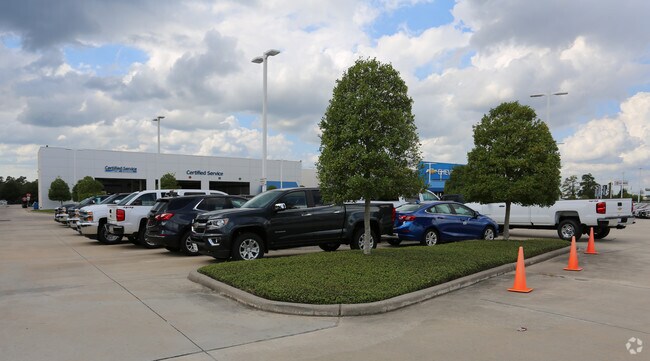
Property Detail
1110 Interstate 45 S
8345-00-24800
S834500 - RIVERSHIRE 01, RES E, ACRES 9.157
Commercialnec
MONTGOMERY
1
Texas
C and X Area of minimal flood hazard, usually depicted on FIRMs as above the 500-year flood level.
9.16 AC
2024
Montgomery County
2025
Houston
693103
Houston-Pasadena-The Woodlands, TX
64,236 SF
NEARBY LISTINGS FOR SALE OR LEASE
DEMOGRAPHICS near 1110 Interstate 45 S
1 mile
3 mile
5 mile
2025 Total Population
11,933
57,283
117,770
2030 Population
14,008
67,205
138,876
Pop Growth 2025-2030
+ 17.39%
+ 17.32%
+ 17.92%
Average Age
35
37
37
2025 Total Households
4,664
20,426
42,959
HH Growth 2025-2030
+ 17.90%
+ 18.48%
+ 18.72%
Median Household Inc
$56,922
$70,078
$77,835
Avg Household Size
2.50
2.60
2.60
2025 Avg HH Vehicles
2.00
2.00
2.00
Median Home Value
$296,958
$278,973
$338,165
Median Year Built
1994
1999
2009
Nearby Places
Map Layers
Map Styles
 Street
 Aerial
Transit
 Traffic
 Biking
Places
Listings with unknown addresses are not visible on the map
- Restaurants
- Banks
- Shops
- Fitness
- Groceries
PUBLIC TRANSPORTATION
AIRPORT
George Bush Intcntl/Houston
Drive
Walk
Distance
George Bush Intcntl/Houston
36 min
29.9 mi
Freight Ports
Port of Houston
Drive
Walk
Distance
Port of Houston
59 min
45.6 mi
Nearby Properties
Address
Land Use
TOTAL SIZE
Lot Size
Zoning
Address
Land Use
TOTAL SIZE
Lot Size
Zoning
470,259 SF
27.98 AC
1
Address
Land Use
TOTAL SIZE
Lot Size
Zoning
619,770 SF
81.76 AC
Address
Land Use
TOTAL SIZE
Lot Size
Zoning
353,247 SF
14.38 AC
Address
Land Use
TOTAL SIZE
Lot Size
Zoning
292,274 SF
7.55 AC
Address
Land Use
TOTAL SIZE
Lot Size
Zoning
354,000 SF
13.81 AC
Address
Land Use
TOTAL SIZE
Lot Size
Zoning
441,092 SF
29.09 AC
Address
Land Use
TOTAL SIZE
Lot Size
Zoning
304,482 SF
12.15 AC
Address
Land Use
TOTAL SIZE
Lot Size
Zoning
274,494 SF
28.96 AC
Address
Land Use
TOTAL SIZE
Lot Size
Zoning
262,925 SF
12.16 AC
Address
Land Use
TOTAL SIZE
Lot Size
Zoning
284,451 SF
13.66 AC
1
Address
Land Use
TOTAL SIZE
Lot Size
Zoning
326,478 SF
20.22 AC
Address
Land Use
TOTAL SIZE
Lot Size
Zoning
258,100 SF
12.04 AC
1
Address
Land Use
TOTAL SIZE
Lot Size
Zoning
159,144 SF
32.27 AC
Address
Land Use
TOTAL SIZE
Lot Size
Zoning
168,926 SF
9.12 AC
Address
Land Use
TOTAL SIZE
Lot Size
Zoning
195,956 SF
1.76 AC
1
Address
Land Use
TOTAL SIZE
Lot Size
Zoning
276,238 SF
21.48 AC
Address
Land Use
TOTAL SIZE
Lot Size
Zoning
134,935 SF
10.50 AC
1
Address
Land Use
TOTAL SIZE
Lot Size
Zoning
211,275 SF
12.58 AC
Address
Land Use
TOTAL SIZE
Lot Size
Zoning
191,006 SF
9.19 AC
Address
Land Use
TOTAL SIZE
Lot Size
Zoning
142,800 SF
7.82 AC
Address
Land Use
TOTAL SIZE
Lot Size
Zoning
136,300 SF
9.08 AC
1
Address
Land Use
TOTAL SIZE
Lot Size
Zoning
89,298 SF
9.22 AC
Address
Land Use
TOTAL SIZE
Lot Size
Zoning
590,471 SF
32.21 AC
Address
Land Use
TOTAL SIZE
Lot Size
Zoning
197,533 SF
58.31 AC
Address
Land Use
TOTAL SIZE
Lot Size
Zoning
100,800 SF
8.60 AC
Address
Land Use
TOTAL SIZE
Lot Size
Zoning
85,560 SF
8.55 AC
Address
Land Use
TOTAL SIZE
Lot Size
Zoning
175,476 SF
8.03 AC
1
Address
Land Use
TOTAL SIZE
Lot Size
Zoning
171,124 SF
9.03 AC
1
Address
Land Use
TOTAL SIZE
Lot Size
Zoning
70,010 SF
8.89 AC
The World's #1 Commercial Real Estate Marketplace
Connect with us
© 2026 CoStar Group
The information above has been obtained from sources believed reliable. While we do not doubt its accuracy we have not verified it and make no guarantee, warranty or representation about it. It is your responsibility to independently confirm its accuracy and completeness. Any projections, opinions, assumptions, or estimates used are for example only and do not represent the current or future performance of the property. The value of this transaction to you depends on tax and other factors which should be evaluated by your tax, financial, and legal advisors. You and your advisors should conduct a careful, independent investigation of the property to determine to your satisfaction the suitability of the property for your needs.