Property Record
1110 Mason Pond Pl, Ladson, SC 29456

NEARBY LISTINGS FOR SALE OR LEASE
-
-
View all Ladson listings for sale on LoopNet.com
Property Detail
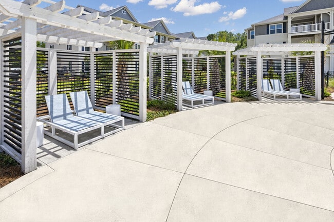
1110 Mason Pond Pl
Charleston-North Charleston, SC
Ladson
388-10-00-056
MAPPLATB L19 MAPPLATP 0404-0405 SUBDIVISIONNAME LADSON LOT PARCEL 2
Apartment
Charleston
X
South Carolina
45019C0280K
16.56 AC
2025
Summerville
2024
Charleston/N Charleston
003106
DEMOGRAPHICS near 1110 Mason Pond Pl
1 Mile
3 Mile
5 Mile
2024 Total Population
4,156
61,136
168,259
2029 Population
4,487
68,474
187,812
Pop Growth 2024-2029
+ 7.96%
+ 12.00%
+ 11.62%
Average Age
38
38
38
2024 Total Households
1,461
23,288
64,802
HH Growth 2024-2029
+ 7.94%
+ 11.74%
+ 11.52%
Median Household Inc
$50,821
$68,597
$70,670
Avg Household Size
2.70
2.60
2.50
2024 Avg HH Vehicles
2.00
2.00
2.00
Median Home Value
$204,965
$221,835
$245,951
Median Year Built
1982
2000
1998
Nearby Places
Map Layers
Map Styles
 Street
 Aerial
- Restaurants
- Banks
- Shops
- Fitness
- Groceries
PUBLIC TRANSPORTATION
AIRPORT
Charleston AFB/International
DRIVE
WALK
Distance
Charleston AFB/International
23 min
14.6 mi
Freight Ports
North Charleston Terminal
DRIVE
WALK
Distance
North Charleston Terminal
18 min
11.8 mi
Nearby Properties
Address
Land Use
TOTAL SIZE
Lot Size
Zoning
Address
Land Use
TOTAL SIZE
Lot Size
Zoning
Address
Land Use
TOTAL SIZE
Lot Size
Zoning
1,520 SF
12 AC
BERKELEY C
Address
Land Use
TOTAL SIZE
Lot Size
Zoning
511,092 SF
53.35 AC
GOOSE CREE
Address
Land Use
TOTAL SIZE
Lot Size
Zoning
2,551 SF
12.96 AC
BERKELEY C
Address
Land Use
TOTAL SIZE
Lot Size
Zoning
1,430 SF
28.27 AC
Address
Land Use
TOTAL SIZE
Lot Size
Zoning
182,112 SF
38.64 AC
Address
Land Use
TOTAL SIZE
Lot Size
Zoning
152,460 SF
26.94 AC
Address
Land Use
TOTAL SIZE
Lot Size
Zoning
28,770 SF
15.53 AC
Address
Land Use
TOTAL SIZE
Lot Size
Zoning
16.53 AC
Address
Land Use
TOTAL SIZE
Lot Size
Zoning
1,272 SF
18.46 AC
Address
Land Use
TOTAL SIZE
Lot Size
Zoning
Address
Land Use
TOTAL SIZE
Lot Size
Zoning
33.62 AC
Address
Land Use
TOTAL SIZE
Lot Size
Zoning
14.33 AC
Address
Land Use
TOTAL SIZE
Lot Size
Zoning
534 SF
13.08 AC
SUMMERVILL
Address
Land Use
TOTAL SIZE
Lot Size
Zoning
67,964 SF
3.77 AC
BERKELEY C
Address
Land Use
TOTAL SIZE
Lot Size
Zoning
33,666 SF
34.65 AC
BERKELEY C
Address
Land Use
TOTAL SIZE
Lot Size
Zoning
181,427 SF
16.47 AC
Address
Land Use
TOTAL SIZE
Lot Size
Zoning
167,144 SF
23.79 AC
GOOSE CREE
Address
Land Use
TOTAL SIZE
Lot Size
Zoning
194,515 SF
26.73 AC
Address
Land Use
TOTAL SIZE
Lot Size
Zoning
30,790 SF
7.59 AC
BERKELEY C
Address
Land Use
TOTAL SIZE
Lot Size
Zoning
1,592 SF
17.20 AC
BERKELEY C
Address
Land Use
TOTAL SIZE
Lot Size
Zoning
Address
Land Use
TOTAL SIZE
Lot Size
Zoning
22,910 SF
15.70 AC
BERKELEY C
Address
Land Use
TOTAL SIZE
Lot Size
Zoning
124,678 SF
65.93 AC
Address
Land Use
TOTAL SIZE
Lot Size
Zoning
13,620 SF
9.44 AC
BERKELEY C
Address
Land Use
TOTAL SIZE
Lot Size
Zoning
67,135 SF
6.13 AC
BERKELEY C
Address
Land Use
TOTAL SIZE
Lot Size
Zoning
38.95 AC
BERKELEY C
Address
Land Use
TOTAL SIZE
Lot Size
Zoning
11,036 SF
9.19 AC
BERKELEY C
Address
Land Use
TOTAL SIZE
Lot Size
Zoning
12,000 SF
7.50 AC
BERKELEY C
Address
Land Use
TOTAL SIZE
Lot Size
Zoning
33,884 SF
10.49 AC
NORTH CHAR
The World's #1 Commercial Real Estate Marketplace
Connect with us
© 2025 CoStar Group
The information above has been obtained from sources believed reliable. While we do not doubt its accuracy we have not verified it and make no guarantee, warranty or representation about it. It is your responsibility to independently confirm its accuracy and completeness. Any projections, opinions, assumptions, or estimates used are for example only and do not represent the current or future performance of the property. The value of this transaction to you depends on tax and other factors which should be evaluated by your tax, financial, and legal advisors. You and your advisors should conduct a careful, independent investigation of the property to determine to your satisfaction the suitability of the property for your needs.