Property Record
1110 Palmer Dr, Murfreesboro, TN 37130
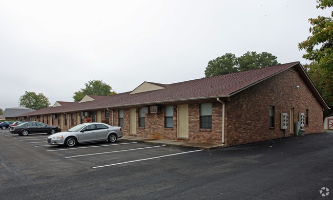

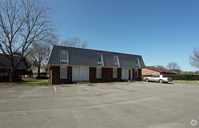
Property Detail
1110 Palmer Dr
090H-C-011.00-000
241.9' X 204.9' IRR
Apartment
Rutherford
RM16
Tennessee
B and X Area of moderate flood hazard, usually the area between the limits of the 100-year and 500-year floods.
38
2025
1.14 AC
2025
Outer Rutherford County
041601
Nashville
13,167 SF
Nashville-Davidson--Murfreesboro--Franklin, TN
NEARBY LISTINGS FOR SALE OR LEASE
-
-
View all Murfreesboro listings for sale on LoopNet.com
DEMOGRAPHICS near 1110 Palmer Dr
1 mile
3 mile
5 mile
2025 Total Population
20,087
73,365
131,500
2030 Population
21,558
79,085
141,644
Pop Growth 2025-2030
+ 7.32%
+ 7.80%
+ 7.71%
Average Age
32
35
37
2025 Total Households
7,554
29,166
51,842
HH Growth 2025-2030
+ 7.97%
+ 8.13%
+ 7.98%
Median Household Inc
$51,762
$59,335
$70,690
Avg Household Size
2.30
2.30
2.40
2025 Avg HH Vehicles
2.00
2.00
2.00
Median Home Value
$405,463
$412,118
$409,691
Median Year Built
1986
1990
1994
Nearby Places
Map Layers
Map Styles
 Street
 Aerial
Transit
 Traffic
 Biking
Places
Listings with unknown addresses are not visible on the map
- Restaurants
- Banks
- Shops
- Fitness
- Groceries
PUBLIC TRANSPORTATION
AIRPORT
Nashville International
Drive
Walk
Distance
Nashville International
40 min
29.5 mi
Freight Ports
Port of Mobile
Drive
Walk
Distance
Port of Mobile
494 min
451.6 mi
Nearby Properties
Address
Land Use
TOTAL SIZE
Lot Size
Zoning
Address
Land Use
TOTAL SIZE
Lot Size
Zoning
969,473 SF
43.50 AC
Address
Land Use
TOTAL SIZE
Lot Size
Zoning
30,630 SF
8.50 AC
Address
Land Use
TOTAL SIZE
Lot Size
Zoning
166,604 SF
2.21 AC
Address
Land Use
TOTAL SIZE
Lot Size
Zoning
233,821 SF
15.50 AC
Address
Land Use
TOTAL SIZE
Lot Size
Zoning
238,794 SF
71.70 AC
Address
Land Use
TOTAL SIZE
Lot Size
Zoning
231,649 SF
19.95 AC
Address
Land Use
TOTAL SIZE
Lot Size
Zoning
128,141 SF
21.80 AC
Address
Land Use
TOTAL SIZE
Lot Size
Zoning
408,067 SF
33.01 AC
CH
Address
Land Use
TOTAL SIZE
Lot Size
Zoning
146,555 SF
3.22 AC
Address
Land Use
TOTAL SIZE
Lot Size
Zoning
2,472 SF
44.34 AC
Address
Land Use
TOTAL SIZE
Lot Size
Zoning
130,261 SF
18.01 AC
Address
Land Use
TOTAL SIZE
Lot Size
Zoning
102,366 SF
7.90 AC
Address
Land Use
TOTAL SIZE
Lot Size
Zoning
4,842 SF
17.80 AC
Address
Land Use
TOTAL SIZE
Lot Size
Zoning
1,488 SF
17.26 AC
RM16
Address
Land Use
TOTAL SIZE
Lot Size
Zoning
106,006 SF
17.20 AC
Address
Land Use
TOTAL SIZE
Lot Size
Zoning
4,409 SF
21.60 AC
RM16
Address
Land Use
TOTAL SIZE
Lot Size
Zoning
78,768 SF
1.50 AC
Address
Land Use
TOTAL SIZE
Lot Size
Zoning
3,104 SF
16.01 AC
RM16
Address
Land Use
TOTAL SIZE
Lot Size
Zoning
403,206 SF
63.11 AC
Address
Land Use
TOTAL SIZE
Lot Size
Zoning
120,638 SF
20.55 AC
Address
Land Use
TOTAL SIZE
Lot Size
Zoning
6,253 SF
38.80 AC
RM16
Address
Land Use
TOTAL SIZE
Lot Size
Zoning
57,146 SF
3.47 AC
Address
Land Use
TOTAL SIZE
Lot Size
Zoning
123,688 SF
15.27 AC
Address
Land Use
TOTAL SIZE
Lot Size
Zoning
24,816 SF
22 AC
RM12
Address
Land Use
TOTAL SIZE
Lot Size
Zoning
11,449 SF
25.50 AC
RM16
Address
Land Use
TOTAL SIZE
Lot Size
Zoning
38,064 SF
7 AC
Address
Land Use
TOTAL SIZE
Lot Size
Zoning
92,559 SF
14.23 AC
Address
Land Use
TOTAL SIZE
Lot Size
Zoning
110,449 SF
7.29 AC
Address
Land Use
TOTAL SIZE
Lot Size
Zoning
88,406 SF
27.10 AC
Address
Land Use
TOTAL SIZE
Lot Size
Zoning
74,803 SF
10.16 AC
The World's #1 Commercial Real Estate Marketplace
Connect with us
© 2026 CoStar Group
The information above has been obtained from sources believed reliable. While we do not doubt its accuracy we have not verified it and make no guarantee, warranty or representation about it. It is your responsibility to independently confirm its accuracy and completeness. Any projections, opinions, assumptions, or estimates used are for example only and do not represent the current or future performance of the property. The value of this transaction to you depends on tax and other factors which should be evaluated by your tax, financial, and legal advisors. You and your advisors should conduct a careful, independent investigation of the property to determine to your satisfaction the suitability of the property for your needs.