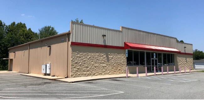
Property Record
1110 Roxboro St, Haw River, NC 27258

NEARBY LISTINGS FOR SALE OR LEASE
Property Detail
1110 Roxboro St
Burlington, NC
Douglas Terrace
154459
DOUGLAS TERRACE LOTS 7-9 13-21-2G
Storebuilding
Alamance
X
North Carolina
3710889600K
7-9
2025
1.49 AC
2025
N Central Alamance County
021201
Greensboro/Winston-Salem
8,000 SF
DEMOGRAPHICS near 1110 Roxboro St
1 Mile
3 Mile
5 Mile
2024 Total Population
2,352
15,814
64,410
2029 Population
2,579
17,129
69,880
Pop Growth 2024-2029
+ 9.65%
+ 8.32%
+ 8.49%
Average Age
40
39
39
2024 Total Households
904
6,025
25,634
HH Growth 2024-2029
+ 9.85%
+ 8.56%
+ 8.71%
Median Household Inc
$42,132
$47,500
$47,533
Avg Household Size
2.60
2.60
2.40
2024 Avg HH Vehicles
2.00
2.00
2.00
Median Home Value
$125,954
$126,619
$153,217
Median Year Built
1984
1978
1979
Nearby Places
Map Layers
Map Styles
 Street
 Aerial
- Restaurants
- Banks
- Shops
- Fitness
- Groceries
PUBLIC TRANSPORTATION
COMMUTER RAIL
Burlington Station (Piedmont - North Carolina by Train (NC Train))
DRIVE
WALK
Distance
Burlington Station (Piedmont - North Carolina by Train (NC Train))
12 min
6.8 mi
Freight Ports
Virginia Port Authority - Richmond
DRIVE
WALK
Distance
Virginia Port Authority - Richmond
202 min
174.3 mi
SALE & LEASE HISTORY
LISTING DATE
SALE/LEASE

Jul 30, 2020
For Lease
Nearby Properties
Address
Land Use
TOTAL SIZE
Lot Size
Zoning
Address
Land Use
TOTAL SIZE
Lot Size
Zoning
578,100 SF
55.30 AC
Address
Land Use
TOTAL SIZE
Lot Size
Zoning
33,280 SF
9.07 AC
I2
Address
Land Use
TOTAL SIZE
Lot Size
Zoning
3,534 SF
45.96 AC
Address
Land Use
TOTAL SIZE
Lot Size
Zoning
72,164 SF
73.50 AC
Address
Land Use
TOTAL SIZE
Lot Size
Zoning
51,994 SF
42.20 AC
OI
Address
Land Use
TOTAL SIZE
Lot Size
Zoning
91,995 SF
25.44 AC
Address
Land Use
TOTAL SIZE
Lot Size
Zoning
23,268 SF
6.11 AC
Address
Land Use
TOTAL SIZE
Lot Size
Zoning
36,000 SF
4.43 AC
Address
Land Use
TOTAL SIZE
Lot Size
Zoning
2,923 SF
10.13 AC
Address
Land Use
TOTAL SIZE
Lot Size
Zoning
158,339 SF
16.34 AC
Address
Land Use
TOTAL SIZE
Lot Size
Zoning
41,787 SF
8.07 AC
COI
Address
Land Use
TOTAL SIZE
Lot Size
Zoning
25,200 SF
5.30 AC
Address
Land Use
TOTAL SIZE
Lot Size
Zoning
8,970 SF
11.57 AC
I&C
Address
Land Use
TOTAL SIZE
Lot Size
Zoning
13,968 SF
10.04 AC
R 18
Address
Land Use
TOTAL SIZE
Lot Size
Zoning
50,549 SF
4.33 AC
OI
Address
Land Use
TOTAL SIZE
Lot Size
Zoning
213,665 SF
53.52 AC
I 2
Address
Land Use
TOTAL SIZE
Lot Size
Zoning
5,984 SF
19.75 AC
Address
Land Use
TOTAL SIZE
Lot Size
Zoning
17,749 SF
20 AC
Address
Land Use
TOTAL SIZE
Lot Size
Zoning
94,372 SF
7.13 AC
Address
Land Use
TOTAL SIZE
Lot Size
Zoning
61.79 AC
I2
Address
Land Use
TOTAL SIZE
Lot Size
Zoning
14,700 SF
8.41 AC
Address
Land Use
TOTAL SIZE
Lot Size
Zoning
2,824 SF
8.91 AC
MFA
Address
Land Use
TOTAL SIZE
Lot Size
Zoning
15,600 SF
3.28 AC
Address
Land Use
TOTAL SIZE
Lot Size
Zoning
6,579 SF
12.84 AC
Address
Land Use
TOTAL SIZE
Lot Size
Zoning
56,336 SF
7.88 AC
I 1
Address
Land Use
TOTAL SIZE
Lot Size
Zoning
27,940 SF
4.40 AC
I 2
Address
Land Use
TOTAL SIZE
Lot Size
Zoning
74,372 SF
8.83 AC
B 2
Address
Land Use
TOTAL SIZE
Lot Size
Zoning
27,084 SF
4 AC
Address
Land Use
TOTAL SIZE
Lot Size
Zoning
56,005 SF
9.98 AC
Address
Land Use
TOTAL SIZE
Lot Size
Zoning
26,828 SF
1.50 AC
The World's #1 Commercial Real Estate Marketplace
Connect with us
© 2025 CoStar Group
The information above has been obtained from sources believed reliable. While we do not doubt its accuracy we have not verified it and make no guarantee, warranty or representation about it. It is your responsibility to independently confirm its accuracy and completeness. Any projections, opinions, assumptions, or estimates used are for example only and do not represent the current or future performance of the property. The value of this transaction to you depends on tax and other factors which should be evaluated by your tax, financial, and legal advisors. You and your advisors should conduct a careful, independent investigation of the property to determine to your satisfaction the suitability of the property for your needs.