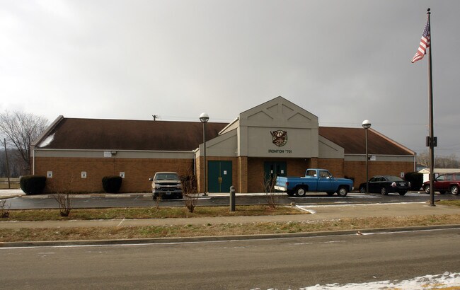
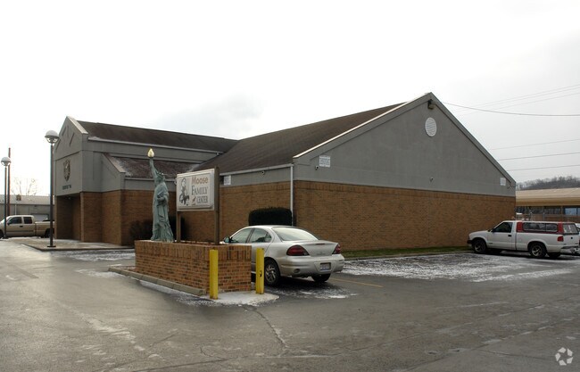
Property Record
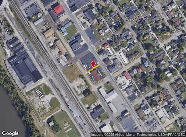
1110 S 3Rd St, Ironton, OH 45638
NEARBY LISTINGS FOR SALE OR LEASE
Property Detail
1110 S 3Rd St
35-034-1000-000
East Ironton Add
Charitableorganization
EAST IRONTON ADD 36X132 & 8X44 VAC CERRY AL. 128,129,130 INCL.
X
Lawrence
21089C0218D
Ohio
0
0.40 AC
2024
Lawrence County
050300
Huntington/Ashland
8,080 SF
Huntington-Ashland, WV-KY-OH
DEMOGRAPHICS near 1110 S 3Rd St
1 Mile
3 Mile
5 Mile
2024 Total Population
6,045
28,091
49,786
2029 Population
5,896
27,385
48,733
Pop Growth 2024-2029
(2.46%)
(2.51%)
(2.12%)
Average Age
42
43
42
2024 Total Households
2,707
11,636
20,666
HH Growth 2024-2029
(2.40%)
(2.42%)
(2.03%)
Median Household Inc
$37,206
$53,861
$50,186
Avg Household Size
2.10
2.30
2.30
2024 Avg HH Vehicles
2.00
2.00
2.00
Median Home Value
$101,724
$118,633
$111,763
Median Year Built
1948
1965
1966
Nearby Places
Map Layers
Map Styles
 Street
 Aerial
- Restaurants
- Banks
- Shops
- Fitness
- Groceries
PUBLIC TRANSPORTATION
COMMUTER RAIL
Ashland Amtrak Station (Cardinal - Amtrak)
DRIVE
WALK
Distance
Ashland Amtrak Station (Cardinal - Amtrak)
9 min
5.5 mi
AIRPORT
Tri-State/Milton J Ferguson Field
DRIVE
WALK
Distance
Tri-State/Milton J Ferguson Field
30 min
17.3 mi
Freight Ports
Port of Toledo
DRIVE
WALK
Distance
Port of Toledo
330 min
254.0 mi
Nearby Properties
Address
Land Use
TOTAL SIZE
Lot Size
Zoning
Address
Land Use
TOTAL SIZE
Lot Size
Zoning
Address
Land Use
TOTAL SIZE
Lot Size
Zoning
3,514 SF
21.96 AC
Z02
Address
Land Use
TOTAL SIZE
Lot Size
Zoning
Address
Land Use
TOTAL SIZE
Lot Size
Zoning
11.95 AC
Address
Land Use
TOTAL SIZE
Lot Size
Zoning
12.54 AC
Address
Land Use
TOTAL SIZE
Lot Size
Zoning
40.94 AC
Address
Land Use
TOTAL SIZE
Lot Size
Zoning
Address
Land Use
TOTAL SIZE
Lot Size
Zoning
1.63 AC
COMMERCIAL
Address
Land Use
TOTAL SIZE
Lot Size
Zoning
Address
Land Use
TOTAL SIZE
Lot Size
Zoning
3.86 AC
Address
Land Use
TOTAL SIZE
Lot Size
Zoning
19.91 AC
Address
Land Use
TOTAL SIZE
Lot Size
Zoning
1,424 SF
6.46 AC
Address
Land Use
TOTAL SIZE
Lot Size
Zoning
139,148 SF
Address
Land Use
TOTAL SIZE
Lot Size
Zoning
35,014 SF
3.81 AC
Address
Land Use
TOTAL SIZE
Lot Size
Zoning
9.43 AC
Address
Land Use
TOTAL SIZE
Lot Size
Zoning
30,250 SF
8.29 AC
Address
Land Use
TOTAL SIZE
Lot Size
Zoning
75,820 SF
1.71 AC
Address
Land Use
TOTAL SIZE
Lot Size
Zoning
1,440 SF
1.38 AC
Address
Land Use
TOTAL SIZE
Lot Size
Zoning
9.49 AC
Address
Land Use
TOTAL SIZE
Lot Size
Zoning
47,557 SF
1.69 AC
Address
Land Use
TOTAL SIZE
Lot Size
Zoning
2.50 AC
Address
Land Use
TOTAL SIZE
Lot Size
Zoning
97,299 SF
8.82 AC
Address
Land Use
TOTAL SIZE
Lot Size
Zoning
135,431 SF
9.19 AC
Address
Land Use
TOTAL SIZE
Lot Size
Zoning
Address
Land Use
TOTAL SIZE
Lot Size
Zoning
Address
Land Use
TOTAL SIZE
Lot Size
Zoning
5,472 SF
4.94 AC
Address
Land Use
TOTAL SIZE
Lot Size
Zoning
Address
Land Use
TOTAL SIZE
Lot Size
Zoning
Address
Land Use
TOTAL SIZE
Lot Size
Zoning
110 AC
OTHER
Address
Land Use
TOTAL SIZE
Lot Size
Zoning
9,564 SF
1.65 AC
The World's #1 Commercial Real Estate Marketplace
Connect with us
© 2026 CoStar Group
The information above has been obtained from sources believed reliable. While we do not doubt its accuracy we have not verified it and make no guarantee, warranty or representation about it. It is your responsibility to independently confirm its accuracy and completeness. Any projections, opinions, assumptions, or estimates used are for example only and do not represent the current or future performance of the property. The value of this transaction to you depends on tax and other factors which should be evaluated by your tax, financial, and legal advisors. You and your advisors should conduct a careful, independent investigation of the property to determine to your satisfaction the suitability of the property for your needs.