Property Record
1111 Cecil Rd, Florence, SC 29501
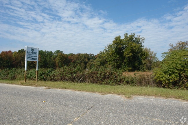
Property Detail
1111 Cecil Rd
00145-01-009
I-95
Distributionwarehouseregional
FLORENCE
B and X Area of moderate flood hazard, usually the area between the limits of the 100-year and 500-year floods.
South Carolina
2025
36.62 AC
2025
Florence/Dillon
000101
Other Market Areas
55,500 SF
Florence, SC
NEARBY LISTINGS FOR SALE OR LEASE
-
-
View all Florence listings for sale on LoopNet.com
DEMOGRAPHICS near 1111 Cecil Rd
1 mile
3 mile
5 mile
2025 Total Population
1,391
13,887
37,324
2030 Population
1,385
14,214
38,087
Pop Growth 2025-2030
(0.43%)
+ 2.35%
+ 2.04%
Average Age
41
41
41
2025 Total Households
548
5,465
15,199
HH Growth 2025-2030
(0.18%)
+ 2.45%
+ 2.13%
Median Household Inc
$55,707
$42,149
$50,450
Avg Household Size
2.50
2.40
2.40
2025 Avg HH Vehicles
2.00
2.00
2.00
Median Home Value
$103,889
$118,953
$173,331
Median Year Built
1974
1976
1975
Nearby Places
Map Layers
Map Styles
 Street
 Aerial
Layers
 Traffic
 Biking
Places
Listings with unknown addresses are not visible on the map
- Restaurants
- Banks
- Shops
- Fitness
- Groceries
PUBLIC TRANSPORTATION
COMMUTER RAIL
Florence Amtrak Station (Palmetto - Amtrak, Silver Meteor - Amtrak)
Drive
Walk
Distance
Florence Amtrak Station (Palmetto - Amtrak, Silver Meteor - Amtrak)
11 min
5.0 mi
Freight Ports
North Charleston Terminal
Drive
Walk
Distance
North Charleston Terminal
143 min
126.4 mi
SALE & LEASE HISTORY
LISTING DATE
SALE/LEASE

Sep 24, 2016
For Sale
Jul 12, 2019
For Sale
Nearby Properties
Address
Land Use
TOTAL SIZE
Lot Size
Zoning
Address
Land Use
TOTAL SIZE
Lot Size
Zoning
21.29 AC
Address
Land Use
TOTAL SIZE
Lot Size
Zoning
4,550 SF
275.48 AC
Address
Land Use
TOTAL SIZE
Lot Size
Zoning
1,720 SF
36.06 AC
Address
Land Use
TOTAL SIZE
Lot Size
Zoning
10,806 SF
9.50 AC
Address
Land Use
TOTAL SIZE
Lot Size
Zoning
6,000 SF
3.62 AC
Address
Land Use
TOTAL SIZE
Lot Size
Zoning
5,401 SF
2.30 AC
Address
Land Use
TOTAL SIZE
Lot Size
Zoning
3,612 SF
0.87 AC
Address
Land Use
TOTAL SIZE
Lot Size
Zoning
179,000 SF
16.53 AC
Address
Land Use
TOTAL SIZE
Lot Size
Zoning
422,500 SF
92 AC
Address
Land Use
TOTAL SIZE
Lot Size
Zoning
133,616 SF
10.98 AC
Address
Land Use
TOTAL SIZE
Lot Size
Zoning
92,451 SF
2.82 AC
Address
Land Use
TOTAL SIZE
Lot Size
Zoning
20,265 SF
28.17 AC
B3
Address
Land Use
TOTAL SIZE
Lot Size
Zoning
50,490 SF
2.10 AC
Address
Land Use
TOTAL SIZE
Lot Size
Zoning
53,949 SF
10.01 AC
Address
Land Use
TOTAL SIZE
Lot Size
Zoning
130,000 SF
15.52 AC
Address
Land Use
TOTAL SIZE
Lot Size
Zoning
2,200 SF
0.47 AC
Address
Land Use
TOTAL SIZE
Lot Size
Zoning
56,646 SF
2.36 AC
Address
Land Use
TOTAL SIZE
Lot Size
Zoning
2,219 SF
0.52 AC
Address
Land Use
TOTAL SIZE
Lot Size
Zoning
38,700 SF
2.17 AC
Address
Land Use
TOTAL SIZE
Lot Size
Zoning
4.53 AC
Address
Land Use
TOTAL SIZE
Lot Size
Zoning
5.54 AC
Address
Land Use
TOTAL SIZE
Lot Size
Zoning
2,327 SF
0.92 AC
Address
Land Use
TOTAL SIZE
Lot Size
Zoning
15.97 AC
Address
Land Use
TOTAL SIZE
Lot Size
Zoning
78,500 SF
6.47 AC
Address
Land Use
TOTAL SIZE
Lot Size
Zoning
1,860 SF
0.51 AC
Address
Land Use
TOTAL SIZE
Lot Size
Zoning
34,164 SF
8.95 AC
Address
Land Use
TOTAL SIZE
Lot Size
Zoning
1,778 SF
0.59 AC
The World's #1 Commercial Real Estate Marketplace
Connect with us
© 2026 CoStar Group
The information above has been obtained from sources believed reliable. While we do not doubt its accuracy we have not verified it and make no guarantee, warranty or representation about it. It is your responsibility to independently confirm its accuracy and completeness. Any projections, opinions, assumptions, or estimates used are for example only and do not represent the current or future performance of the property. The value of this transaction to you depends on tax and other factors which should be evaluated by your tax, financial, and legal advisors. You and your advisors should conduct a careful, independent investigation of the property to determine to your satisfaction the suitability of the property for your needs.