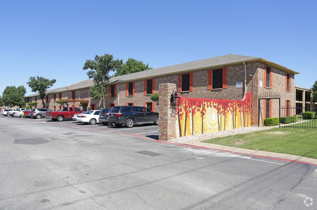
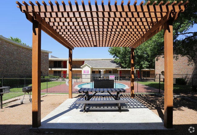
Property Record
1111 N O Connor Rd, Irving, TX 75061


NEARBY LISTINGS FOR SALE OR LEASE
Property Detail
1111 N O Connor Rd
Dallas-Fort Worth-Arlington, TX
Legends
32263500040020000
LEGENDS BLK D LOT 2 & PT OF ABST 1134 9.31 ACS TOTAL INT202000007010 DD01082020 CO-DC 2635000400200 1CI26350004
Apartment
Dallas
X
Texas
48113C0305L
2
2024
9.31 AC
2025
Irving
014502
Dallas/Ft Worth
237,472 SF
DEMOGRAPHICS near 1111 N O Connor Rd
1 Mile
3 Mile
5 Mile
2024 Total Population
15,309
130,084
221,709
2029 Population
15,131
128,599
219,485
Pop Growth 2024-2029
(1.16%)
(1.14%)
(1.00%)
Average Age
36
36
35
2024 Total Households
4,718
43,342
79,235
HH Growth 2024-2029
(1.34%)
(1.34%)
(1.10%)
Median Household Inc
$57,290
$62,595
$64,222
Avg Household Size
3.10
2.90
2.70
2024 Avg HH Vehicles
2.00
2.00
2.00
Median Home Value
$223,754
$222,744
$225,591
Median Year Built
1968
1973
1981
Nearby Places
Map Layers
Map Styles
 Street
 Aerial
- Restaurants
- Banks
- Shops
- Fitness
- Groceries
PUBLIC TRANSPORTATION
COMMUTER RAIL
Downtown Irving/Heritage Crossing Station (TRINITY RAILWAY - Dallas Area Rapid Transit (DART), Trinity Railway Express - Dallas Area Rapid Transit (DART))
DRIVE
WALK
Distance
Downtown Irving/Heritage Crossing Station (TRINITY RAILWAY - Dallas Area Rapid Transit (DART), Trinity Railway Express - Dallas Area Rapid Transit (DART))
2 min
1.0 mi
West Irving (TRINITY RAILWAY - Dallas Area Rapid Transit (DART), Trinity Railway Express - Dallas Area Rapid Transit (DART))
DRIVE
WALK
Distance
West Irving (TRINITY RAILWAY - Dallas Area Rapid Transit (DART), Trinity Railway Express - Dallas Area Rapid Transit (DART))
10 min
4.4 mi
AIRPORT
Dallas Love Field
DRIVE
WALK
Distance
Dallas Love Field
16 min
9.2 mi
Dallas-Fort Worth International
DRIVE
WALK
Distance
Dallas-Fort Worth International
16 min
10.7 mi
Freight Ports
Port of Shreveport
DRIVE
WALK
Distance
Port of Shreveport
226 min
208.4 mi
Nearby Properties
Address
Land Use
TOTAL SIZE
Lot Size
Zoning
Address
Land Use
TOTAL SIZE
Lot Size
Zoning
1,673,367 SF
17.29 AC
Z243
Address
Land Use
TOTAL SIZE
Lot Size
Zoning
30,000 SF
78.01 AC
Z392
Address
Land Use
TOTAL SIZE
Lot Size
Zoning
654,829 SF
9.78 AC
Z243
Address
Land Use
TOTAL SIZE
Lot Size
Zoning
253,580 SF
188.04 AC
Z393
Address
Land Use
TOTAL SIZE
Lot Size
Zoning
529,640 SF
5.13 AC
Z393
Address
Land Use
TOTAL SIZE
Lot Size
Zoning
558,547 SF
7.39 AC
Z198
Address
Land Use
TOTAL SIZE
Lot Size
Zoning
616,333 SF
6.32 AC
Z393
Address
Land Use
TOTAL SIZE
Lot Size
Zoning
573,495 SF
30.30 AC
Z243
Address
Land Use
TOTAL SIZE
Lot Size
Zoning
685,774 SF
7.36 AC
Z198
Address
Land Use
TOTAL SIZE
Lot Size
Zoning
571,923 SF
4.97 AC
Z198
Address
Land Use
TOTAL SIZE
Lot Size
Zoning
949,876 SF
8.39 AC
Z57
Address
Land Use
TOTAL SIZE
Lot Size
Zoning
444,743 SF
4.41 AC
Z198
Address
Land Use
TOTAL SIZE
Lot Size
Zoning
741,171 SF
3.79 AC
Z198
Address
Land Use
TOTAL SIZE
Lot Size
Zoning
1,102,000 SF
4.98 AC
Z393
Address
Land Use
TOTAL SIZE
Lot Size
Zoning
310,154 SF
10.33 AC
Z393
Address
Land Use
TOTAL SIZE
Lot Size
Zoning
569,805 SF
5.85 AC
Z392
Address
Land Use
TOTAL SIZE
Lot Size
Zoning
840,836 SF
4.13 AC
Z393
Address
Land Use
TOTAL SIZE
Lot Size
Zoning
348,013 SF
11.09 AC
Z243
Address
Land Use
TOTAL SIZE
Lot Size
Zoning
151,552 SF
16 AC
Z58
Address
Land Use
TOTAL SIZE
Lot Size
Zoning
168,598 SF
11.33 AC
Z128
Address
Land Use
TOTAL SIZE
Lot Size
Zoning
251,673 SF
14.60 AC
Z57
Address
Land Use
TOTAL SIZE
Lot Size
Zoning
886,275 SF
3.53 AC
Z243
Address
Land Use
TOTAL SIZE
Lot Size
Zoning
241,780 SF
16.46 AC
RMR2
Address
Land Use
TOTAL SIZE
Lot Size
Zoning
659,704 SF
11.55 AC
Z393
Address
Land Use
TOTAL SIZE
Lot Size
Zoning
643,370 SF
22.95 AC
Z393
Address
Land Use
TOTAL SIZE
Lot Size
Zoning
230,000 SF
12.40 AC
Z393
Address
Land Use
TOTAL SIZE
Lot Size
Zoning
213,935 SF
10.51 AC
Z243
Address
Land Use
TOTAL SIZE
Lot Size
Zoning
216,265 SF
10.66 AC
Z243
Address
Land Use
TOTAL SIZE
Lot Size
Zoning
120,000 SF
9.94 AC
Z393
Address
Land Use
TOTAL SIZE
Lot Size
Zoning
447,043 SF
15.41 AC
Z57
The World's #1 Commercial Real Estate Marketplace
Connect with us
© 2026 CoStar Group
The information above has been obtained from sources believed reliable. While we do not doubt its accuracy we have not verified it and make no guarantee, warranty or representation about it. It is your responsibility to independently confirm its accuracy and completeness. Any projections, opinions, assumptions, or estimates used are for example only and do not represent the current or future performance of the property. The value of this transaction to you depends on tax and other factors which should be evaluated by your tax, financial, and legal advisors. You and your advisors should conduct a careful, independent investigation of the property to determine to your satisfaction the suitability of the property for your needs.