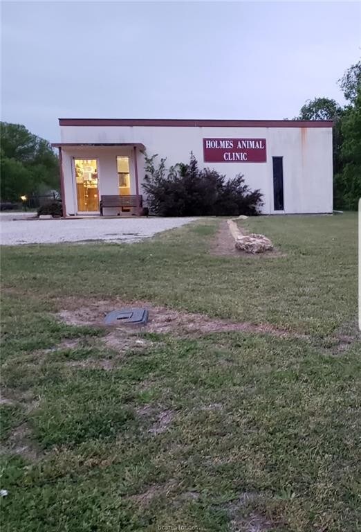
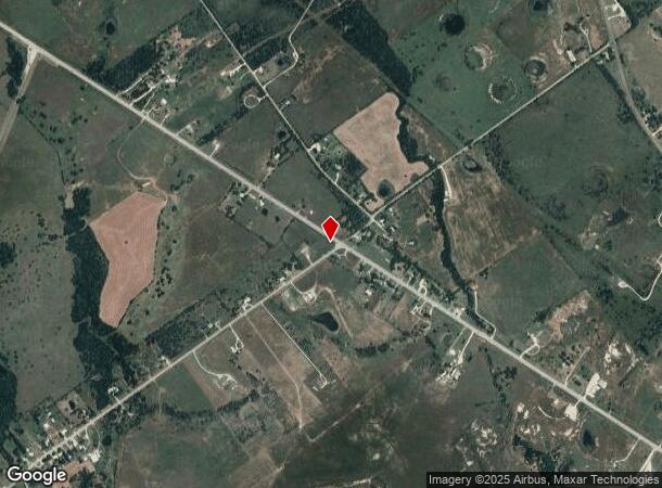
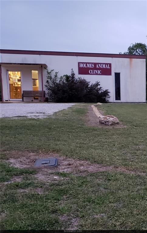
Property Record
1111 W Highway 171, Mexia, TX 76667
Property Detail
1111 W Highway 171
Commercialnec
A030 P VARELA, BLOCK 023, ACRES 1.51, (NORTHVIEW HEIGHTS BLK G 0.05 AC)
B and X Area of moderate flood hazard, usually the area between the limits of the 100-year and 500-year floods.
LIMESTONE
2025
Texas
2025
1.51 AC
970200
Other Market Areas
1,980 SF
R16622
NEARBY LISTINGS FOR SALE OR LEASE
-
-
View all Mexia listings for sale on LoopNet.com
DEMOGRAPHICS near 1111 W Highway 171
1 mile
3 mile
5 mile
2025 Total Population
1,326
7,411
8,940
2030 Population
1,345
7,509
9,055
Pop Growth 2025-2030
+ 1.43%
+ 1.32%
+ 1.29%
Average Age
40
39
40
2025 Total Households
461
2,632
3,226
HH Growth 2025-2030
+ 1.30%
+ 1.22%
+ 1.18%
Median Household Inc
$42,500
$43,145
$47,367
Avg Household Size
2.60
2.60
2.60
2025 Avg HH Vehicles
2.00
2.00
2.00
Median Home Value
$143,292
$118,483
$132,867
Median Year Built
1979
1978
1979
Nearby Places
Map Layers
Map Styles
 Street
 Aerial
Transit
 Traffic
 Biking
Places
Listings with unknown addresses are not visible on the map
- Restaurants
- Banks
- Shops
- Fitness
- Groceries
SALE & LEASE HISTORY
LISTING DATE
SALE/LEASE

Jun 12, 2019
For Sale
Nearby Properties
Address
Land Use
TOTAL SIZE
Lot Size
Zoning
Address
Land Use
TOTAL SIZE
Lot Size
Zoning
85,779 SF
4.70 AC
Address
Land Use
TOTAL SIZE
Lot Size
Zoning
81,950 SF
1.32 AC
Address
Land Use
TOTAL SIZE
Lot Size
Zoning
40,989 SF
2.76 AC
Address
Land Use
TOTAL SIZE
Lot Size
Zoning
616 SF
594.50 AC
Address
Land Use
TOTAL SIZE
Lot Size
Zoning
212,900 SF
15.13 AC
Address
Land Use
TOTAL SIZE
Lot Size
Zoning
25,610 SF
9.15 AC
Address
Land Use
TOTAL SIZE
Lot Size
Zoning
28,580 SF
1.44 AC
Address
Land Use
TOTAL SIZE
Lot Size
Zoning
49,847 SF
6.84 AC
Address
Land Use
TOTAL SIZE
Lot Size
Zoning
35,695 SF
1.74 AC
Address
Land Use
TOTAL SIZE
Lot Size
Zoning
59,840 SF
4.90 AC
Address
Land Use
TOTAL SIZE
Lot Size
Zoning
36,872 SF
7.72 AC
Address
Land Use
TOTAL SIZE
Lot Size
Zoning
4,080 SF
16 AC
Address
Land Use
TOTAL SIZE
Lot Size
Zoning
19,128 SF
0.40 AC
Address
Land Use
TOTAL SIZE
Lot Size
Zoning
3,200 SF
19.34 AC
Address
Land Use
TOTAL SIZE
Lot Size
Zoning
21,788 SF
1.73 AC
Address
Land Use
TOTAL SIZE
Lot Size
Zoning
83,589 SF
9.74 AC
Address
Land Use
TOTAL SIZE
Lot Size
Zoning
80,659 SF
16.95 AC
Address
Land Use
TOTAL SIZE
Lot Size
Zoning
13,255 SF
1.32 AC
Address
Land Use
TOTAL SIZE
Lot Size
Zoning
67,540 SF
2.38 AC
Address
Land Use
TOTAL SIZE
Lot Size
Zoning
37,336 SF
5.66 AC
Address
Land Use
TOTAL SIZE
Lot Size
Zoning
2,700 SF
15 AC
Address
Land Use
TOTAL SIZE
Lot Size
Zoning
5,822 SF
1.09 AC
Address
Land Use
TOTAL SIZE
Lot Size
Zoning
33,380 SF
1.32 AC
Address
Land Use
TOTAL SIZE
Lot Size
Zoning
15,270 SF
1.76 AC
Address
Land Use
TOTAL SIZE
Lot Size
Zoning
12,380 SF
2.81 AC
Address
Land Use
TOTAL SIZE
Lot Size
Zoning
9,642 SF
4 AC
Address
Land Use
TOTAL SIZE
Lot Size
Zoning
8,000 SF
0.26 AC
Address
Land Use
TOTAL SIZE
Lot Size
Zoning
9,120 SF
24.45 AC
Address
Land Use
TOTAL SIZE
Lot Size
Zoning
15,270 SF
1.76 AC
Address
Land Use
TOTAL SIZE
Lot Size
Zoning
13,869 SF
0.93 AC
The World's #1 Commercial Real Estate Marketplace
Connect with us
© 2026 CoStar Group
The information above has been obtained from sources believed reliable. While we do not doubt its accuracy we have not verified it and make no guarantee, warranty or representation about it. It is your responsibility to independently confirm its accuracy and completeness. Any projections, opinions, assumptions, or estimates used are for example only and do not represent the current or future performance of the property. The value of this transaction to you depends on tax and other factors which should be evaluated by your tax, financial, and legal advisors. You and your advisors should conduct a careful, independent investigation of the property to determine to your satisfaction the suitability of the property for your needs.