Property Record
1111 W Mc Highway 85, Buckeye, AZ 85326

NEARBY LISTINGS FOR SALE OR LEASE
-
-
View all Buckeye listings for sale on LoopNet.com
Property Detail
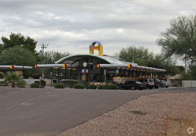
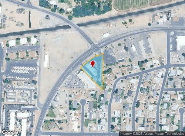
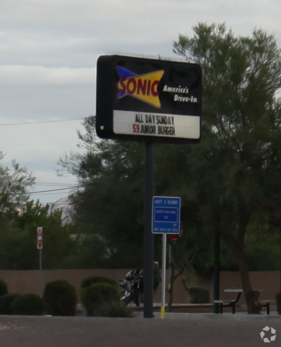
1111 W Mc Highway 85
Phoenix-Mesa-Scottsdale, AZ
Mesa City
400-75-105H
BEG AT NW COR TH S 3D 13M W 647.76F TH S 88D 57M E 169.85F TO PT ON CEN LN US H/W 80 TH NELY 347.43F TO POB TH NELY 339.11F TO E LN NW4 LOT 4 TH S 477.86F TO SE COR NW4 LOT 4 TH N 44D 48M W 382.54F TO POB EX NWLY 50F H/W 80 & EX ANY POR LY WI/IN FOL
Restaurantdrivein
Maricopa
X
Arizona
04013C2115L
4
2025
1.15 AC
2025
South Buckeye
050611
Phoenix
1,406 SF
DEMOGRAPHICS near 1111 W Mc Highway 85
1 Mile
3 Mile
5 Mile
2024 Total Population
5,070
26,775
53,648
2029 Population
5,487
29,195
58,734
Pop Growth 2024-2029
+ 8.22%
+ 9.04%
+ 9.48%
Average Age
36
33
34
2024 Total Households
1,699
7,968
16,023
HH Growth 2024-2029
+ 8.24%
+ 9.10%
+ 9.56%
Median Household Inc
$56,677
$68,276
$72,300
Avg Household Size
3.00
3.30
3.30
2024 Avg HH Vehicles
2.00
2.00
2.00
Median Home Value
$182,676
$261,720
$273,880
Median Year Built
1986
2005
2006
Nearby Places
Map Layers
Map Styles
 Street
 Aerial
- Restaurants
- Banks
- Shops
- Fitness
- Groceries
Nearby Properties
Address
Land Use
TOTAL SIZE
Lot Size
Zoning
Address
Land Use
TOTAL SIZE
Lot Size
Zoning
2,310,631 SF
215.58 AC
Address
Land Use
TOTAL SIZE
Lot Size
Zoning
1,207,360 SF
67.69 AC
Address
Land Use
TOTAL SIZE
Lot Size
Zoning
13.35 AC
Address
Land Use
TOTAL SIZE
Lot Size
Zoning
1,834,456 SF
142.44 AC
C-G
Address
Land Use
TOTAL SIZE
Lot Size
Zoning
11.14 AC
Address
Land Use
TOTAL SIZE
Lot Size
Zoning
3,494 SF
6.20 AC
GC
Address
Land Use
TOTAL SIZE
Lot Size
Zoning
510,427 SF
64.69 AC
GC
Address
Land Use
TOTAL SIZE
Lot Size
Zoning
290,752 SF
21.32 AC
SU
Address
Land Use
TOTAL SIZE
Lot Size
Zoning
269,665 SF
54.66 AC
PC
Address
Land Use
TOTAL SIZE
Lot Size
Zoning
93,337 SF
15.37 AC
PC
Address
Land Use
TOTAL SIZE
Lot Size
Zoning
78,774 SF
7.57 AC
PUD
Address
Land Use
TOTAL SIZE
Lot Size
Zoning
122,714 SF
12.27 AC
C-C
Address
Land Use
TOTAL SIZE
Lot Size
Zoning
68,255 SF
3.16 AC
PUD
Address
Land Use
TOTAL SIZE
Lot Size
Zoning
85,712 SF
15.18 AC
PR
Address
Land Use
TOTAL SIZE
Lot Size
Zoning
228,652 SF
136.91 AC
SU
Address
Land Use
TOTAL SIZE
Lot Size
Zoning
8,144 SF
39.69 AC
R-43
Address
Land Use
TOTAL SIZE
Lot Size
Zoning
60,201 SF
14.10 AC
PUD
Address
Land Use
TOTAL SIZE
Lot Size
Zoning
125,120 SF
8.49 AC
SU
Address
Land Use
TOTAL SIZE
Lot Size
Zoning
181,308 SF
20.19 AC
C-G
Address
Land Use
TOTAL SIZE
Lot Size
Zoning
20,248 SF
23.16 AC
SU
Address
Land Use
TOTAL SIZE
Lot Size
Zoning
3.10 AC
Address
Land Use
TOTAL SIZE
Lot Size
Zoning
178,939 SF
13.98 AC
CC
Address
Land Use
TOTAL SIZE
Lot Size
Zoning
150,139 SF
20.48 AC
C-G
Address
Land Use
TOTAL SIZE
Lot Size
Zoning
136,836 SF
8.85 AC
R-R
Address
Land Use
TOTAL SIZE
Lot Size
Zoning
53.11 AC
C-G
Address
Land Use
TOTAL SIZE
Lot Size
Zoning
40,859 SF
6.92 AC
PUD
Address
Land Use
TOTAL SIZE
Lot Size
Zoning
Address
Land Use
TOTAL SIZE
Lot Size
Zoning
24,119 SF
5.13 AC
CC
Address
Land Use
TOTAL SIZE
Lot Size
Zoning
108,952 SF
32.46 AC
I-2
Address
Land Use
TOTAL SIZE
Lot Size
Zoning
32,567 SF
7.38 AC
PR
The World's #1 Commercial Real Estate Marketplace
Connect with us
© 2025 CoStar Group
The information above has been obtained from sources believed reliable. While we do not doubt its accuracy we have not verified it and make no guarantee, warranty or representation about it. It is your responsibility to independently confirm its accuracy and completeness. Any projections, opinions, assumptions, or estimates used are for example only and do not represent the current or future performance of the property. The value of this transaction to you depends on tax and other factors which should be evaluated by your tax, financial, and legal advisors. You and your advisors should conduct a careful, independent investigation of the property to determine to your satisfaction the suitability of the property for your needs.