Property Record
1112 Main St, Osterville, MA 02655
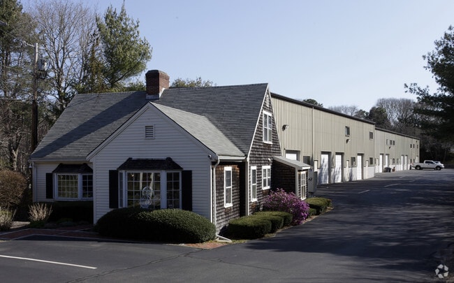

Property Detail
1112 Main St
Commercialcondominium
Barnstable
RC;BA
Massachusetts
B and X Area of moderate flood hazard, usually the area between the limits of the 100-year and 500-year floods.
13a02
2025
Cape Cod
2025
Other Market Areas
013002
Barnstable Town, MA
1,200 SF
OSTE-000118-000000-000013-C000017
NEARBY LISTINGS FOR SALE OR LEASE
DEMOGRAPHICS near 1112 Main St
1 mile
3 mile
5 mile
2025 Total Population
2,445
16,332
42,965
2030 Population
2,576
16,215
42,210
Pop Growth 2025-2030
+ 5.36%
(0.72%)
(1.76%)
Average Age
53
49
48
2025 Total Households
1,169
7,022
17,777
HH Growth 2025-2030
+ 5.13%
(0.66%)
(1.85%)
Median Household Inc
$110,454
$115,358
$101,075
Avg Household Size
2.00
2.30
2.30
2025 Avg HH Vehicles
2.00
2.00
2.00
Median Home Value
$873,979
$737,279
$643,870
Median Year Built
1980
1979
1981
Nearby Places
Map Layers
Map Styles
 Street
 Aerial
Layers
 Traffic
 Biking
Places
Listings with unknown addresses are not visible on the map
- Restaurants
- Banks
- Shops
- Fitness
- Groceries
PUBLIC TRANSPORTATION
COMMUTER RAIL
Drive
Walk
Distance
14 min
7.6 mi
AIRPORT
Martha's Vineyard
Drive
Walk
Distance
Martha's Vineyard
96 min
33.5 mi
Nantucket Memorial
Drive
Walk
Distance
Nantucket Memorial
163 min
40.7 mi
Freight Ports
Port of New Bedford Harbor
Drive
Walk
Distance
Port of New Bedford Harbor
68 min
46.6 mi
SALE & LEASE HISTORY
LISTING DATE
SALE/LEASE

Nov 22, 2024
For Sale
Dec 12, 2016
For Sale
Dec 12, 2016
For Sale
Aug 23, 2021
For Sale
Aug 05, 2017
For Sale
Nearby Properties
Address
Land Use
TOTAL SIZE
Lot Size
Zoning
Address
Land Use
TOTAL SIZE
Lot Size
Zoning
Address
Land Use
TOTAL SIZE
Lot Size
Zoning
3.28 AC
RF
Address
Land Use
TOTAL SIZE
Lot Size
Zoning
79,282 SF
43.70 AC
RC;BA
Address
Land Use
TOTAL SIZE
Lot Size
Zoning
2.84 AC
RF
Address
Land Use
TOTAL SIZE
Lot Size
Zoning
6.44 AC
RF
Address
Land Use
TOTAL SIZE
Lot Size
Zoning
6,460 SF
9 AC
RF
Address
Land Use
TOTAL SIZE
Lot Size
Zoning
6,423 SF
4.15 AC
RF
Address
Land Use
TOTAL SIZE
Lot Size
Zoning
4.66 AC
R
Address
Land Use
TOTAL SIZE
Lot Size
Zoning
4.62 AC
1
Address
Land Use
TOTAL SIZE
Lot Size
Zoning
600 SF
14.90 AC
Address
Land Use
TOTAL SIZE
Lot Size
Zoning
9,002 SF
4.41 AC
RF
Address
Land Use
TOTAL SIZE
Lot Size
Zoning
2.72 AC
1
Address
Land Use
TOTAL SIZE
Lot Size
Zoning
3,524 SF
10.70 AC
RD;RC
Address
Land Use
TOTAL SIZE
Lot Size
Zoning
73,621 SF
9.91 AC
RC;HB
Address
Land Use
TOTAL SIZE
Lot Size
Zoning
2.64 AC
1
Address
Land Use
TOTAL SIZE
Lot Size
Zoning
6,095 SF
2.26 AC
1
Address
Land Use
TOTAL SIZE
Lot Size
Zoning
5.46 AC
RF
Address
Land Use
TOTAL SIZE
Lot Size
Zoning
2.33 AC
1
Address
Land Use
TOTAL SIZE
Lot Size
Zoning
8,879 SF
1.33 AC
R
Address
Land Use
TOTAL SIZE
Lot Size
Zoning
Address
Land Use
TOTAL SIZE
Lot Size
Zoning
1.23 AC
RF
Address
Land Use
TOTAL SIZE
Lot Size
Zoning
50,212 SF
13.50 AC
Address
Land Use
TOTAL SIZE
Lot Size
Zoning
4,020 SF
2 AC
RF
Address
Land Use
TOTAL SIZE
Lot Size
Zoning
9,162 SF
3.11 AC
RF
Address
Land Use
TOTAL SIZE
Lot Size
Zoning
1.34 AC
RF
Address
Land Use
TOTAL SIZE
Lot Size
Zoning
3.92 AC
R
Address
Land Use
TOTAL SIZE
Lot Size
Zoning
7,528 SF
2.20 AC
RF
Address
Land Use
TOTAL SIZE
Lot Size
Zoning
2.32 AC
RF
Address
Land Use
TOTAL SIZE
Lot Size
Zoning
0.26 AC
RF
Address
Land Use
TOTAL SIZE
Lot Size
Zoning
1.52 AC
RF;RF-
The World's #1 Commercial Real Estate Marketplace
Connect with us
© 2026 CoStar Group
The information above has been obtained from sources believed reliable. While we do not doubt its accuracy we have not verified it and make no guarantee, warranty or representation about it. It is your responsibility to independently confirm its accuracy and completeness. Any projections, opinions, assumptions, or estimates used are for example only and do not represent the current or future performance of the property. The value of this transaction to you depends on tax and other factors which should be evaluated by your tax, financial, and legal advisors. You and your advisors should conduct a careful, independent investigation of the property to determine to your satisfaction the suitability of the property for your needs.