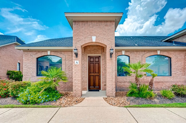
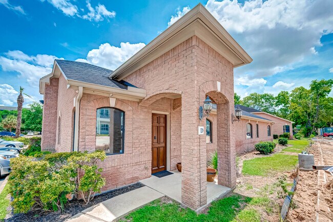
Property Record
11131 Mccracken Cir, Cypress, TX 77429
NEARBY LISTINGS FOR SALE OR LEASE
Property Detail
11131 Mccracken Cir
1274440080006
The Palms Office Condo Amend
Officecondo
UNIT F BLDG 11131 .0250 INT COMMON LAND & ELE THE PALMS OFFICE CONDO AMEND
X
Harris
48201C0430M
Texas
2024
0.06 AC
2025
FM 1960/Hwy 249
552303
Houston
675 SF
Houston-The Woodlands-Sugar Land, TX
DEMOGRAPHICS near 11131 Mccracken Cir
1 Mile
3 Mile
5 Mile
2024 Total Population
13,668
106,165
255,730
2029 Population
13,952
107,742
259,111
Pop Growth 2024-2029
+ 2.08%
+ 1.49%
+ 1.32%
Average Age
37
38
38
2024 Total Households
5,127
39,038
93,876
HH Growth 2024-2029
+ 2.01%
+ 1.41%
+ 1.29%
Median Household Inc
$59,030
$69,689
$79,844
Avg Household Size
2.60
2.70
2.70
2024 Avg HH Vehicles
2.00
2.00
2.00
Median Home Value
$223,862
$227,425
$256,080
Median Year Built
1987
1992
1994
Nearby Places
Map Layers
Map Styles
 Street
 Aerial
- Restaurants
- Banks
- Shops
- Fitness
- Groceries
PUBLIC TRANSPORTATION
AIRPORT
George Bush Intcntl/Houston
DRIVE
WALK
Distance
George Bush Intcntl/Houston
28 min
20.1 mi
William P Hobby
DRIVE
WALK
Distance
William P Hobby
56 min
36.0 mi
Freight Ports
Port of Houston
DRIVE
WALK
Distance
Port of Houston
47 min
31.6 mi
SALE & LEASE HISTORY
LISTING DATE
SALE/LEASE

May 03, 2024
For Sale
Aug 21, 2021
For Sale
Nearby Properties
Address
Land Use
TOTAL SIZE
Lot Size
Zoning
Address
Land Use
TOTAL SIZE
Lot Size
Zoning
587,609 SF
42.44 AC
Address
Land Use
TOTAL SIZE
Lot Size
Zoning
1,648,539 SF
28.70 AC
Address
Land Use
TOTAL SIZE
Lot Size
Zoning
339,067 SF
34.40 AC
Address
Land Use
TOTAL SIZE
Lot Size
Zoning
1,073,104 SF
4.74 AC
Address
Land Use
TOTAL SIZE
Lot Size
Zoning
445,343 SF
37.78 AC
Address
Land Use
TOTAL SIZE
Lot Size
Zoning
660,000 SF
104.88 AC
Address
Land Use
TOTAL SIZE
Lot Size
Zoning
682,700 SF
37 AC
Address
Land Use
TOTAL SIZE
Lot Size
Zoning
227,400 SF
2.77 AC
Address
Land Use
TOTAL SIZE
Lot Size
Zoning
388,333 SF
41.17 AC
Address
Land Use
TOTAL SIZE
Lot Size
Zoning
386,754 SF
17.99 AC
Address
Land Use
TOTAL SIZE
Lot Size
Zoning
543,414 SF
22.58 AC
Address
Land Use
TOTAL SIZE
Lot Size
Zoning
426,203 SF
23.88 AC
Address
Land Use
TOTAL SIZE
Lot Size
Zoning
301,119 SF
9.92 AC
Address
Land Use
TOTAL SIZE
Lot Size
Zoning
551,524 SF
10.06 AC
Address
Land Use
TOTAL SIZE
Lot Size
Zoning
449,032 SF
23.46 AC
Address
Land Use
TOTAL SIZE
Lot Size
Zoning
267,094 SF
14.76 AC
Address
Land Use
TOTAL SIZE
Lot Size
Zoning
339,301 SF
68.40 AC
Address
Land Use
TOTAL SIZE
Lot Size
Zoning
365,711 SF
26.61 AC
Address
Land Use
TOTAL SIZE
Lot Size
Zoning
405,225 SF
18.34 AC
Address
Land Use
TOTAL SIZE
Lot Size
Zoning
441,000 SF
23.07 AC
Address
Land Use
TOTAL SIZE
Lot Size
Zoning
469,370 SF
19.39 AC
Address
Land Use
TOTAL SIZE
Lot Size
Zoning
375,251 SF
14.85 AC
Address
Land Use
TOTAL SIZE
Lot Size
Zoning
326,807 SF
29.43 AC
Address
Land Use
TOTAL SIZE
Lot Size
Zoning
433,984 SF
17.82 AC
Address
Land Use
TOTAL SIZE
Lot Size
Zoning
368,361 SF
23.95 AC
Address
Land Use
TOTAL SIZE
Lot Size
Zoning
260,253 SF
7.46 AC
Address
Land Use
TOTAL SIZE
Lot Size
Zoning
377,188 SF
16.80 AC
Address
Land Use
TOTAL SIZE
Lot Size
Zoning
237,742 SF
13.80 AC
Address
Land Use
TOTAL SIZE
Lot Size
Zoning
308,141 SF
17.64 AC
Address
Land Use
TOTAL SIZE
Lot Size
Zoning
335,954 SF
35.27 AC
The World's #1 Commercial Real Estate Marketplace
Connect with us
© 2025 CoStar Group
The information above has been obtained from sources believed reliable. While we do not doubt its accuracy we have not verified it and make no guarantee, warranty or representation about it. It is your responsibility to independently confirm its accuracy and completeness. Any projections, opinions, assumptions, or estimates used are for example only and do not represent the current or future performance of the property. The value of this transaction to you depends on tax and other factors which should be evaluated by your tax, financial, and legal advisors. You and your advisors should conduct a careful, independent investigation of the property to determine to your satisfaction the suitability of the property for your needs.