Property Record
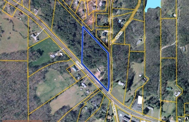
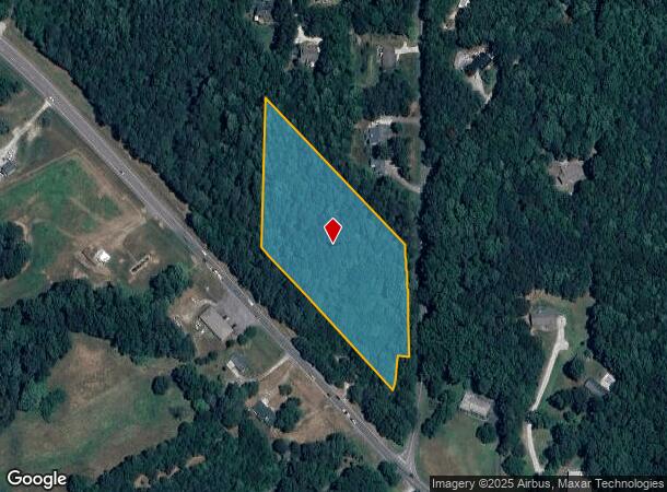
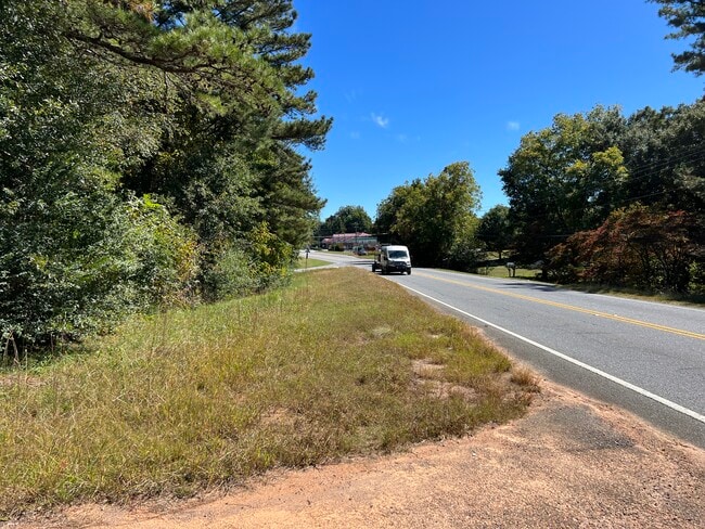
11135 Cumming Hwy, Canton, GA 30115
NEARBY LISTINGS FOR SALE OR LEASE
Property Detail
11135 Cumming Hwy
Atlanta-Sandy Springs-Roswell, GA
Laverne Ledbetter Surv
003N22-00000-008-000-0000
LL 840, 889 ETAL 3RD D TRACT 1
Agriculturalland
Cherokee
X
Georgia
13117C0020F
840
2025
4.50 AC
2025
Cherokee County
090603
Atlanta
DEMOGRAPHICS near 11135 Cumming Hwy
1 Mile
3 Mile
5 Mile
2024 Total Population
1,783
11,330
36,483
2029 Population
2,042
12,903
41,764
Pop Growth 2024-2029
+ 14.53%
+ 13.88%
+ 14.48%
Average Age
42
42
41
2024 Total Households
602
3,837
12,244
HH Growth 2024-2029
+ 14.62%
+ 13.97%
+ 14.57%
Median Household Inc
$109,375
$122,930
$126,821
Avg Household Size
2.90
2.90
2.90
2024 Avg HH Vehicles
3.00
3.00
2.00
Median Home Value
$443,689
$484,482
$472,838
Median Year Built
1994
2000
2001
Nearby Places
Map Layers
Map Styles
 Street
 Aerial
- Restaurants
- Banks
- Shops
- Fitness
- Groceries
SALE & LEASE HISTORY
LISTING DATE
SALE/LEASE

Oct 05, 2022
For Sale
Nearby Properties
Address
Land Use
TOTAL SIZE
Lot Size
Zoning
Address
Land Use
TOTAL SIZE
Lot Size
Zoning
472,267 SF
90.24 AC
AG
Address
Land Use
TOTAL SIZE
Lot Size
Zoning
9,785 SF
202.45 AC
MULTI
Address
Land Use
TOTAL SIZE
Lot Size
Zoning
108,303 SF
39.38 AC
AG
Address
Land Use
TOTAL SIZE
Lot Size
Zoning
95,102 SF
19.53 AC
AG
Address
Land Use
TOTAL SIZE
Lot Size
Zoning
81,240 SF
10.20 AC
GC
Address
Land Use
TOTAL SIZE
Lot Size
Zoning
68,520 SF
12.35 AC
GC
Address
Land Use
TOTAL SIZE
Lot Size
Zoning
8,696 SF
24.23 AC
OI
Address
Land Use
TOTAL SIZE
Lot Size
Zoning
28,914 SF
277.46 AC
PUD
Address
Land Use
TOTAL SIZE
Lot Size
Zoning
33,545 SF
182.62 AC
PUD
Address
Land Use
TOTAL SIZE
Lot Size
Zoning
198.63 AC
AG
Address
Land Use
TOTAL SIZE
Lot Size
Zoning
44,470 SF
40.56 AC
AG
Address
Land Use
TOTAL SIZE
Lot Size
Zoning
254.28 AC
AG
Address
Land Use
TOTAL SIZE
Lot Size
Zoning
74.15 AC
AG
Address
Land Use
TOTAL SIZE
Lot Size
Zoning
33,508 SF
6.43 AC
R-40
Address
Land Use
TOTAL SIZE
Lot Size
Zoning
60 AC
AG
Address
Land Use
TOTAL SIZE
Lot Size
Zoning
108.88 AC
AG
Address
Land Use
TOTAL SIZE
Lot Size
Zoning
102.41 AC
AG
Address
Land Use
TOTAL SIZE
Lot Size
Zoning
18,600 SF
4.24 AC
GC
Address
Land Use
TOTAL SIZE
Lot Size
Zoning
1,232 SF
149.53 AC
AG
Address
Land Use
TOTAL SIZE
Lot Size
Zoning
91.56 AC
AG
Address
Land Use
TOTAL SIZE
Lot Size
Zoning
58 AC
AG
Address
Land Use
TOTAL SIZE
Lot Size
Zoning
115.24 AC
R-40
Address
Land Use
TOTAL SIZE
Lot Size
Zoning
147.45 AC
AG
Address
Land Use
TOTAL SIZE
Lot Size
Zoning
36,392 SF
11.82 AC
AG
Address
Land Use
TOTAL SIZE
Lot Size
Zoning
12,201 SF
3.51 AC
AG
Address
Land Use
TOTAL SIZE
Lot Size
Zoning
58.58 AC
AG
Address
Land Use
TOTAL SIZE
Lot Size
Zoning
63.55 AC
AG
Address
Land Use
TOTAL SIZE
Lot Size
Zoning
1,672 SF
48.31 AC
AG
Address
Land Use
TOTAL SIZE
Lot Size
Zoning
5,757 SF
1.94 AC
GC
Address
Land Use
TOTAL SIZE
Lot Size
Zoning
55.63 AC
AG
The World's #1 Commercial Real Estate Marketplace
Connect with us
© 2025 CoStar Group
The information above has been obtained from sources believed reliable. While we do not doubt its accuracy we have not verified it and make no guarantee, warranty or representation about it. It is your responsibility to independently confirm its accuracy and completeness. Any projections, opinions, assumptions, or estimates used are for example only and do not represent the current or future performance of the property. The value of this transaction to you depends on tax and other factors which should be evaluated by your tax, financial, and legal advisors. You and your advisors should conduct a careful, independent investigation of the property to determine to your satisfaction the suitability of the property for your needs.