Property Record
1114 Ferris Rd, Amelia, OH 45102


NEARBY LISTINGS FOR SALE OR LEASE
Property Detail
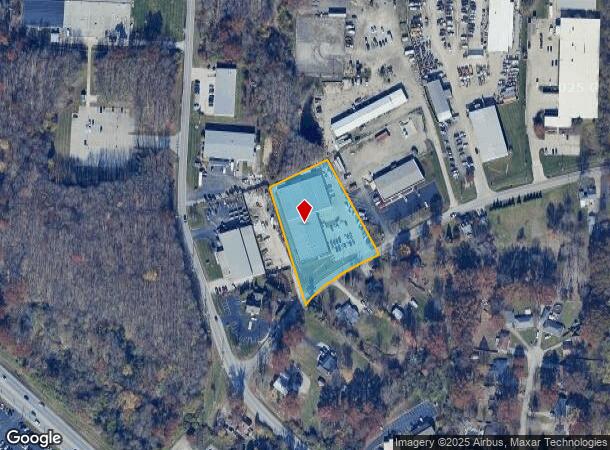
1114 Ferris Rd
41-31-12C-246
Stevens Military Survey Number 1671
Manufacturinglight
03TY ABATEMENT REMOVED
X
Clermont
21037C0070E
Ohio
2024
1.75 AC
2024
East
041202
Cincinnati/Dayton
11,700 SF
Cincinnati, OH-KY-IN
DEMOGRAPHICS near 1114 Ferris Rd
1 Mile
3 Mile
5 Mile
2024 Total Population
4,769
49,363
100,364
2029 Population
4,885
50,885
102,684
Pop Growth 2024-2029
+ 2.43%
+ 3.08%
+ 2.31%
Average Age
42
41
41
2024 Total Households
1,972
20,911
40,977
HH Growth 2024-2029
+ 2.54%
+ 3.18%
+ 2.46%
Median Household Inc
$59,696
$65,783
$67,975
Avg Household Size
2.30
2.30
2.40
2024 Avg HH Vehicles
2.00
2.00
2.00
Median Home Value
$188,065
$226,310
$226,339
Median Year Built
1975
1989
1985
Nearby Places
Map Layers
Map Styles
 Street
 Aerial
- Restaurants
- Banks
- Shops
- Fitness
- Groceries
PUBLIC TRANSPORTATION
AIRPORT
Cincinnati/Northern Kentucky International
DRIVE
WALK
Distance
Cincinnati/Northern Kentucky International
42 min
26.5 mi
Nearby Properties
Address
Land Use
TOTAL SIZE
Lot Size
Zoning
Address
Land Use
TOTAL SIZE
Lot Size
Zoning
7,560 SF
79.10 AC
Address
Land Use
TOTAL SIZE
Lot Size
Zoning
104,856 SF
32.81 AC
Address
Land Use
TOTAL SIZE
Lot Size
Zoning
50,382 SF
33.05 AC
Address
Land Use
TOTAL SIZE
Lot Size
Zoning
8,914 SF
37.70 AC
Address
Land Use
TOTAL SIZE
Lot Size
Zoning
154,426 SF
35.05 AC
Address
Land Use
TOTAL SIZE
Lot Size
Zoning
Address
Land Use
TOTAL SIZE
Lot Size
Zoning
49.15 AC
Address
Land Use
TOTAL SIZE
Lot Size
Zoning
56,080 SF
4.40 AC
Address
Land Use
TOTAL SIZE
Lot Size
Zoning
16.02 AC
Address
Land Use
TOTAL SIZE
Lot Size
Zoning
42,078 SF
58.22 AC
Address
Land Use
TOTAL SIZE
Lot Size
Zoning
26,637 SF
6.97 AC
Address
Land Use
TOTAL SIZE
Lot Size
Zoning
17,700 SF
50.11 AC
Address
Land Use
TOTAL SIZE
Lot Size
Zoning
9,088 SF
42.09 AC
Address
Land Use
TOTAL SIZE
Lot Size
Zoning
980 SF
5.01 AC
Address
Land Use
TOTAL SIZE
Lot Size
Zoning
3,803 SF
21.34 AC
Address
Land Use
TOTAL SIZE
Lot Size
Zoning
70,456 SF
15.28 AC
Address
Land Use
TOTAL SIZE
Lot Size
Zoning
79,064 SF
7.34 AC
Address
Land Use
TOTAL SIZE
Lot Size
Zoning
44,047 SF
3.37 AC
Address
Land Use
TOTAL SIZE
Lot Size
Zoning
83,608 SF
4.45 AC
Address
Land Use
TOTAL SIZE
Lot Size
Zoning
11,442 SF
9.70 AC
Address
Land Use
TOTAL SIZE
Lot Size
Zoning
168,266 SF
105.07 AC
Address
Land Use
TOTAL SIZE
Lot Size
Zoning
70,489 SF
8.57 AC
Address
Land Use
TOTAL SIZE
Lot Size
Zoning
59,730 SF
9.28 AC
Address
Land Use
TOTAL SIZE
Lot Size
Zoning
65,720 SF
7.49 AC
Address
Land Use
TOTAL SIZE
Lot Size
Zoning
230,428 SF
32.44 AC
Address
Land Use
TOTAL SIZE
Lot Size
Zoning
25,072 SF
7.01 AC
Address
Land Use
TOTAL SIZE
Lot Size
Zoning
12,488 SF
32.85 AC
Address
Land Use
TOTAL SIZE
Lot Size
Zoning
189,350 SF
16.25 AC
Address
Land Use
TOTAL SIZE
Lot Size
Zoning
59,360 SF
16.55 AC
Address
Land Use
TOTAL SIZE
Lot Size
Zoning
11,850 SF
24.64 AC
The World's #1 Commercial Real Estate Marketplace
Connect with us
© 2026 CoStar Group
The information above has been obtained from sources believed reliable. While we do not doubt its accuracy we have not verified it and make no guarantee, warranty or representation about it. It is your responsibility to independently confirm its accuracy and completeness. Any projections, opinions, assumptions, or estimates used are for example only and do not represent the current or future performance of the property. The value of this transaction to you depends on tax and other factors which should be evaluated by your tax, financial, and legal advisors. You and your advisors should conduct a careful, independent investigation of the property to determine to your satisfaction the suitability of the property for your needs.