Property Record
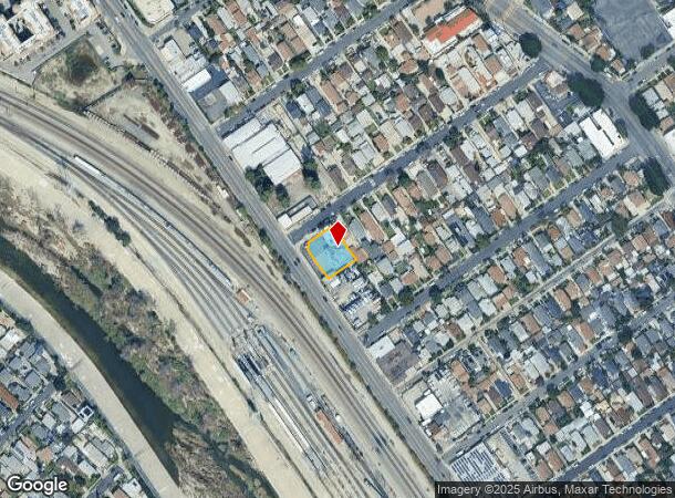
1114 N San Fernando Rd, Los Angeles, CA 90065
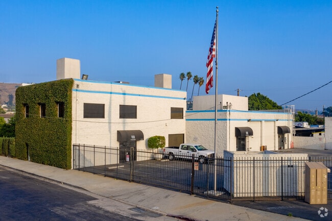
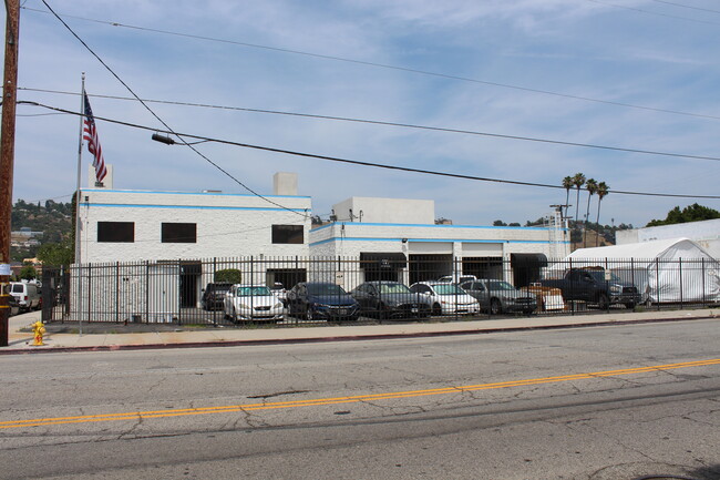

This Property Is For Sale
Current Lease Availabilities
Industrial LEASE
$18.00 - $27.00 SF/YR
1,856 - 7,634 SF
NEARBY LISTINGS FOR SALE OR LEASE
Property Detail
1114 N San Fernando Rd
Los Angeles-Long Beach-Glendale, CA
Nickels Loma Vista Tract
5453-003-061
NICKELS LOMA VISTA TR EX OF ST LOTS 2 AND 3 AND EX OF STS LOT 4
Lightindustrial
Los Angeles
X
California
06037C1628F
2,3,4
2024
0.27 AC
2025
Central Los Angeles
185320
Los Angeles
7,684 SF
DEMOGRAPHICS near 1114 N San Fernando Rd
1 Mile
3 Mile
5 Mile
2024 Total Population
20,618
266,758
971,906
2029 Population
19,990
257,533
944,685
Pop Growth 2024-2029
(3.05%)
(3.46%)
(2.80%)
Average Age
41
40
40
2024 Total Households
6,903
97,506
373,067
HH Growth 2024-2029
(3.39%)
(3.73%)
(2.84%)
Median Household Inc
$72,732
$77,254
$62,201
Avg Household Size
2.80
2.50
2.40
2024 Avg HH Vehicles
2.00
2.00
1.00
Median Home Value
$857,161
$881,335
$861,045
Median Year Built
1948
1955
1960
Nearby Places
- Restaurants
- Banks
- Shops
- Fitness
- Groceries
PUBLIC TRANSPORTATION
TRANSIT/SUBWAY
Lincoln Heights/Cypress Park Station (Gold Line - Los Angeles County Metropolitan Transportation Authority (Metro))
DRIVE
WALK
Distance
Lincoln Heights/Cypress Park Station (Gold Line - Los Angeles County Metropolitan Transportation Authority (Metro))
2 min
20 min
1.0 mi
COMMUTER RAIL
Glendale (Antelope Valley Line - Southern California Regional Rail Authority (Metrolink), Ventura County Line - Southern California Regional Rail Authority (Metrolink))
DRIVE
WALK
Distance
Glendale (Antelope Valley Line - Southern California Regional Rail Authority (Metrolink), Ventura County Line - Southern California Regional Rail Authority (Metrolink))
6 min
3.0 mi
DRIVE
WALK
Distance
7 min
3.2 mi
AIRPORT
Bob Hope
DRIVE
WALK
Distance
Bob Hope
21 min
14.5 mi
Los Angeles International
DRIVE
WALK
Distance
Los Angeles International
29 min
18.2 mi
Long Beach (Daugherty Field)
DRIVE
WALK
Distance
Long Beach (Daugherty Field)
35 min
23.7 mi
Freight Ports
Port of Long Beach
DRIVE
WALK
Distance
Port of Long Beach
37 min
26.6 mi
Nearby Properties
Address
Land Use
TOTAL SIZE
Lot Size
Zoning
Address
Land Use
TOTAL SIZE
Lot Size
Zoning
816,046 SF
15.37 AC
LAA1
Address
Land Use
TOTAL SIZE
Lot Size
Zoning
465,722 SF
5.84 AC
LAC4
Address
Land Use
TOTAL SIZE
Lot Size
Zoning
635,233 SF
12.02 AC
LAR5
Address
Land Use
TOTAL SIZE
Lot Size
Zoning
513,825 SF
4.28 AC
LAC2
Address
Land Use
TOTAL SIZE
Lot Size
Zoning
534,225 SF
Address
Land Use
TOTAL SIZE
Lot Size
Zoning
251,317 SF
114.56 AC
LAR1
Address
Land Use
TOTAL SIZE
Lot Size
Zoning
1,059,650 SF
1.07 AC
LAC2
Address
Land Use
TOTAL SIZE
Lot Size
Zoning
349,519 SF
2.16 AC
GLM1*
Address
Land Use
TOTAL SIZE
Lot Size
Zoning
244,071 SF
1.64 AC
LARAS4
Address
Land Use
TOTAL SIZE
Lot Size
Zoning
175.69 AC
LAA1
Address
Land Use
TOTAL SIZE
Lot Size
Zoning
328,737 SF
7.92 AC
LAC2
Address
Land Use
TOTAL SIZE
Lot Size
Zoning
642,160 SF
8.26 AC
LAADP
Address
Land Use
TOTAL SIZE
Lot Size
Zoning
368,058 SF
2.65 AC
LAUC (CA)
Address
Land Use
TOTAL SIZE
Lot Size
Zoning
354,299 SF
2.18 AC
LAC2
Address
Land Use
TOTAL SIZE
Lot Size
Zoning
150,608 SF
0.88 AC
LAC2
Address
Land Use
TOTAL SIZE
Lot Size
Zoning
354,707 SF
1.14 AC
LACW
Address
Land Use
TOTAL SIZE
Lot Size
Zoning
318,903 SF
1.10 AC
LAC4
Address
Land Use
TOTAL SIZE
Lot Size
Zoning
369,452 SF
0.90 AC
LAC2
Address
Land Use
TOTAL SIZE
Lot Size
Zoning
342,600 SF
2.55 AC
LAC4
Address
Land Use
TOTAL SIZE
Lot Size
Zoning
682,553 SF
1.36 AC
LAC2
Address
Land Use
TOTAL SIZE
Lot Size
Zoning
209,559 SF
0.88 AC
LAR5
Address
Land Use
TOTAL SIZE
Lot Size
Zoning
225,923 SF
1.31 AC
LAR5
Address
Land Use
TOTAL SIZE
Lot Size
Zoning
224,969 SF
1.87 AC
LACW
Address
Land Use
TOTAL SIZE
Lot Size
Zoning
266,548 SF
4.59 AC
LAC4
Address
Land Use
TOTAL SIZE
Lot Size
Zoning
119,455 SF
5.04 AC
LACM
Address
Land Use
TOTAL SIZE
Lot Size
Zoning
53,760 SF
4.60 AC
LAM1
Address
Land Use
TOTAL SIZE
Lot Size
Zoning
252,559 SF
2.87 AC
LAC2
Address
Land Use
TOTAL SIZE
Lot Size
Zoning
195,526 SF
2.81 AC
LAADP
Address
Land Use
TOTAL SIZE
Lot Size
Zoning
358,305 SF
2.69 AC
LAC2
Address
Land Use
TOTAL SIZE
Lot Size
Zoning
222,940 SF
2.48 AC
LAC2
The World's #1 Commercial Real Estate Marketplace
Connect with us
© 2025 CoStar Group
The information above has been obtained from sources believed reliable. While we do not doubt its accuracy we have not verified it and make no guarantee, warranty or representation about it. It is your responsibility to independently confirm its accuracy and completeness. Any projections, opinions, assumptions, or estimates used are for example only and do not represent the current or future performance of the property. The value of this transaction to you depends on tax and other factors which should be evaluated by your tax, financial, and legal advisors. You and your advisors should conduct a careful, independent investigation of the property to determine to your satisfaction the suitability of the property for your needs.