Property Record
8111 La Porte Rd, Houston, TX 77012


Property Detail
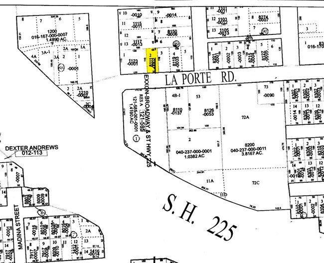
8111 La Porte Rd
Houston-Pasadena-The Woodlands, TX
LT 2 BLK 89 HARRISBURG
0161680000002
HARRIS
Parkinglot
Texas
B and X Area of moderate flood hazard, usually the area between the limits of the 100-year and 500-year floods.
2
2024
0.13 AC
2025
Inner Loop East End
311400
Houston
7,104 SF
NEARBY LISTINGS FOR SALE OR LEASE
DEMOGRAPHICS near 8111 La Porte Rd
1 mile
3 mile
5 mile
2025 Total Population
13,407
120,266
320,622
2030 Population
14,354
128,669
343,530
Pop Growth 2025-2030
+ 7.06%
+ 6.99%
+ 7.14%
Average Age
37
37
37
2025 Total Households
4,366
39,675
105,975
HH Growth 2025-2030
+ 7.40%
+ 7.23%
+ 7.64%
Median Household Inc
$55,697
$50,784
$49,760
Avg Household Size
3.00
2.90
2.80
2025 Avg HH Vehicles
2.00
2.00
2.00
Median Home Value
$178,482
$181,587
$190,185
Median Year Built
1952
1958
1960
Nearby Places
Map Layers
Map Styles
 Street
 Aerial
Layers
 Traffic
 Biking
Places
Listings with unknown addresses are not visible on the map
- Restaurants
- Banks
- Shops
- Fitness
- Groceries
PUBLIC TRANSPORTATION
COMMUTER RAIL
Houston (Sunset Limited - Amtrak)
Drive
Walk
Distance
Houston (Sunset Limited - Amtrak)
13 min
8.5 mi
AIRPORT
William P Hobby
Drive
Walk
Distance
William P Hobby
16 min
7.4 mi
George Bush Intcntl/Houston
Drive
Walk
Distance
George Bush Intcntl/Houston
34 min
25.6 mi
Freight Ports
Port of Houston
Drive
Walk
Distance
Port of Houston
9 min
4.0 mi
Nearby Properties
Address
Land Use
TOTAL SIZE
Lot Size
Zoning
Address
Land Use
TOTAL SIZE
Lot Size
Zoning
65.22 AC
Address
Land Use
TOTAL SIZE
Lot Size
Zoning
256.70 AC
Address
Land Use
TOTAL SIZE
Lot Size
Zoning
108.84 AC
Address
Land Use
TOTAL SIZE
Lot Size
Zoning
1,392,720 SF
83.75 AC
Address
Land Use
TOTAL SIZE
Lot Size
Zoning
143.17 AC
Address
Land Use
TOTAL SIZE
Lot Size
Zoning
4.26 AC
Address
Land Use
TOTAL SIZE
Lot Size
Zoning
165.53 AC
Address
Land Use
TOTAL SIZE
Lot Size
Zoning
2,275,058 SF
24.47 AC
Address
Land Use
TOTAL SIZE
Lot Size
Zoning
403,242 SF
46.18 AC
Address
Land Use
TOTAL SIZE
Lot Size
Zoning
1,171,276 SF
44.19 AC
Address
Land Use
TOTAL SIZE
Lot Size
Zoning
115.83 AC
Address
Land Use
TOTAL SIZE
Lot Size
Zoning
2,918,000 SF
69.31 AC
Address
Land Use
TOTAL SIZE
Lot Size
Zoning
198,023 SF
17.87 AC
Address
Land Use
TOTAL SIZE
Lot Size
Zoning
1,149,387 SF
36.61 AC
Address
Land Use
TOTAL SIZE
Lot Size
Zoning
33.97 AC
Address
Land Use
TOTAL SIZE
Lot Size
Zoning
901,984 SF
59.37 AC
Address
Land Use
TOTAL SIZE
Lot Size
Zoning
143.17 AC
Address
Land Use
TOTAL SIZE
Lot Size
Zoning
261.10 AC
Address
Land Use
TOTAL SIZE
Lot Size
Zoning
107.07 AC
Address
Land Use
TOTAL SIZE
Lot Size
Zoning
331,196 SF
40.14 AC
Address
Land Use
TOTAL SIZE
Lot Size
Zoning
985,528 SF
22.64 AC
Address
Land Use
TOTAL SIZE
Lot Size
Zoning
232,915 SF
7.89 AC
Address
Land Use
TOTAL SIZE
Lot Size
Zoning
260,972 SF
23.45 AC
Address
Land Use
TOTAL SIZE
Lot Size
Zoning
267,844 SF
10.98 AC
Address
Land Use
TOTAL SIZE
Lot Size
Zoning
194,296 SF
15.13 AC
Address
Land Use
TOTAL SIZE
Lot Size
Zoning
153.70 AC
Address
Land Use
TOTAL SIZE
Lot Size
Zoning
224,084 SF
72.45 AC
Address
Land Use
TOTAL SIZE
Lot Size
Zoning
308,748 SF
11.34 AC
Address
Land Use
TOTAL SIZE
Lot Size
Zoning
113,688 SF
4 AC
Address
Land Use
TOTAL SIZE
Lot Size
Zoning
78,073 SF
5.45 AC
The World's #1 Commercial Real Estate Marketplace
Connect with us
© 2026 CoStar Group
The information above has been obtained from sources believed reliable. While we do not doubt its accuracy we have not verified it and make no guarantee, warranty or representation about it. It is your responsibility to independently confirm its accuracy and completeness. Any projections, opinions, assumptions, or estimates used are for example only and do not represent the current or future performance of the property. The value of this transaction to you depends on tax and other factors which should be evaluated by your tax, financial, and legal advisors. You and your advisors should conduct a careful, independent investigation of the property to determine to your satisfaction the suitability of the property for your needs.