Property Record
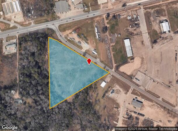
1115 Fm 1485 Rd, Conroe, TX 77301

NEARBY LISTINGS FOR SALE OR LEASE
Property Detail
1115 Fm 1485 Rd
0781-00-01100
Mccomb W P
Commercialnec
A0781 - MCCOMB W P, TRACT 11, ACRES 6.76
AE
Montgomery
48339C0385G
Texas
2024
6.76 AC
2025
Outlying Montgomery Cnty
693002
Houston
9,360 SF
Houston-Pasadena-The Woodlands, TX
DEMOGRAPHICS near 1115 Fm 1485 Rd
1 Mile
3 Mile
5 Mile
2024 Total Population
968
21,642
74,231
2029 Population
1,198
26,670
91,211
Pop Growth 2024-2029
+ 23.76%
+ 23.23%
+ 22.87%
Average Age
35
35
35
2024 Total Households
281
6,738
24,517
HH Growth 2024-2029
+ 23.84%
+ 23.36%
+ 23.51%
Median Household Inc
$55,649
$69,479
$59,137
Avg Household Size
3.20
3.10
2.80
2024 Avg HH Vehicles
2.00
2.00
2.00
Median Home Value
$227,083
$215,975
$192,879
Median Year Built
1996
2004
1998
Nearby Places
Map Layers
Map Styles
 Street
 Aerial
- Restaurants
- Banks
- Shops
- Fitness
- Groceries
PUBLIC TRANSPORTATION
AIRPORT
George Bush Intcntl/Houston
DRIVE
WALK
Distance
George Bush Intcntl/Houston
44 min
34.9 mi
Freight Ports
Port of Houston
DRIVE
WALK
Distance
Port of Houston
66 min
50.6 mi
SALE & LEASE HISTORY
LISTING DATE
SALE/LEASE

Sep 24, 2016
For Sale
Apr 23, 2018
For Sale
Nearby Properties
Address
Land Use
TOTAL SIZE
Lot Size
Zoning
Address
Land Use
TOTAL SIZE
Lot Size
Zoning
619,770 SF
81.76 AC
Address
Land Use
TOTAL SIZE
Lot Size
Zoning
206,008 SF
107.61 AC
Address
Land Use
TOTAL SIZE
Lot Size
Zoning
376,980 SF
24.37 AC
1
Address
Land Use
TOTAL SIZE
Lot Size
Zoning
242,944 SF
179.58 AC
Address
Land Use
TOTAL SIZE
Lot Size
Zoning
186,100 SF
29.68 AC
1
Address
Land Use
TOTAL SIZE
Lot Size
Zoning
262,564 SF
51.89 AC
1
Address
Land Use
TOTAL SIZE
Lot Size
Zoning
38,742 SF
249.26 AC
1
Address
Land Use
TOTAL SIZE
Lot Size
Zoning
159,185 SF
18.45 AC
1
Address
Land Use
TOTAL SIZE
Lot Size
Zoning
117,392 SF
27 AC
1
Address
Land Use
TOTAL SIZE
Lot Size
Zoning
143,641 SF
14.80 AC
1
Address
Land Use
TOTAL SIZE
Lot Size
Zoning
161,142 SF
493.71 AC
Address
Land Use
TOTAL SIZE
Lot Size
Zoning
187,426 SF
61.77 AC
1
Address
Land Use
TOTAL SIZE
Lot Size
Zoning
35,026 SF
3.24 AC
Address
Land Use
TOTAL SIZE
Lot Size
Zoning
70,912 SF
5.07 AC
1
Address
Land Use
TOTAL SIZE
Lot Size
Zoning
82,560 SF
1
Address
Land Use
TOTAL SIZE
Lot Size
Zoning
78,110 SF
14 AC
1
Address
Land Use
TOTAL SIZE
Lot Size
Zoning
63,366 SF
17.93 AC
1
Address
Land Use
TOTAL SIZE
Lot Size
Zoning
255 SF
254.02 AC
Address
Land Use
TOTAL SIZE
Lot Size
Zoning
33,476 SF
7.24 AC
1
Address
Land Use
TOTAL SIZE
Lot Size
Zoning
25,011 SF
8.57 AC
Address
Land Use
TOTAL SIZE
Lot Size
Zoning
132,252 SF
21.40 AC
1
Address
Land Use
TOTAL SIZE
Lot Size
Zoning
14,750 SF
1.66 AC
Address
Land Use
TOTAL SIZE
Lot Size
Zoning
44,182 SF
6.25 AC
1
Address
Land Use
TOTAL SIZE
Lot Size
Zoning
64,150 SF
6.41 AC
1
Address
Land Use
TOTAL SIZE
Lot Size
Zoning
60,000 SF
5.02 AC
1
Address
Land Use
TOTAL SIZE
Lot Size
Zoning
Address
Land Use
TOTAL SIZE
Lot Size
Zoning
84,177 SF
4.74 AC
1
Address
Land Use
TOTAL SIZE
Lot Size
Zoning
163,880 SF
11 AC
Address
Land Use
TOTAL SIZE
Lot Size
Zoning
50,160 SF
3.47 AC
1
Address
Land Use
TOTAL SIZE
Lot Size
Zoning
49,000 SF
5.53 AC
1
The World's #1 Commercial Real Estate Marketplace
Connect with us
© 2026 CoStar Group
The information above has been obtained from sources believed reliable. While we do not doubt its accuracy we have not verified it and make no guarantee, warranty or representation about it. It is your responsibility to independently confirm its accuracy and completeness. Any projections, opinions, assumptions, or estimates used are for example only and do not represent the current or future performance of the property. The value of this transaction to you depends on tax and other factors which should be evaluated by your tax, financial, and legal advisors. You and your advisors should conduct a careful, independent investigation of the property to determine to your satisfaction the suitability of the property for your needs.