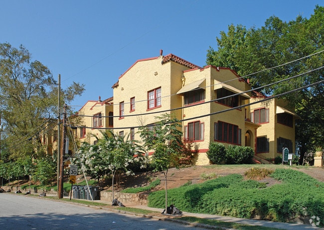
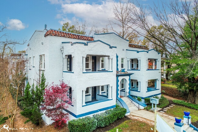
Property Record
1115 Ponce De Leon Ave Ne, Atlanta, GA 30306

NEARBY LISTINGS FOR SALE OR LEASE
Property Detail
1115 Ponce De Leon Ave Ne
Atlanta-Sandy Springs-Roswell, GA
Ponce
14-0016-0013-004-0
KA 1115 PONCE UN 17 16X1B 1XEFF 732SF- EA 60 FC: VERIFIED LUC FOR 2021
Apartment
Fulton
X
Georgia
13089C0063K
6
2024
0.40 AC
2025
Poncey-Highland
001501
Atlanta
17,280 SF
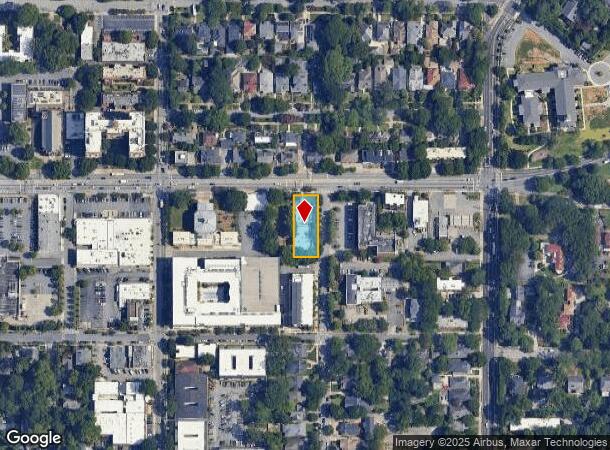
DEMOGRAPHICS near 1115 Ponce De Leon Ave Ne
1 Mile
3 Mile
5 Mile
2024 Total Population
19,976
184,834
426,297
2029 Population
20,353
189,066
437,507
Pop Growth 2024-2029
+ 1.89%
+ 2.29%
+ 2.63%
Average Age
37
36
37
2024 Total Households
10,763
89,470
201,724
HH Growth 2024-2029
+ 2.09%
+ 2.74%
+ 2.93%
Median Household Inc
$115,117
$104,816
$87,761
Avg Household Size
1.80
1.80
1.90
2024 Avg HH Vehicles
1.00
1.00
1.00
Median Home Value
$713,843
$586,003
$487,566
Median Year Built
1958
1991
1990
Nearby Places
- Restaurants
- Banks
- Shops
- Fitness
- Groceries
PUBLIC TRANSPORTATION
AIRPORT
Hartsfield - Jackson Atlanta International
DRIVE
WALK
Distance
Hartsfield - Jackson Atlanta International
21 min
12.2 mi
SALE & LEASE HISTORY
LISTING DATE
SALE/LEASE

Feb 25, 2022
For Sale
Nearby Properties
Address
Land Use
TOTAL SIZE
Lot Size
Zoning
Address
Land Use
TOTAL SIZE
Lot Size
Zoning
1,585,451 SF
1.97 AC
SPI2
Address
Land Use
TOTAL SIZE
Lot Size
Zoning
2,283,599 SF
12.93 AC
I1
Address
Land Use
TOTAL SIZE
Lot Size
Zoning
179.40 AC
R4
Address
Land Use
TOTAL SIZE
Lot Size
Zoning
3.16 AC
SPI1
Address
Land Use
TOTAL SIZE
Lot Size
Zoning
9 AC
C5
Address
Land Use
TOTAL SIZE
Lot Size
Zoning
10.27 AC
C5
Address
Land Use
TOTAL SIZE
Lot Size
Zoning
1,039,831 SF
0.31 AC
C4
Address
Land Use
TOTAL SIZE
Lot Size
Zoning
1,227,912 SF
2.15 AC
SPI4
Address
Land Use
TOTAL SIZE
Lot Size
Zoning
1,736,017 SF
3.63 AC
SPI2
Address
Land Use
TOTAL SIZE
Lot Size
Zoning
1,300,309 SF
4.81 AC
SPI1
Address
Land Use
TOTAL SIZE
Lot Size
Zoning
1,434,872 SF
1.89 AC
SPI1
Address
Land Use
TOTAL SIZE
Lot Size
Zoning
1,116,157 SF
1.48 AC
SPI3
Address
Land Use
TOTAL SIZE
Lot Size
Zoning
1,467,469 SF
0.07 AC
C4
Address
Land Use
TOTAL SIZE
Lot Size
Zoning
10,954,869 SF
28.88 AC
C3
Address
Land Use
TOTAL SIZE
Lot Size
Zoning
1.55 AC
SPI1
Address
Land Use
TOTAL SIZE
Lot Size
Zoning
1,646,011 SF
3.74 AC
SPI4
Address
Land Use
TOTAL SIZE
Lot Size
Zoning
342,275 SF
0.70 AC
SPI3
Address
Land Use
TOTAL SIZE
Lot Size
Zoning
903,732 SF
0.34 AC
SPI1
Address
Land Use
TOTAL SIZE
Lot Size
Zoning
467,847 SF
1.62 AC
I2
Address
Land Use
TOTAL SIZE
Lot Size
Zoning
1,314,183 SF
2.61 AC
SPI1
Address
Land Use
TOTAL SIZE
Lot Size
Zoning
2,577,342 SF
2.04 AC
SPI1
Address
Land Use
TOTAL SIZE
Lot Size
Zoning
1,356,182 SF
2.52 AC
SPI4
Address
Land Use
TOTAL SIZE
Lot Size
Zoning
2,612 SF
137.60 AC
X
Address
Land Use
TOTAL SIZE
Lot Size
Zoning
1,121,700 SF
2.21 AC
I2
Address
Land Use
TOTAL SIZE
Lot Size
Zoning
345,125 SF
7.73 AC
C1
Address
Land Use
TOTAL SIZE
Lot Size
Zoning
13,340,229 SF
3.68 AC
SPI1
Address
Land Use
TOTAL SIZE
Lot Size
Zoning
415,551 SF
1.13 AC
C4
Address
Land Use
TOTAL SIZE
Lot Size
Zoning
628,608 SF
0.39 AC
SPI4
Address
Land Use
TOTAL SIZE
Lot Size
Zoning
883,867 SF
2.71 AC
C1
Address
Land Use
TOTAL SIZE
Lot Size
Zoning
7,420 SF
0.13 AC
RG6
The World's #1 Commercial Real Estate Marketplace
Connect with us
© 2025 CoStar Group
The information above has been obtained from sources believed reliable. While we do not doubt its accuracy we have not verified it and make no guarantee, warranty or representation about it. It is your responsibility to independently confirm its accuracy and completeness. Any projections, opinions, assumptions, or estimates used are for example only and do not represent the current or future performance of the property. The value of this transaction to you depends on tax and other factors which should be evaluated by your tax, financial, and legal advisors. You and your advisors should conduct a careful, independent investigation of the property to determine to your satisfaction the suitability of the property for your needs.