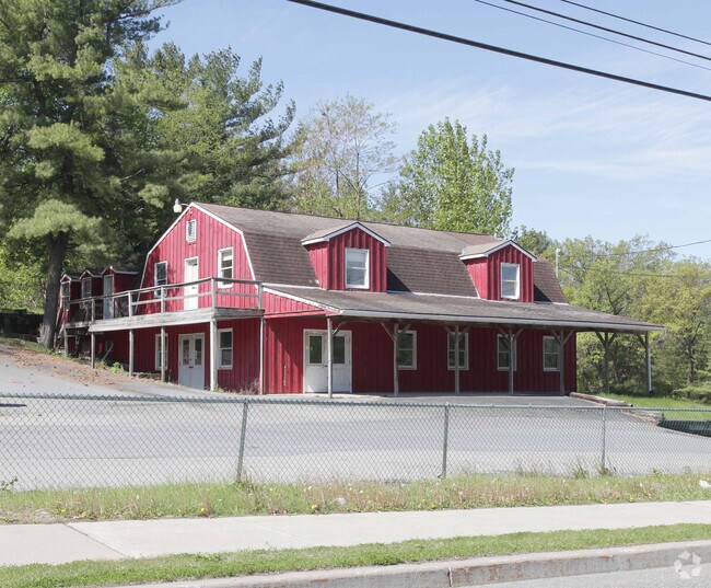
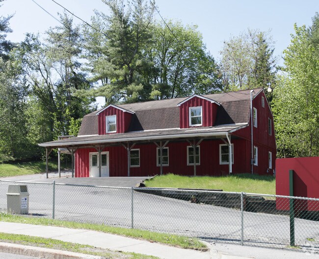
Property Record
1115 State Route 9, Queensbury, NY 12804
NEARBY LISTINGS FOR SALE OR LEASE
Property Detail
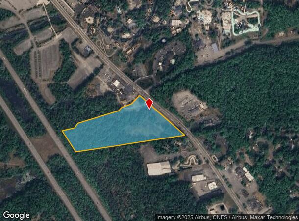
1115 State Route 9
Glens Falls, NY
PARK 746.83'RF 73.-1-3.2
523400-295-012-0001-004-000-0000
Warren
Amusementpark
New York
2025
4.000
2024
10.48 AC
070701
Warren County
5,120 SF
Albany/Schenectady/Troy
DEMOGRAPHICS near 1115 State Route 9
1 Mile
3 Mile
5 Mile
2024 Total Population
2,242
22,996
46,705
2029 Population
2,264
22,669
46,274
Pop Growth 2024-2029
+ 0.98%
(1.42%)
(0.92%)
Average Age
47
45
44
2024 Total Households
1,122
10,072
20,492
HH Growth 2024-2029
+ 1.07%
(1.40%)
(0.92%)
Median Household Inc
$80,418
$77,630
$75,405
Avg Household Size
1.90
2.20
2.20
2024 Avg HH Vehicles
2.00
2.00
2.00
Median Home Value
$275,547
$243,361
$228,633
Median Year Built
1977
1980
1976
Nearby Places
- Restaurants
- Banks
- Shops
- Fitness
- Groceries
PUBLIC TRANSPORTATION
COMMUTER RAIL
DRIVE
WALK
Distance
21 min
9.5 mi
Freight Ports
Albany, NY Port
DRIVE
WALK
Distance
Albany, NY Port
74 min
56.8 mi
Nearby Properties
Address
Land Use
TOTAL SIZE
Lot Size
Zoning
Address
Land Use
TOTAL SIZE
Lot Size
Zoning
27,660 SF
130.13 AC
O
Address
Land Use
TOTAL SIZE
Lot Size
Zoning
154,236 SF
104.60 AC
RR-3A
Address
Land Use
TOTAL SIZE
Lot Size
Zoning
Address
Land Use
TOTAL SIZE
Lot Size
Zoning
216,921 SF
10.76 AC
CI
Address
Land Use
TOTAL SIZE
Lot Size
Zoning
116,357 SF
34.05 AC
PUD
Address
Land Use
TOTAL SIZE
Lot Size
Zoning
191,130 SF
20.09 AC
R-1A
Address
Land Use
TOTAL SIZE
Lot Size
Zoning
6,112 SF
28.50 AC
O
Address
Land Use
TOTAL SIZE
Lot Size
Zoning
Address
Land Use
TOTAL SIZE
Lot Size
Zoning
29,108 SF
22.48 AC
MDR
Address
Land Use
TOTAL SIZE
Lot Size
Zoning
3,060 SF
129.15 AC
RC
Address
Land Use
TOTAL SIZE
Lot Size
Zoning
27,470 SF
14.76 AC
MDR
Address
Land Use
TOTAL SIZE
Lot Size
Zoning
31,456 SF
15.49 AC
MDR
Address
Land Use
TOTAL SIZE
Lot Size
Zoning
89,151 SF
16.53 AC
O
Address
Land Use
TOTAL SIZE
Lot Size
Zoning
9.72 AC
CI
Address
Land Use
TOTAL SIZE
Lot Size
Zoning
215,447 SF
17.74 AC
CI
Address
Land Use
TOTAL SIZE
Lot Size
Zoning
130,142 SF
20.71 AC
CI
Address
Land Use
TOTAL SIZE
Lot Size
Zoning
8,042 SF
39.64 AC
O
Address
Land Use
TOTAL SIZE
Lot Size
Zoning
1,600 SF
42.56 AC
SPLIT
Address
Land Use
TOTAL SIZE
Lot Size
Zoning
117,258 SF
54.25 AC
MDR
Address
Land Use
TOTAL SIZE
Lot Size
Zoning
Address
Land Use
TOTAL SIZE
Lot Size
Zoning
37,514 SF
4.88 AC
PRD
Address
Land Use
TOTAL SIZE
Lot Size
Zoning
71,996 SF
40.15 AC
RR-3A
Address
Land Use
TOTAL SIZE
Lot Size
Zoning
121,153 SF
24.13 AC
CI
Address
Land Use
TOTAL SIZE
Lot Size
Zoning
86,968 SF
7.05 AC
CI
Address
Land Use
TOTAL SIZE
Lot Size
Zoning
53,853 SF
5.99 AC
CI
Address
Land Use
TOTAL SIZE
Lot Size
Zoning
128,398 SF
12.23 AC
CI
Address
Land Use
TOTAL SIZE
Lot Size
Zoning
87,388 SF
18.79 AC
CI
Address
Land Use
TOTAL SIZE
Lot Size
Zoning
9,678 SF
11.46 AC
O
Address
Land Use
TOTAL SIZE
Lot Size
Zoning
60,597 SF
2.50 AC
ESC
Address
Land Use
TOTAL SIZE
Lot Size
Zoning
49,615 SF
6.21 AC
CI
The World's #1 Commercial Real Estate Marketplace
Connect with us
© 2025 CoStar Group
The information above has been obtained from sources believed reliable. While we do not doubt its accuracy we have not verified it and make no guarantee, warranty or representation about it. It is your responsibility to independently confirm its accuracy and completeness. Any projections, opinions, assumptions, or estimates used are for example only and do not represent the current or future performance of the property. The value of this transaction to you depends on tax and other factors which should be evaluated by your tax, financial, and legal advisors. You and your advisors should conduct a careful, independent investigation of the property to determine to your satisfaction the suitability of the property for your needs.