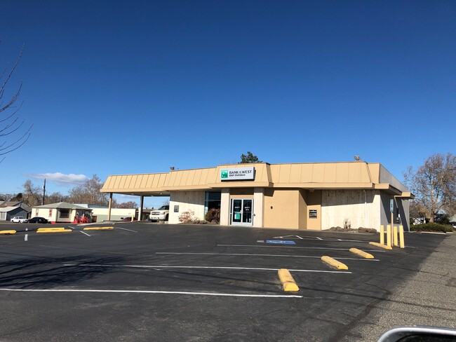
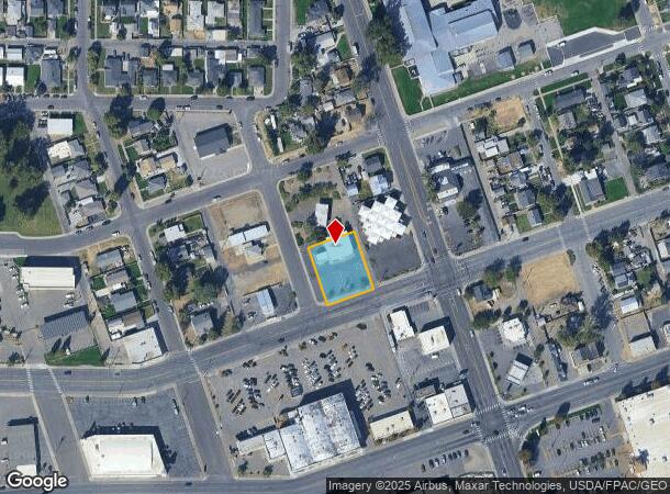
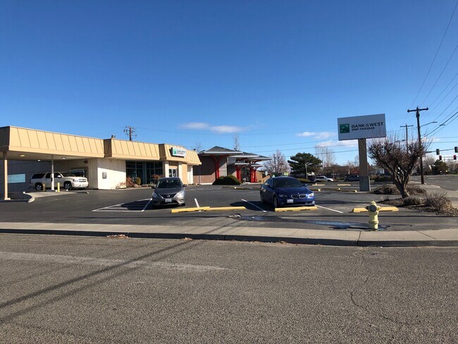
Property Record
1115 W Clark St, Connell, WA 99326
NEARBY LISTINGS FOR SALE OR LEASE
Property Detail
1115 W Clark St
Other Market Areas
Pettits 2Nd Add
Kennewick-Richland, WA
PETTITS 2ND ADD LOTS 19 TO 24, BLK 8
112-271-211
Franklin
Financialbuilding
Washington
2025
19-24
2025
0.41 AC
020802
Yakima/Kennewick
3,501 SF
DEMOGRAPHICS near 1115 W Clark St
1 Mile
3 Mile
5 Mile
2024 Total Population
13,762
64,587
135,950
2029 Population
14,835
69,805
146,426
Pop Growth 2024-2029
+ 7.80%
+ 8.08%
+ 7.71%
Average Age
33
34
35
2024 Total Households
4,037
20,138
44,880
HH Growth 2024-2029
+ 7.93%
+ 8.08%
+ 7.70%
Median Household Inc
$50,988
$55,501
$68,825
Avg Household Size
3.30
3.10
2.90
2024 Avg HH Vehicles
2.00
2.00
2.00
Median Home Value
$145,944
$218,537
$293,865
Median Year Built
1956
1970
1977
Nearby Places
- Restaurants
- Banks
- Shops
- Fitness
- Groceries
PUBLIC TRANSPORTATION
COMMUTER RAIL
Pasco Amtrak Station (Empire Builder - Amtrak)
DRIVE
WALK
Distance
Pasco Amtrak Station (Empire Builder - Amtrak)
3 min
1.2 mi
AIRPORT
Tri-Cities
DRIVE
WALK
Distance
Tri-Cities
8 min
3.1 mi
Freight Ports
Port of Tacoma
DRIVE
WALK
Distance
Port of Tacoma
274 min
238.6 mi
SALE & LEASE HISTORY
LISTING DATE
SALE/LEASE

May 21, 2021
For Sale
Nearby Properties
Address
Land Use
TOTAL SIZE
Lot Size
Zoning
Address
Land Use
TOTAL SIZE
Lot Size
Zoning
267,998 SF
137.35 AC
Address
Land Use
TOTAL SIZE
Lot Size
Zoning
1,078,419 SF
114.48 AC
Address
Land Use
TOTAL SIZE
Lot Size
Zoning
1,049,518 SF
104.40 AC
Address
Land Use
TOTAL SIZE
Lot Size
Zoning
53,980 SF
25.90 AC
Address
Land Use
TOTAL SIZE
Lot Size
Zoning
2,863,808 SF
28.33 AC
Address
Land Use
TOTAL SIZE
Lot Size
Zoning
444,084 SF
58 AC
Address
Land Use
TOTAL SIZE
Lot Size
Zoning
377,541 SF
24.58 AC
Address
Land Use
TOTAL SIZE
Lot Size
Zoning
140,275 SF
6.36 AC
Address
Land Use
TOTAL SIZE
Lot Size
Zoning
153,320 SF
7.37 AC
Address
Land Use
TOTAL SIZE
Lot Size
Zoning
113,585 SF
15.43 AC
Address
Land Use
TOTAL SIZE
Lot Size
Zoning
35,284 SF
30.53 AC
Address
Land Use
TOTAL SIZE
Lot Size
Zoning
114,673 SF
6.58 AC
Address
Land Use
TOTAL SIZE
Lot Size
Zoning
84,951 SF
4.39 AC
Address
Land Use
TOTAL SIZE
Lot Size
Zoning
145,121 SF
31.84 AC
BENTON COU
Address
Land Use
TOTAL SIZE
Lot Size
Zoning
64,936 SF
Address
Land Use
TOTAL SIZE
Lot Size
Zoning
84,680 SF
3 AC
Address
Land Use
TOTAL SIZE
Lot Size
Zoning
61,400 SF
11.50 AC
Address
Land Use
TOTAL SIZE
Lot Size
Zoning
67,635 SF
5.95 AC
Address
Land Use
TOTAL SIZE
Lot Size
Zoning
241,912 SF
12.99 AC
Address
Land Use
TOTAL SIZE
Lot Size
Zoning
110,740 SF
18.15 AC
Address
Land Use
TOTAL SIZE
Lot Size
Zoning
584,810 SF
Address
Land Use
TOTAL SIZE
Lot Size
Zoning
20,919 SF
58.49 AC
KENNEWICK
Address
Land Use
TOTAL SIZE
Lot Size
Zoning
88,510 SF
14.04 AC
Address
Land Use
TOTAL SIZE
Lot Size
Zoning
47,064 SF
13.70 AC
KENNEWICK
Address
Land Use
TOTAL SIZE
Lot Size
Zoning
58,701 SF
11.34 AC
Address
Land Use
TOTAL SIZE
Lot Size
Zoning
80,604 SF
4.30 AC
Address
Land Use
TOTAL SIZE
Lot Size
Zoning
75,542 SF
6.36 AC
Address
Land Use
TOTAL SIZE
Lot Size
Zoning
125,508 SF
3.49 AC
Address
Land Use
TOTAL SIZE
Lot Size
Zoning
114,726 SF
7.59 AC
Address
Land Use
TOTAL SIZE
Lot Size
Zoning
101,720 SF
4.92 AC
33
The World's #1 Commercial Real Estate Marketplace
Connect with us
© 2025 CoStar Group
The information above has been obtained from sources believed reliable. While we do not doubt its accuracy we have not verified it and make no guarantee, warranty or representation about it. It is your responsibility to independently confirm its accuracy and completeness. Any projections, opinions, assumptions, or estimates used are for example only and do not represent the current or future performance of the property. The value of this transaction to you depends on tax and other factors which should be evaluated by your tax, financial, and legal advisors. You and your advisors should conduct a careful, independent investigation of the property to determine to your satisfaction the suitability of the property for your needs.