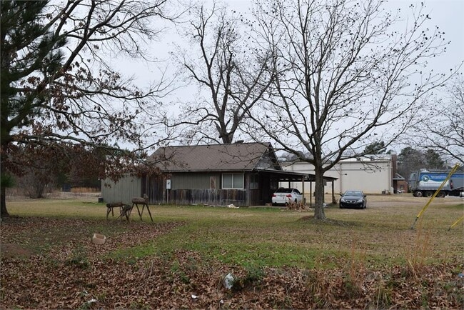
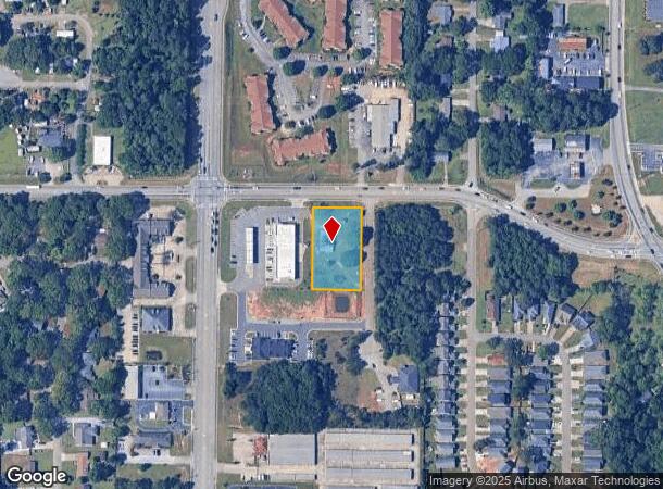
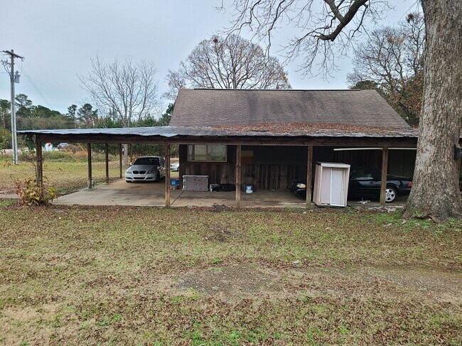
Property Record
1116 Leverett Rd, Warner Robins, GA 31088
NEARBY LISTINGS FOR SALE OR LEASE
Property Detail
1116 Leverett Rd
Warner Robins, GA
Levere Ho Lk Corder
0W0790111000
0.847 ACRE PB 72/128 142/5TH
Utilities
Houston
X
Georgia
13225C0150C
142
2024
0.85 AC
2024
Perry/Warner Robins
021116
Other Market Areas
1,104 SF
DEMOGRAPHICS near 1116 Leverett Rd
1 Mile
3 Mile
5 Mile
2024 Total Population
7,807
65,447
121,057
2029 Population
8,534
71,451
132,329
Pop Growth 2024-2029
+ 9.31%
+ 9.17%
+ 9.31%
Average Age
37
38
38
2024 Total Households
3,292
26,276
47,191
HH Growth 2024-2029
+ 9.05%
+ 9.03%
+ 9.15%
Median Household Inc
$53,496
$64,848
$67,016
Avg Household Size
2.30
2.40
2.50
2024 Avg HH Vehicles
2.00
2.00
2.00
Median Home Value
$136,149
$147,345
$159,795
Median Year Built
1982
1987
1990
Nearby Places
Map Layers
Map Styles
 Street
 Aerial
- Restaurants
- Banks
- Shops
- Fitness
- Groceries
SALE & LEASE HISTORY
LISTING DATE
SALE/LEASE

Jan 13, 2022
For Sale
Nearby Properties
Address
Land Use
TOTAL SIZE
Lot Size
Zoning
Address
Land Use
TOTAL SIZE
Lot Size
Zoning
27,504 SF
26.31 AC
PUD
Address
Land Use
TOTAL SIZE
Lot Size
Zoning
88,965 SF
18.72 AC
R2
Address
Land Use
TOTAL SIZE
Lot Size
Zoning
11,658 SF
30.23 AC
R2
Address
Land Use
TOTAL SIZE
Lot Size
Zoning
5,400 SF
22.93 AC
R4
Address
Land Use
TOTAL SIZE
Lot Size
Zoning
14,754 SF
24 AC
C2
Address
Land Use
TOTAL SIZE
Lot Size
Zoning
15,006 SF
28 AC
PDE
Address
Land Use
TOTAL SIZE
Lot Size
Zoning
10,568 SF
35.44 AC
R4
Address
Land Use
TOTAL SIZE
Lot Size
Zoning
100,320 SF
26.91 AC
C2
Address
Land Use
TOTAL SIZE
Lot Size
Zoning
26,271 SF
17.43 AC
C2
Address
Land Use
TOTAL SIZE
Lot Size
Zoning
7,172 SF
24.73 AC
R4
Address
Land Use
TOTAL SIZE
Lot Size
Zoning
226,032 SF
49.90 AC
C2
Address
Land Use
TOTAL SIZE
Lot Size
Zoning
11,056 SF
17.41 AC
R4
Address
Land Use
TOTAL SIZE
Lot Size
Zoning
301,206 SF
19.79 AC
C2
Address
Land Use
TOTAL SIZE
Lot Size
Zoning
219,205 SF
26.17 AC
R2
Address
Land Use
TOTAL SIZE
Lot Size
Zoning
304,246 SF
23.11 AC
C2
Address
Land Use
TOTAL SIZE
Lot Size
Zoning
18,954 SF
20 AC
C2
Address
Land Use
TOTAL SIZE
Lot Size
Zoning
28,668 SF
17.38 AC
R4 C2
Address
Land Use
TOTAL SIZE
Lot Size
Zoning
92,930 SF
18.66 AC
C2
Address
Land Use
TOTAL SIZE
Lot Size
Zoning
158,300 SF
29.99 AC
R1
Address
Land Use
TOTAL SIZE
Lot Size
Zoning
21,750 SF
11.48 AC
C2
Address
Land Use
TOTAL SIZE
Lot Size
Zoning
16,570 SF
15.62 AC
R4
Address
Land Use
TOTAL SIZE
Lot Size
Zoning
223,608 SF
22.40 AC
C2
Address
Land Use
TOTAL SIZE
Lot Size
Zoning
76,751 SF
26.32 AC
R1
Address
Land Use
TOTAL SIZE
Lot Size
Zoning
15,184 SF
14.03 AC
R4
Address
Land Use
TOTAL SIZE
Lot Size
Zoning
19,200 SF
14.70 AC
R4
Address
Land Use
TOTAL SIZE
Lot Size
Zoning
156,000 SF
19.25 AC
R2
Address
Land Use
TOTAL SIZE
Lot Size
Zoning
17,832 SF
13.60 AC
R4
Address
Land Use
TOTAL SIZE
Lot Size
Zoning
128,540 SF
32.26 AC
R2
Address
Land Use
TOTAL SIZE
Lot Size
Zoning
139,016 SF
24.71 AC
C2
Address
Land Use
TOTAL SIZE
Lot Size
Zoning
100,500 SF
19.64 AC
R2
The World's #1 Commercial Real Estate Marketplace
Connect with us
© 2025 CoStar Group
The information above has been obtained from sources believed reliable. While we do not doubt its accuracy we have not verified it and make no guarantee, warranty or representation about it. It is your responsibility to independently confirm its accuracy and completeness. Any projections, opinions, assumptions, or estimates used are for example only and do not represent the current or future performance of the property. The value of this transaction to you depends on tax and other factors which should be evaluated by your tax, financial, and legal advisors. You and your advisors should conduct a careful, independent investigation of the property to determine to your satisfaction the suitability of the property for your needs.