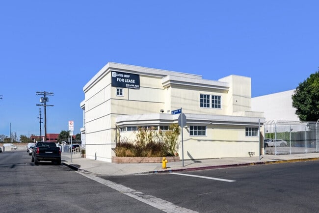
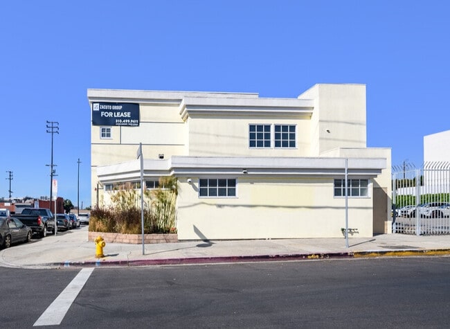
Property Record
1957 Pontius Ave, Los Angeles, CA 90025

Current Lease Availabilities
NEARBY LISTINGS FOR SALE OR LEASE
Property Detail
1957 Pontius Ave
Los Angeles-Long Beach-Glendale, CA
1477
4323-025-034
TRACT # 1477 LOT 29
Officebuilding
Los Angeles
X
California
06037C1590G
29
2025
0.14 AC
2025
Westwood
267300
Los Angeles
2,555 SF
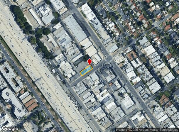
DEMOGRAPHICS near 1957 Pontius Ave
1 Mile
3 Mile
5 Mile
2024 Total Population
45,424
316,398
645,162
2029 Population
44,779
311,093
632,955
Pop Growth 2024-2029
(1.42%)
(1.68%)
(1.89%)
Average Age
39
39
41
2024 Total Households
21,421
137,834
292,735
HH Growth 2024-2029
(1.61%)
(1.86%)
(2.05%)
Median Household Inc
$100,220
$101,191
$105,343
Avg Household Size
2.00
2.10
2.10
2024 Avg HH Vehicles
1.00
1.00
2.00
Median Home Value
$1,031,514
$1,104,380
$1,102,796
Median Year Built
1974
1970
1969
Nearby Places
Map Layers
Map Styles
 Street
 Aerial
- Restaurants
- Banks
- Shops
- Fitness
- Groceries
PUBLIC TRANSPORTATION
AIRPORT
Los Angeles International
DRIVE
WALK
Distance
Los Angeles International
16 min
8.8 mi
Bob Hope
DRIVE
WALK
Distance
Bob Hope
27 min
18.1 mi
Long Beach (Daugherty Field)
DRIVE
WALK
Distance
Long Beach (Daugherty Field)
35 min
26.2 mi
Freight Ports
Port of Long Beach
DRIVE
WALK
Distance
Port of Long Beach
38 min
28.1 mi
Nearby Properties
Address
Land Use
TOTAL SIZE
Lot Size
Zoning
Address
Land Use
TOTAL SIZE
Lot Size
Zoning
1,436,724 SF
21.11 AC
LAC2
Address
Land Use
TOTAL SIZE
Lot Size
Zoning
486,993 SF
8.31 AC
SMCP3-CP5*
Address
Land Use
TOTAL SIZE
Lot Size
Zoning
45,135 SF
1.69 AC
LARE9
Address
Land Use
TOTAL SIZE
Lot Size
Zoning
3.47 AC
LARE15
Address
Land Use
TOTAL SIZE
Lot Size
Zoning
157,691 SF
45.86 AC
CCS1*
Address
Land Use
TOTAL SIZE
Lot Size
Zoning
597,158 SF
2.15 AC
LAC2
Address
Land Use
TOTAL SIZE
Lot Size
Zoning
1,353,044 SF
6.18 AC
LAC2
Address
Land Use
TOTAL SIZE
Lot Size
Zoning
227,227 SF
7.62 AC
BHC3*
Address
Land Use
TOTAL SIZE
Lot Size
Zoning
5.57 AC
LAC2
Address
Land Use
TOTAL SIZE
Lot Size
Zoning
33,373 SF
52.98 AC
LACCS
Address
Land Use
TOTAL SIZE
Lot Size
Zoning
1,029,337 SF
3.34 AC
LAC4
Address
Land Use
TOTAL SIZE
Lot Size
Zoning
618,301 SF
1.99 AC
LAC4
Address
Land Use
TOTAL SIZE
Lot Size
Zoning
346,856 SF
3.67 AC
CCC3*
Address
Land Use
TOTAL SIZE
Lot Size
Zoning
840,124 SF
2.77 AC
LAC2
Address
Land Use
TOTAL SIZE
Lot Size
Zoning
318,556 SF
3.19 AC
SMC5*
Address
Land Use
TOTAL SIZE
Lot Size
Zoning
636,436 SF
6.62 AC
LAC2
Address
Land Use
TOTAL SIZE
Lot Size
Zoning
500,629 SF
1.60 AC
LAC4
Address
Land Use
TOTAL SIZE
Lot Size
Zoning
366,614 SF
4.25 AC
LAC4
Address
Land Use
TOTAL SIZE
Lot Size
Zoning
1,232,625 SF
2.40 AC
LAC2
Address
Land Use
TOTAL SIZE
Lot Size
Zoning
1,226,598 SF
2.30 AC
LAC2
Address
Land Use
TOTAL SIZE
Lot Size
Zoning
32,180 SF
BHC3*
Address
Land Use
TOTAL SIZE
Lot Size
Zoning
824,156 SF
2.15 AC
LAC2
Address
Land Use
TOTAL SIZE
Lot Size
Zoning
767,078 SF
9.30 AC
LAC2
Address
Land Use
TOTAL SIZE
Lot Size
Zoning
133,959 SF
1.23 AC
BHC3*
Address
Land Use
TOTAL SIZE
Lot Size
Zoning
858,380 SF
7.23 AC
SMC5*
Address
Land Use
TOTAL SIZE
Lot Size
Zoning
605,678 SF
LAC2
Address
Land Use
TOTAL SIZE
Lot Size
Zoning
808,626 SF
1.88 AC
LAC2
Address
Land Use
TOTAL SIZE
Lot Size
Zoning
35,635 SF
2.81 AC
LAC2
Address
Land Use
TOTAL SIZE
Lot Size
Zoning
483,875 SF
7.31 AC
SMC5*
Address
Land Use
TOTAL SIZE
Lot Size
Zoning
23,509 SF
0.35 AC
BHC3*
The World's #1 Commercial Real Estate Marketplace
Connect with us
© 2025 CoStar Group
The information above has been obtained from sources believed reliable. While we do not doubt its accuracy we have not verified it and make no guarantee, warranty or representation about it. It is your responsibility to independently confirm its accuracy and completeness. Any projections, opinions, assumptions, or estimates used are for example only and do not represent the current or future performance of the property. The value of this transaction to you depends on tax and other factors which should be evaluated by your tax, financial, and legal advisors. You and your advisors should conduct a careful, independent investigation of the property to determine to your satisfaction the suitability of the property for your needs.