Property Record
11163 Main St, Clarence, NY 14031
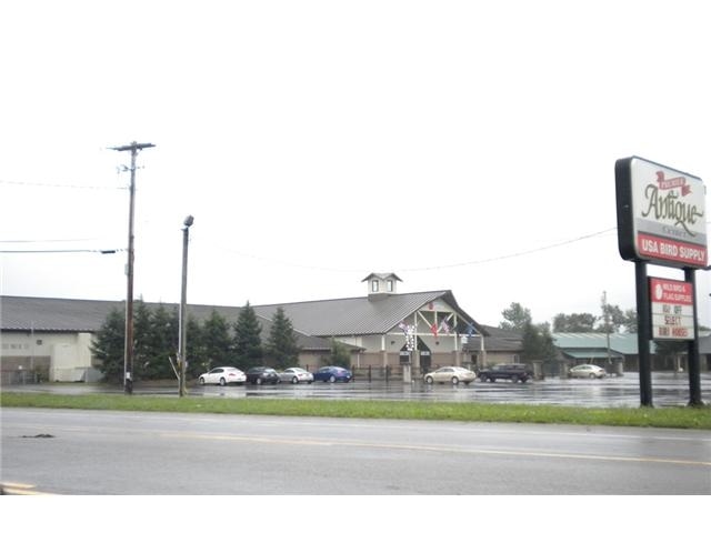


Property Detail
11163 Main St
145689-073-000-0001-004-121
Erie
Distributionwarehouseregional
New York
17
30.100
B and X Area of moderate flood hazard, usually the area between the limits of the 100-year and 500-year floods.
4.07 AC
2025
Outlying Erie County
2025
Buffalo/Niagara Falls
014804
Buffalo-Cheektowaga, NY
71,260 SF
NEARBY LISTINGS FOR SALE OR LEASE
DEMOGRAPHICS near 11163 Main St
1 mile
3 mile
5 mile
2025 Total Population
823
9,329
29,992
2030 Population
834
9,522
30,434
Pop Growth 2025-2030
+ 1.34%
+ 2.07%
+ 1.47%
Average Age
49
47
45
2025 Total Households
335
3,884
11,550
HH Growth 2025-2030
+ 1.19%
+ 1.93%
+ 1.46%
Median Household Inc
$92,948
$91,164
$97,682
Avg Household Size
2.20
2.30
2.40
2025 Avg HH Vehicles
2.00
2.00
2.00
Median Home Value
$335,246
$321,633
$341,161
Median Year Built
1974
1981
1983
Nearby Places
Map Layers
Map Styles
 Street
 Aerial
Layers
 Traffic
 Biking
Places
Listings with unknown addresses are not visible on the map
- Restaurants
- Banks
- Shops
- Fitness
- Groceries
PUBLIC TRANSPORTATION
AIRPORT
Buffalo Niagara International
Drive
Walk
Distance
Buffalo Niagara International
17 min
9.7 mi
Niagara Falls International
Drive
Walk
Distance
Niagara Falls International
42 min
25.0 mi
Freight Ports
Albany, NY Port
Drive
Walk
Distance
Albany, NY Port
320 min
271.6 mi
Nearby Properties
Address
Land Use
TOTAL SIZE
Lot Size
Zoning
Address
Land Use
TOTAL SIZE
Lot Size
Zoning
163,016 SF
14.07 AC
Address
Land Use
TOTAL SIZE
Lot Size
Zoning
123,868 SF
25.41 AC
RB
Address
Land Use
TOTAL SIZE
Lot Size
Zoning
84,940 SF
18.58 AC
RB
Address
Land Use
TOTAL SIZE
Lot Size
Zoning
83,662 SF
11.30 AC
Address
Land Use
TOTAL SIZE
Lot Size
Zoning
120,425 SF
15.50 AC
Address
Land Use
TOTAL SIZE
Lot Size
Zoning
6,720 SF
56.70 AC
Address
Land Use
TOTAL SIZE
Lot Size
Zoning
106,593 SF
28 AC
Address
Land Use
TOTAL SIZE
Lot Size
Zoning
1,104 SF
50.20 AC
20
Address
Land Use
TOTAL SIZE
Lot Size
Zoning
100 SF
38.45 AC
RB
Address
Land Use
TOTAL SIZE
Lot Size
Zoning
48,852 SF
70.18 AC
19
Address
Land Use
TOTAL SIZE
Lot Size
Zoning
35,966 SF
120.58 AC
17
Address
Land Use
TOTAL SIZE
Lot Size
Zoning
480 SF
22.19 AC
Address
Land Use
TOTAL SIZE
Lot Size
Zoning
55,440 SF
6.43 AC
IND
Address
Land Use
TOTAL SIZE
Lot Size
Zoning
64,160 SF
7 AC
Address
Land Use
TOTAL SIZE
Lot Size
Zoning
7,632 SF
160.83 AC
11
Address
Land Use
TOTAL SIZE
Lot Size
Zoning
72,323 SF
12.11 AC
Address
Land Use
TOTAL SIZE
Lot Size
Zoning
8,154 SF
94 AC
17
Address
Land Use
TOTAL SIZE
Lot Size
Zoning
34,922 SF
12.80 AC
Address
Land Use
TOTAL SIZE
Lot Size
Zoning
768 SF
105.96 AC
21
Address
Land Use
TOTAL SIZE
Lot Size
Zoning
8,901 SF
2.20 AC
Address
Land Use
TOTAL SIZE
Lot Size
Zoning
20,411 SF
17.08 AC
Address
Land Use
TOTAL SIZE
Lot Size
Zoning
63,823 SF
20.60 AC
Address
Land Use
TOTAL SIZE
Lot Size
Zoning
27,477 SF
16.60 AC
Address
Land Use
TOTAL SIZE
Lot Size
Zoning
34,266 SF
52.98 AC
Address
Land Use
TOTAL SIZE
Lot Size
Zoning
35,025 SF
4.28 AC
Address
Land Use
TOTAL SIZE
Lot Size
Zoning
5,627 SF
303.30 AC
17
Address
Land Use
TOTAL SIZE
Lot Size
Zoning
13,512 SF
4.80 AC
17
Address
Land Use
TOTAL SIZE
Lot Size
Zoning
26,709 SF
7.23 AC
Address
Land Use
TOTAL SIZE
Lot Size
Zoning
23,582 SF
12.80 AC
Address
Land Use
TOTAL SIZE
Lot Size
Zoning
13,797 SF
3.40 AC
The World's #1 Commercial Real Estate Marketplace
Connect with us
© 2026 CoStar Group
The information above has been obtained from sources believed reliable. While we do not doubt its accuracy we have not verified it and make no guarantee, warranty or representation about it. It is your responsibility to independently confirm its accuracy and completeness. Any projections, opinions, assumptions, or estimates used are for example only and do not represent the current or future performance of the property. The value of this transaction to you depends on tax and other factors which should be evaluated by your tax, financial, and legal advisors. You and your advisors should conduct a careful, independent investigation of the property to determine to your satisfaction the suitability of the property for your needs.