Property Record
1118 Brock Industrial Dr, Birmingham, AL 35208


NEARBY LISTINGS FOR SALE OR LEASE
Property Detail
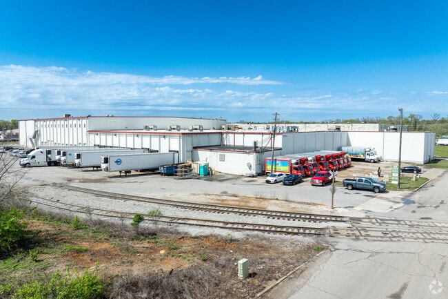
1118 Brock Industrial Dr
Birmingham, AL
Roberts Industrial Subdivision
22-00-32-1-004-005.002
LOT 6BB ROBERTS INDUSTRIAL SUBDIVISION RESURVEY NO 2 PB 245 PG 67 SEC 32 T 17S R 3W
Warehouse
Jefferson
AE
Alabama
01073C0388H
6
2023
5.60 AC
2024
Bessemer
003700
Birmingham
98,280 SF
DEMOGRAPHICS near 1118 Brock Industrial Dr
1 Mile
3 Mile
5 Mile
2024 Total Population
6,120
60,800
144,549
2029 Population
6,246
61,464
145,229
Pop Growth 2024-2029
+ 2.06%
+ 1.09%
+ 0.47%
Average Age
42
42
40
2024 Total Households
2,614
25,930
62,985
HH Growth 2024-2029
+ 2.41%
+ 1.17%
+ 0.64%
Median Household Inc
$34,416
$33,705
$37,419
Avg Household Size
2.10
2.20
2.10
2024 Avg HH Vehicles
1.00
1.00
1.00
Median Home Value
$86,301
$76,101
$94,182
Median Year Built
1953
1959
1964
Nearby Places
Map Layers
Map Styles
 Street
 Aerial
- Restaurants
- Banks
- Shops
- Fitness
- Groceries
PUBLIC TRANSPORTATION
COMMUTER RAIL
Birmingham (Crescent - Amtrak)
DRIVE
WALK
Distance
Birmingham (Crescent - Amtrak)
10 min
5.7 mi
AIRPORT
Birmingham-Shuttlesworth International
DRIVE
WALK
Distance
Birmingham-Shuttlesworth International
16 min
10.5 mi
Freight Ports
Port of Mobile
DRIVE
WALK
Distance
Port of Mobile
286 min
260.1 mi
Nearby Properties
Address
Land Use
TOTAL SIZE
Lot Size
Zoning
Address
Land Use
TOTAL SIZE
Lot Size
Zoning
203,878 SF
12.58 AC
B6
Address
Land Use
TOTAL SIZE
Lot Size
Zoning
344,150 SF
42 AC
R5
Address
Land Use
TOTAL SIZE
Lot Size
Zoning
416,477 SF
80 AC
R5
Address
Land Use
TOTAL SIZE
Lot Size
Zoning
2,017,741 SF
37.70 AC
M2M1
Address
Land Use
TOTAL SIZE
Lot Size
Zoning
127,240 SF
3.50 AC
R4
Address
Land Use
TOTAL SIZE
Lot Size
Zoning
116,442 SF
2.67 AC
B6
Address
Land Use
TOTAL SIZE
Lot Size
Zoning
32,922 SF
15 AC
I3
Address
Land Use
TOTAL SIZE
Lot Size
Zoning
106,366 SF
8.70 AC
R3
Address
Land Use
TOTAL SIZE
Lot Size
Zoning
68,046 SF
6 AC
B6
Address
Land Use
TOTAL SIZE
Lot Size
Zoning
123,937 SF
7.79 AC
R4
Address
Land Use
TOTAL SIZE
Lot Size
Zoning
250,918 SF
10 AC
B-2
Address
Land Use
TOTAL SIZE
Lot Size
Zoning
65,299 SF
2 AC
B2
Address
Land Use
TOTAL SIZE
Lot Size
Zoning
93,081 SF
1.06 AC
B2
Address
Land Use
TOTAL SIZE
Lot Size
Zoning
1.83 AC
B6
Address
Land Use
TOTAL SIZE
Lot Size
Zoning
225,942 SF
7.30 AC
M1
Address
Land Use
TOTAL SIZE
Lot Size
Zoning
41,695 SF
5.40 AC
R4
Address
Land Use
TOTAL SIZE
Lot Size
Zoning
74,509 SF
9 AC
B6
Address
Land Use
TOTAL SIZE
Lot Size
Zoning
211,517 SF
9.50 AC
M1
Address
Land Use
TOTAL SIZE
Lot Size
Zoning
140,764 SF
7.21 AC
R6
Address
Land Use
TOTAL SIZE
Lot Size
Zoning
37,619 SF
9.36 AC
R3
Address
Land Use
TOTAL SIZE
Lot Size
Zoning
225,899 SF
11 AC
M1
Address
Land Use
TOTAL SIZE
Lot Size
Zoning
8,324 SF
158 AC
R3
Address
Land Use
TOTAL SIZE
Lot Size
Zoning
10,297 SF
9.76 AC
QM
Address
Land Use
TOTAL SIZE
Lot Size
Zoning
65,260 SF
5.29 AC
B2
Address
Land Use
TOTAL SIZE
Lot Size
Zoning
109,753 SF
6.18 AC
R5
Address
Land Use
TOTAL SIZE
Lot Size
Zoning
147,113 SF
18.31 AC
M2
Address
Land Use
TOTAL SIZE
Lot Size
Zoning
92,678 SF
2.07 AC
R4
Address
Land Use
TOTAL SIZE
Lot Size
Zoning
39,347 SF
6.03 AC
B2
Address
Land Use
TOTAL SIZE
Lot Size
Zoning
65,371 SF
1.27 AC
B2
Address
Land Use
TOTAL SIZE
Lot Size
Zoning
111,846 SF
6.80 AC
M1
The World's #1 Commercial Real Estate Marketplace
Connect with us
© 2026 CoStar Group
The information above has been obtained from sources believed reliable. While we do not doubt its accuracy we have not verified it and make no guarantee, warranty or representation about it. It is your responsibility to independently confirm its accuracy and completeness. Any projections, opinions, assumptions, or estimates used are for example only and do not represent the current or future performance of the property. The value of this transaction to you depends on tax and other factors which should be evaluated by your tax, financial, and legal advisors. You and your advisors should conduct a careful, independent investigation of the property to determine to your satisfaction the suitability of the property for your needs.