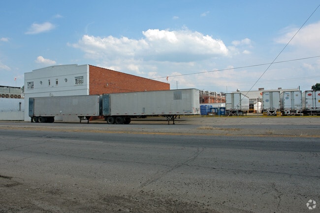
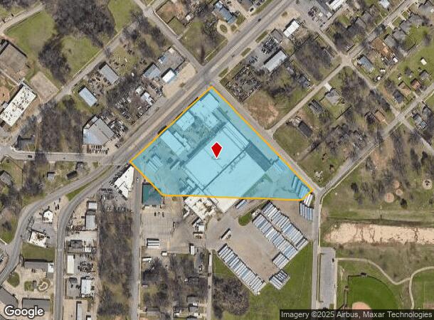
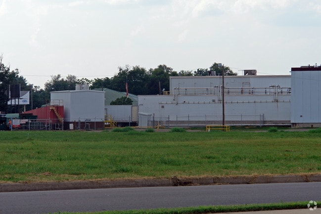
Property Record
1118 N P St, Fort Smith, AR 72901
NEARBY LISTINGS FOR SALE OR LEASE
Property Detail
1118 N P St
12729-0018-00002-00
Fishback #2
Shipyard
BLKS B & C & CLOSED STREETS & ALLEYS
AE
Sebastian
40135C0495F
Arkansas
2025
1.84 AC
2025
Greater Ft Smith
001001
Fort Smith
121,877 SF
Fort Smith, AR-OK
DEMOGRAPHICS near 1118 N P St
1 Mile
3 Mile
5 Mile
2024 Total Population
10,802
48,846
75,826
2029 Population
11,185
50,089
77,756
Pop Growth 2024-2029
+ 3.55%
+ 2.54%
+ 2.55%
Average Age
37
37
38
2024 Total Households
4,006
19,125
30,290
HH Growth 2024-2029
+ 3.54%
+ 2.55%
+ 2.55%
Median Household Inc
$28,638
$38,922
$41,801
Avg Household Size
2.50
2.40
2.40
2024 Avg HH Vehicles
2.00
2.00
2.00
Median Home Value
$79,434
$106,942
$130,768
Median Year Built
1958
1965
1971
Nearby Places
Map Layers
Map Styles
 Street
 Aerial
- Restaurants
- Banks
- Shops
- Fitness
- Groceries
PUBLIC TRANSPORTATION
AIRPORT
Fort Smith Regional
DRIVE
WALK
Distance
Fort Smith Regional
17 min
7.9 mi
Nearby Properties
Address
Land Use
TOTAL SIZE
Lot Size
Zoning
Address
Land Use
TOTAL SIZE
Lot Size
Zoning
34,852 SF
17.68 AC
Address
Land Use
TOTAL SIZE
Lot Size
Zoning
53,104 SF
7.29 AC
Address
Land Use
TOTAL SIZE
Lot Size
Zoning
856,730 SF
78.67 AC
Address
Land Use
TOTAL SIZE
Lot Size
Zoning
59,938 SF
48.92 AC
Address
Land Use
TOTAL SIZE
Lot Size
Zoning
154,417 SF
8.08 AC
Address
Land Use
TOTAL SIZE
Lot Size
Zoning
178,951 SF
1.92 AC
Address
Land Use
TOTAL SIZE
Lot Size
Zoning
202,092 SF
16.25 AC
Address
Land Use
TOTAL SIZE
Lot Size
Zoning
67,084 SF
0.62 AC
Address
Land Use
TOTAL SIZE
Lot Size
Zoning
49,702 SF
1.36 AC
Address
Land Use
TOTAL SIZE
Lot Size
Zoning
59,096 SF
21.97 AC
Address
Land Use
TOTAL SIZE
Lot Size
Zoning
936,618 SF
53.06 AC
Address
Land Use
TOTAL SIZE
Lot Size
Zoning
60,146 SF
0.81 AC
Address
Land Use
TOTAL SIZE
Lot Size
Zoning
165,245 SF
15.39 AC
Address
Land Use
TOTAL SIZE
Lot Size
Zoning
94,409 SF
2.81 AC
Address
Land Use
TOTAL SIZE
Lot Size
Zoning
71,047 SF
0.45 AC
Address
Land Use
TOTAL SIZE
Lot Size
Zoning
197,067 SF
17.34 AC
Address
Land Use
TOTAL SIZE
Lot Size
Zoning
85,735 SF
2.28 AC
Address
Land Use
TOTAL SIZE
Lot Size
Zoning
6,643 SF
0.96 AC
Address
Land Use
TOTAL SIZE
Lot Size
Zoning
581,085 SF
30.29 AC
Address
Land Use
TOTAL SIZE
Lot Size
Zoning
56,330 SF
12.75 AC
Address
Land Use
TOTAL SIZE
Lot Size
Zoning
99,151 SF
7.70 AC
Address
Land Use
TOTAL SIZE
Lot Size
Zoning
46,324 SF
7.84 AC
Address
Land Use
TOTAL SIZE
Lot Size
Zoning
64,590 SF
13.74 AC
Address
Land Use
TOTAL SIZE
Lot Size
Zoning
26,000 SF
0.37 AC
Address
Land Use
TOTAL SIZE
Lot Size
Zoning
62,463 SF
1.38 AC
Address
Land Use
TOTAL SIZE
Lot Size
Zoning
44,103 SF
4.81 AC
Address
Land Use
TOTAL SIZE
Lot Size
Zoning
85,608 SF
5.06 AC
Address
Land Use
TOTAL SIZE
Lot Size
Zoning
73,092 SF
3.34 AC
Address
Land Use
TOTAL SIZE
Lot Size
Zoning
17,764 SF
7.51 AC
Address
Land Use
TOTAL SIZE
Lot Size
Zoning
91,333 SF
8.90 AC
The World's #1 Commercial Real Estate Marketplace
Connect with us
© 2026 CoStar Group
The information above has been obtained from sources believed reliable. While we do not doubt its accuracy we have not verified it and make no guarantee, warranty or representation about it. It is your responsibility to independently confirm its accuracy and completeness. Any projections, opinions, assumptions, or estimates used are for example only and do not represent the current or future performance of the property. The value of this transaction to you depends on tax and other factors which should be evaluated by your tax, financial, and legal advisors. You and your advisors should conduct a careful, independent investigation of the property to determine to your satisfaction the suitability of the property for your needs.