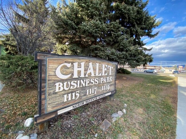
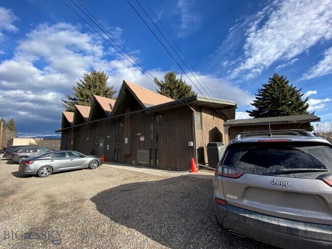
Property Record
1119 N 7Th Ave, Bozeman, MT 59715
NEARBY LISTINGS FOR SALE OR LEASE
Property Detail
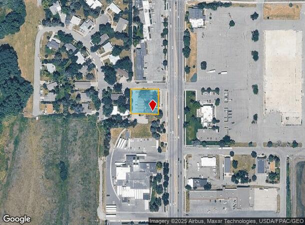
1119 N 7Th Ave
Bozeman, MT
Royal Vista Add
06-0798-01-4-24-01-0000
ROYAL VISTA ADD, S01, T02 S, R05 E, BLOCK 2, LOT 1 & 2, PLAT E-28
Officebuilding
Gallatin
X
Montana
30031C0808E
1,2
2025
0.47 AC
2025
Bozeman/Yellowstone Country
000600
Other Market Areas
1,960 SF
DEMOGRAPHICS near 1119 N 7Th Ave
1 Mile
3 Mile
5 Mile
2024 Total Population
8,313
59,833
75,260
2029 Population
9,541
68,332
85,893
Pop Growth 2024-2029
+ 14.77%
+ 14.20%
+ 14.13%
Average Age
38
35
36
2024 Total Households
3,991
24,521
30,647
HH Growth 2024-2029
+ 15.31%
+ 15.15%
+ 14.99%
Median Household Inc
$55,396
$71,285
$80,612
Avg Household Size
2.00
2.20
2.30
2024 Avg HH Vehicles
2.00
2.00
2.00
Median Home Value
$578,060
$589,055
$617,354
Median Year Built
1982
2000
2002
Nearby Places
- Restaurants
- Banks
- Shops
- Fitness
- Groceries
PUBLIC TRANSPORTATION
AIRPORT
Bozeman Yellowstone International
DRIVE
WALK
Distance
Bozeman Yellowstone International
13 min
9.2 mi
Freight Ports
Port of Everett
DRIVE
WALK
Distance
Port of Everett
744 min
699.6 mi
SALE & LEASE HISTORY
LISTING DATE
SALE/LEASE

Jan 05, 2022
For Sale
Nearby Properties
Address
Land Use
TOTAL SIZE
Lot Size
Zoning
Address
Land Use
TOTAL SIZE
Lot Size
Zoning
175,398 SF
34.43 AC
Address
Land Use
TOTAL SIZE
Lot Size
Zoning
15,099 SF
16.05 AC
Address
Land Use
TOTAL SIZE
Lot Size
Zoning
138,308 SF
58.03 AC
Address
Land Use
TOTAL SIZE
Lot Size
Zoning
33,109 SF
9.89 AC
Address
Land Use
TOTAL SIZE
Lot Size
Zoning
67,716 SF
38.83 AC
Address
Land Use
TOTAL SIZE
Lot Size
Zoning
89,441 SF
0.46 AC
6
Address
Land Use
TOTAL SIZE
Lot Size
Zoning
214,283 SF
5.20 AC
Address
Land Use
TOTAL SIZE
Lot Size
Zoning
6,317 SF
9.14 AC
Address
Land Use
TOTAL SIZE
Lot Size
Zoning
23,325 SF
9.82 AC
Address
Land Use
TOTAL SIZE
Lot Size
Zoning
69,093 SF
8.96 AC
BP
Address
Land Use
TOTAL SIZE
Lot Size
Zoning
10,368 SF
6.75 AC
Address
Land Use
TOTAL SIZE
Lot Size
Zoning
8,100 SF
64.73 AC
Address
Land Use
TOTAL SIZE
Lot Size
Zoning
33,771 SF
7.10 AC
Address
Land Use
TOTAL SIZE
Lot Size
Zoning
85,290 SF
7.82 AC
Address
Land Use
TOTAL SIZE
Lot Size
Zoning
20,118 SF
7.95 AC
Address
Land Use
TOTAL SIZE
Lot Size
Zoning
81,620 SF
10.65 AC
1
Address
Land Use
TOTAL SIZE
Lot Size
Zoning
85,052 SF
1.26 AC
6
Address
Land Use
TOTAL SIZE
Lot Size
Zoning
69,917 SF
0.68 AC
6
Address
Land Use
TOTAL SIZE
Lot Size
Zoning
259,349 SF
B2
Address
Land Use
TOTAL SIZE
Lot Size
Zoning
96,944 SF
0.44 AC
1
Address
Land Use
TOTAL SIZE
Lot Size
Zoning
149,599 SF
18.41 AC
Address
Land Use
TOTAL SIZE
Lot Size
Zoning
119,732 SF
7.32 AC
Address
Land Use
TOTAL SIZE
Lot Size
Zoning
7,552 SF
8.60 AC
Address
Land Use
TOTAL SIZE
Lot Size
Zoning
90,003 SF
17.01 AC
Address
Land Use
TOTAL SIZE
Lot Size
Zoning
11,639 SF
6.69 AC
Address
Land Use
TOTAL SIZE
Lot Size
Zoning
162,081 SF
4.95 AC
Address
Land Use
TOTAL SIZE
Lot Size
Zoning
19,938 SF
Address
Land Use
TOTAL SIZE
Lot Size
Zoning
90,347 SF
1.74 AC
5
Address
Land Use
TOTAL SIZE
Lot Size
Zoning
27,219 SF
10.11 AC
R3
Address
Land Use
TOTAL SIZE
Lot Size
Zoning
34,198 SF
5.30 AC
The World's #1 Commercial Real Estate Marketplace
Connect with us
© 2025 CoStar Group
The information above has been obtained from sources believed reliable. While we do not doubt its accuracy we have not verified it and make no guarantee, warranty or representation about it. It is your responsibility to independently confirm its accuracy and completeness. Any projections, opinions, assumptions, or estimates used are for example only and do not represent the current or future performance of the property. The value of this transaction to you depends on tax and other factors which should be evaluated by your tax, financial, and legal advisors. You and your advisors should conduct a careful, independent investigation of the property to determine to your satisfaction the suitability of the property for your needs.