Property Record
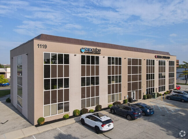
1119 Keystone Way, Carmel, IN 46032


NEARBY LISTINGS FOR SALE OR LEASE
Property Detail
1119 Keystone Way
29-10-31-000-016.003-018
ACREAGE 1.40, SECTION 31, TOWNSHIP 18, RANGE 4
Officebuilding
Hamilton
X
Indiana
18057C0228G
1.40 AC
2023
Carmel
2024
Indianapolis
111007
Indianapolis-Carmel-Greenwood, IN
19,260 SF
DEMOGRAPHICS near 1119 Keystone Way
1 Mile
3 Mile
5 Mile
2024 Total Population
8,487
66,210
172,496
2029 Population
9,595
73,819
188,832
Pop Growth 2024-2029
+ 13.06%
+ 11.49%
+ 9.47%
Average Age
41
41
40
2024 Total Households
3,540
28,303
71,515
HH Growth 2024-2029
+ 13.36%
+ 11.39%
+ 8.84%
Median Household Inc
$81,764
$89,485
$93,910
Avg Household Size
2.30
2.30
2.30
2024 Avg HH Vehicles
2.00
2.00
2.00
Median Home Value
$342,942
$350,099
$358,390
Median Year Built
1977
1990
1992
Nearby Places
Map Layers
Map Styles
 Street
 Aerial
- Restaurants
- Banks
- Shops
- Fitness
- Groceries
PUBLIC TRANSPORTATION
AIRPORT
Indianapolis International
DRIVE
WALK
Distance
Indianapolis International
53 min
32.1 mi
SALE & LEASE HISTORY
LISTING DATE
SALE/LEASE

Sep 24, 2016
For Sale
Oct 24, 2018
For Lease
Oct 18, 2019
For Lease
May 29, 2024
For Lease
Mar 30, 2021
For Lease
Jul 24, 2020
For Lease
Jan 06, 2020
For Lease
Nearby Properties
Address
Land Use
TOTAL SIZE
Lot Size
Zoning
Address
Land Use
TOTAL SIZE
Lot Size
Zoning
435,973 SF
Address
Land Use
TOTAL SIZE
Lot Size
Zoning
239,161 SF
12.12 AC
Address
Land Use
TOTAL SIZE
Lot Size
Zoning
267,771 SF
13.10 AC
Address
Land Use
TOTAL SIZE
Lot Size
Zoning
342,574 SF
5.64 AC
Address
Land Use
TOTAL SIZE
Lot Size
Zoning
337,250 SF
18.54 AC
Address
Land Use
TOTAL SIZE
Lot Size
Zoning
417,894 SF
15.22 AC
Address
Land Use
TOTAL SIZE
Lot Size
Zoning
328,241 SF
91.83 AC
Address
Land Use
TOTAL SIZE
Lot Size
Zoning
272,700 SF
2.10 AC
Address
Land Use
TOTAL SIZE
Lot Size
Zoning
408,298 SF
15.67 AC
Address
Land Use
TOTAL SIZE
Lot Size
Zoning
317,335 SF
4.22 AC
Address
Land Use
TOTAL SIZE
Lot Size
Zoning
359,968 SF
13.65 AC
Address
Land Use
TOTAL SIZE
Lot Size
Zoning
412,120 SF
12.16 AC
Address
Land Use
TOTAL SIZE
Lot Size
Zoning
298,290 SF
2.80 AC
Address
Land Use
TOTAL SIZE
Lot Size
Zoning
393,106 SF
13.37 AC
Address
Land Use
TOTAL SIZE
Lot Size
Zoning
3,053 SF
10.33 AC
ZO01
Address
Land Use
TOTAL SIZE
Lot Size
Zoning
428,056 SF
20.27 AC
Address
Land Use
TOTAL SIZE
Lot Size
Zoning
115,160 SF
2.35 AC
Address
Land Use
TOTAL SIZE
Lot Size
Zoning
236,320 SF
20.74 AC
Address
Land Use
TOTAL SIZE
Lot Size
Zoning
162,462 SF
2 AC
Address
Land Use
TOTAL SIZE
Lot Size
Zoning
261,003 SF
1.92 AC
Address
Land Use
TOTAL SIZE
Lot Size
Zoning
280,428 SF
12.81 AC
Address
Land Use
TOTAL SIZE
Lot Size
Zoning
261,335 SF
4.28 AC
Address
Land Use
TOTAL SIZE
Lot Size
Zoning
290,488 SF
13.72 AC
Address
Land Use
TOTAL SIZE
Lot Size
Zoning
83,446 SF
67.68 AC
Address
Land Use
TOTAL SIZE
Lot Size
Zoning
245,922 SF
19.03 AC
Address
Land Use
TOTAL SIZE
Lot Size
Zoning
331,800 SF
1.54 AC
Address
Land Use
TOTAL SIZE
Lot Size
Zoning
117,664 SF
7.51 AC
Address
Land Use
TOTAL SIZE
Lot Size
Zoning
318,922 SF
31.70 AC
Address
Land Use
TOTAL SIZE
Lot Size
Zoning
153,184 SF
1.17 AC
Address
Land Use
TOTAL SIZE
Lot Size
Zoning
285,284 SF
7.78 AC
The World's #1 Commercial Real Estate Marketplace
Connect with us
© 2026 CoStar Group
The information above has been obtained from sources believed reliable. While we do not doubt its accuracy we have not verified it and make no guarantee, warranty or representation about it. It is your responsibility to independently confirm its accuracy and completeness. Any projections, opinions, assumptions, or estimates used are for example only and do not represent the current or future performance of the property. The value of this transaction to you depends on tax and other factors which should be evaluated by your tax, financial, and legal advisors. You and your advisors should conduct a careful, independent investigation of the property to determine to your satisfaction the suitability of the property for your needs.