Property Record
112 Clardy Rd, Liberty, SC 29657


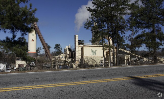
Property Detail
112 Clardy Rd
4098-00-64-9438
N/SIDE LIBERTY DR
Autorepair
PICKENS
B and X Area of moderate flood hazard, usually the area between the limits of the 100-year and 500-year floods.
South Carolina
0
6.16 AC
2025
Outlying Pickens County
011005
Greenville/Spartanburg
3,445 SF
Greenville-Anderson-Greer, SC
NEARBY LISTINGS FOR SALE OR LEASE
-
-
View all Liberty listings for sale on LoopNet.com
DEMOGRAPHICS near 112 Clardy Rd
1 mile
3 mile
5 mile
2025 Total Population
727
11,985
36,751
2030 Population
775
12,595
38,816
Pop Growth 2025-2030
+ 6.60%
+ 5.09%
+ 5.62%
Average Age
41
40
41
2025 Total Households
301
4,677
14,695
HH Growth 2025-2030
+ 6.98%
+ 5.39%
+ 5.93%
Median Household Inc
$43,749
$58,452
$57,431
Avg Household Size
2.40
2.50
2.50
2025 Avg HH Vehicles
2.00
2.00
2.00
Median Home Value
$162,149
$199,183
$211,197
Median Year Built
1983
1988
1986
Nearby Places
Map Layers
Map Styles
 Street
 Aerial
Layers
 Traffic
 Biking
Places
Listings with unknown addresses are not visible on the map
- Restaurants
- Banks
- Shops
- Fitness
- Groceries
PUBLIC TRANSPORTATION
AIRPORT
Greenville Spartanburg International
Drive
Walk
Distance
Greenville Spartanburg International
51 min
32.6 mi
Freight Ports
North Charleston Terminal
Drive
Walk
Distance
North Charleston Terminal
254 min
219.0 mi
Nearby Properties
Address
Land Use
TOTAL SIZE
Lot Size
Zoning
Address
Land Use
TOTAL SIZE
Lot Size
Zoning
133,426 SF
26.37 AC
Address
Land Use
TOTAL SIZE
Lot Size
Zoning
61,236 SF
9.42 AC
Address
Land Use
TOTAL SIZE
Lot Size
Zoning
10,000 SF
78.65 AC
Address
Land Use
TOTAL SIZE
Lot Size
Zoning
310,714 SF
45.73 AC
Address
Land Use
TOTAL SIZE
Lot Size
Zoning
44,601 SF
3 AC
Address
Land Use
TOTAL SIZE
Lot Size
Zoning
33,822 SF
19.86 AC
Address
Land Use
TOTAL SIZE
Lot Size
Zoning
4,957 SF
1.40 AC
508
Address
Land Use
TOTAL SIZE
Lot Size
Zoning
239.49 AC
510
Address
Land Use
TOTAL SIZE
Lot Size
Zoning
15,008 SF
2.10 AC
510
Address
Land Use
TOTAL SIZE
Lot Size
Zoning
21.43 AC
Address
Land Use
TOTAL SIZE
Lot Size
Zoning
14.96 AC
Address
Land Use
TOTAL SIZE
Lot Size
Zoning
4,997 SF
12 AC
Address
Land Use
TOTAL SIZE
Lot Size
Zoning
2,434 SF
6.19 AC
Address
Land Use
TOTAL SIZE
Lot Size
Zoning
6,876 SF
2 AC
507
Address
Land Use
TOTAL SIZE
Lot Size
Zoning
29.37 AC
Address
Land Use
TOTAL SIZE
Lot Size
Zoning
34.59 AC
Address
Land Use
TOTAL SIZE
Lot Size
Zoning
4,684 SF
0.22 AC
509
Address
Land Use
TOTAL SIZE
Lot Size
Zoning
180.03 AC
Address
Land Use
TOTAL SIZE
Lot Size
Zoning
512 SF
21.75 AC
Address
Land Use
TOTAL SIZE
Lot Size
Zoning
54.85 AC
Address
Land Use
TOTAL SIZE
Lot Size
Zoning
14.93 AC
500
Address
Land Use
TOTAL SIZE
Lot Size
Zoning
15,448 SF
1.05 AC
507
Address
Land Use
TOTAL SIZE
Lot Size
Zoning
19.43 AC
Address
Land Use
TOTAL SIZE
Lot Size
Zoning
922 SF
14.30 AC
Address
Land Use
TOTAL SIZE
Lot Size
Zoning
116.77 AC
Address
Land Use
TOTAL SIZE
Lot Size
Zoning
8.56 AC
510
Address
Land Use
TOTAL SIZE
Lot Size
Zoning
11.33 AC
Address
Land Use
TOTAL SIZE
Lot Size
Zoning
79,200 SF
26.95 AC
508
The World's #1 Commercial Real Estate Marketplace
Connect with us
© 2026 CoStar Group
The information above has been obtained from sources believed reliable. While we do not doubt its accuracy we have not verified it and make no guarantee, warranty or representation about it. It is your responsibility to independently confirm its accuracy and completeness. Any projections, opinions, assumptions, or estimates used are for example only and do not represent the current or future performance of the property. The value of this transaction to you depends on tax and other factors which should be evaluated by your tax, financial, and legal advisors. You and your advisors should conduct a careful, independent investigation of the property to determine to your satisfaction the suitability of the property for your needs.