Property Record
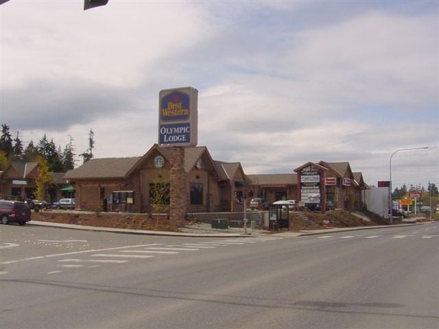
112 Del Guzzi Dr, Port Angeles, WA 98362


NEARBY LISTINGS FOR SALE OR LEASE
Property Detail
112 Del Guzzi Dr
Port Angeles, WA
Ennis
65612
ENNIS CRK EST SP# 85-11-7 V16 P58 LOT 1
Storebuilding
Clallam
X
Washington
53009C1182F
1
2024
0.95 AC
2025
Bellingham/Northwest
001200
Other Market Areas
14,428 SF
DEMOGRAPHICS near 112 Del Guzzi Dr
1 Mile
3 Mile
5 Mile
2024 Total Population
4,104
19,380
30,235
2029 Population
4,301
20,304
31,692
Pop Growth 2024-2029
+ 4.80%
+ 4.77%
+ 4.82%
Average Age
46
45
44
2024 Total Households
1,899
8,816
13,309
HH Growth 2024-2029
+ 4.69%
+ 4.74%
+ 4.80%
Median Household Inc
$56,046
$57,812
$61,545
Avg Household Size
2.10
2.10
2.20
2024 Avg HH Vehicles
2.00
2.00
2.00
Median Home Value
$288,009
$317,157
$321,025
Median Year Built
1969
1967
1973
Nearby Places
Map Layers
Map Styles
 Street
 Aerial
- Restaurants
- Banks
- Shops
- Fitness
- Groceries
SALE & LEASE HISTORY
LISTING DATE
SALE/LEASE

Sep 25, 2016
For Lease
Nov 16, 2016
For Lease
Nearby Properties
Address
Land Use
TOTAL SIZE
Lot Size
Zoning
Address
Land Use
TOTAL SIZE
Lot Size
Zoning
384,016 SF
12.06 AC
Address
Land Use
TOTAL SIZE
Lot Size
Zoning
184,682 SF
18.71 AC
Address
Land Use
TOTAL SIZE
Lot Size
Zoning
15,388 SF
5.90 AC
CBD
Address
Land Use
TOTAL SIZE
Lot Size
Zoning
67,080 SF
3 AC
PIH
Address
Land Use
TOTAL SIZE
Lot Size
Zoning
63,575 SF
2.03 AC
UNC
Address
Land Use
TOTAL SIZE
Lot Size
Zoning
128,380 SF
24.30 AC
URC
Address
Land Use
TOTAL SIZE
Lot Size
Zoning
47,287 SF
4.73 AC
PCSD
Address
Land Use
TOTAL SIZE
Lot Size
Zoning
55,164 SF
4.29 AC
PCSD
Address
Land Use
TOTAL SIZE
Lot Size
Zoning
44,076 SF
3.29 AC
UNC
Address
Land Use
TOTAL SIZE
Lot Size
Zoning
18,410 SF
0.64 AC
CSD
Address
Land Use
TOTAL SIZE
Lot Size
Zoning
2,391 SF
1.93 AC
PCA
Address
Land Use
TOTAL SIZE
Lot Size
Zoning
7.60 AC
Address
Land Use
TOTAL SIZE
Lot Size
Zoning
Address
Land Use
TOTAL SIZE
Lot Size
Zoning
57,305 SF
3.18 AC
VLD
Address
Land Use
TOTAL SIZE
Lot Size
Zoning
17,118 SF
0.60 AC
UNC
Address
Land Use
TOTAL SIZE
Lot Size
Zoning
7.60 AC
Address
Land Use
TOTAL SIZE
Lot Size
Zoning
2.64 AC
Address
Land Use
TOTAL SIZE
Lot Size
Zoning
16,693 SF
2.46 AC
PRHD
Address
Land Use
TOTAL SIZE
Lot Size
Zoning
26,796 SF
8.43 AC
GC
Address
Land Use
TOTAL SIZE
Lot Size
Zoning
26,400 SF
3.03 AC
Address
Land Use
TOTAL SIZE
Lot Size
Zoning
32,601 SF
2.36 AC
RMD
Address
Land Use
TOTAL SIZE
Lot Size
Zoning
21,000 SF
2.09 AC
UNC
Address
Land Use
TOTAL SIZE
Lot Size
Zoning
16,434 SF
1.80 AC
Address
Land Use
TOTAL SIZE
Lot Size
Zoning
Address
Land Use
TOTAL SIZE
Lot Size
Zoning
30,189 SF
2.63 AC
PCA
Address
Land Use
TOTAL SIZE
Lot Size
Zoning
22.85 AC
IH
Address
Land Use
TOTAL SIZE
Lot Size
Zoning
1.18 AC
Address
Land Use
TOTAL SIZE
Lot Size
Zoning
Address
Land Use
TOTAL SIZE
Lot Size
Zoning
19,484 SF
4.88 AC
GC
Address
Land Use
TOTAL SIZE
Lot Size
Zoning
24,087 SF
13.28 AC
The World's #1 Commercial Real Estate Marketplace
Connect with us
© 2025 CoStar Group
The information above has been obtained from sources believed reliable. While we do not doubt its accuracy we have not verified it and make no guarantee, warranty or representation about it. It is your responsibility to independently confirm its accuracy and completeness. Any projections, opinions, assumptions, or estimates used are for example only and do not represent the current or future performance of the property. The value of this transaction to you depends on tax and other factors which should be evaluated by your tax, financial, and legal advisors. You and your advisors should conduct a careful, independent investigation of the property to determine to your satisfaction the suitability of the property for your needs.