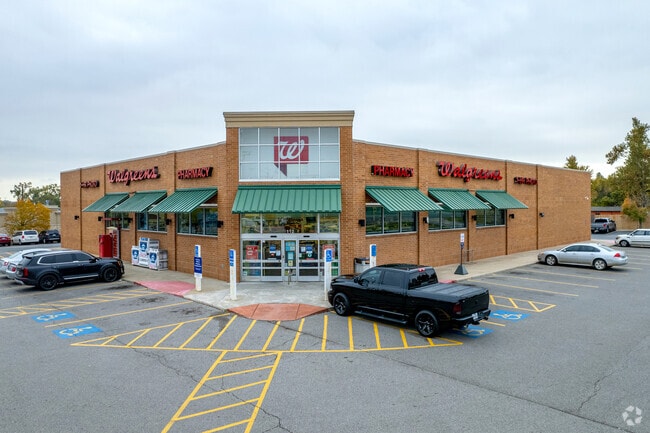
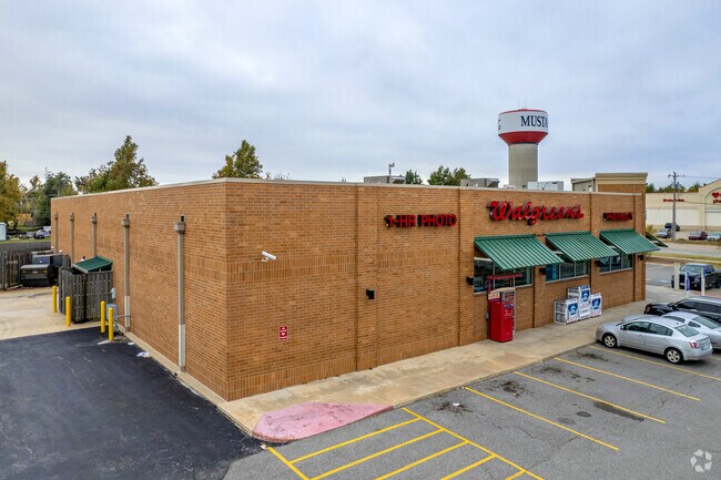
Property Record
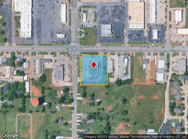
112 E State Highway 152, Mustang, OK 73064
NEARBY LISTINGS FOR SALE OR LEASE
Property Detail
112 E State Highway 152
090009621
T11N R05W S34 NW4 A#4 PT NW4 - BEG 82.31S &; 50E OF NW/C, TH NE34.85 E253 S306 W280 N283.87 TPB
Storebuilding
Canadian
X
Oklahoma
40027C0025J
1.96 AC
2024
Canadian County
2025
Oklahoma City
301406
Oklahoma City, OK
13,538 SF
DEMOGRAPHICS near 112 E State Highway 152
1 Mile
3 Mile
5 Mile
2024 Total Population
10,234
28,073
73,058
2029 Population
12,650
34,733
88,512
Pop Growth 2024-2029
+ 23.61%
+ 23.72%
+ 21.15%
Average Age
38
38
37
2024 Total Households
3,900
10,291
26,202
HH Growth 2024-2029
+ 23.54%
+ 23.59%
+ 21.56%
Median Household Inc
$75,281
$87,371
$83,349
Avg Household Size
2.60
2.70
2.70
2024 Avg HH Vehicles
2.00
2.00
2.00
Median Home Value
$170,101
$202,547
$203,500
Median Year Built
1996
1996
2003
Nearby Places
Map Layers
Map Styles
 Street
 Aerial
- Restaurants
- Banks
- Shops
- Fitness
- Groceries
PUBLIC TRANSPORTATION
AIRPORT
Will Rogers World
DRIVE
WALK
Distance
Will Rogers World
16 min
10.2 mi
SALE & LEASE HISTORY
LISTING DATE
SALE/LEASE

Sep 05, 2019
For Sale
Nearby Properties
Address
Land Use
TOTAL SIZE
Lot Size
Zoning
Address
Land Use
TOTAL SIZE
Lot Size
Zoning
108,294 SF
75 AC
Address
Land Use
TOTAL SIZE
Lot Size
Zoning
292,053 SF
18.36 AC
Address
Land Use
TOTAL SIZE
Lot Size
Zoning
141,384 SF
38.94 AC
Address
Land Use
TOTAL SIZE
Lot Size
Zoning
130,567 SF
24.06 AC
Address
Land Use
TOTAL SIZE
Lot Size
Zoning
51,628 SF
2.38 AC
Address
Land Use
TOTAL SIZE
Lot Size
Zoning
1,636 SF
0.77 AC
Address
Land Use
TOTAL SIZE
Lot Size
Zoning
57,121 SF
155.38 AC
Address
Land Use
TOTAL SIZE
Lot Size
Zoning
30,650 SF
5 AC
Address
Land Use
TOTAL SIZE
Lot Size
Zoning
13,728 SF
7.70 AC
Address
Land Use
TOTAL SIZE
Lot Size
Zoning
33,313 SF
9.24 AC
Address
Land Use
TOTAL SIZE
Lot Size
Zoning
72,317 SF
21.13 AC
Address
Land Use
TOTAL SIZE
Lot Size
Zoning
17,582 SF
4.34 AC
Address
Land Use
TOTAL SIZE
Lot Size
Zoning
50,402 SF
2.42 AC
Address
Land Use
TOTAL SIZE
Lot Size
Zoning
77,066 SF
5 AC
Address
Land Use
TOTAL SIZE
Lot Size
Zoning
9,800 SF
4.37 AC
Address
Land Use
TOTAL SIZE
Lot Size
Zoning
212,376 SF
9.93 AC
Address
Land Use
TOTAL SIZE
Lot Size
Zoning
17,192 SF
2.32 AC
Address
Land Use
TOTAL SIZE
Lot Size
Zoning
52,605 SF
8.62 AC
Address
Land Use
TOTAL SIZE
Lot Size
Zoning
16,100 SF
4.20 AC
Address
Land Use
TOTAL SIZE
Lot Size
Zoning
10,871 SF
3.68 AC
Address
Land Use
TOTAL SIZE
Lot Size
Zoning
148,749 SF
6.87 AC
Address
Land Use
TOTAL SIZE
Lot Size
Zoning
9,928 SF
2.25 AC
Address
Land Use
TOTAL SIZE
Lot Size
Zoning
7,020 SF
0.58 AC
Address
Land Use
TOTAL SIZE
Lot Size
Zoning
2,258 SF
17.93 AC
Address
Land Use
TOTAL SIZE
Lot Size
Zoning
504 SF
16.38 AC
Address
Land Use
TOTAL SIZE
Lot Size
Zoning
280 SF
2.05 AC
Address
Land Use
TOTAL SIZE
Lot Size
Zoning
1,088 SF
13.89 AC
Address
Land Use
TOTAL SIZE
Lot Size
Zoning
7,560 SF
2.64 AC
Address
Land Use
TOTAL SIZE
Lot Size
Zoning
9,960 SF
1.61 AC
Address
Land Use
TOTAL SIZE
Lot Size
Zoning
76,630 SF
7.58 AC
The World's #1 Commercial Real Estate Marketplace
Connect with us
© 2026 CoStar Group
The information above has been obtained from sources believed reliable. While we do not doubt its accuracy we have not verified it and make no guarantee, warranty or representation about it. It is your responsibility to independently confirm its accuracy and completeness. Any projections, opinions, assumptions, or estimates used are for example only and do not represent the current or future performance of the property. The value of this transaction to you depends on tax and other factors which should be evaluated by your tax, financial, and legal advisors. You and your advisors should conduct a careful, independent investigation of the property to determine to your satisfaction the suitability of the property for your needs.